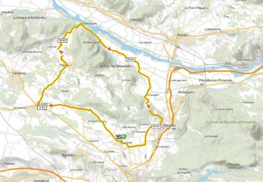
13.1 km | 16.1 km-effort
Autour de Trevaressse
clerouin
User
Length
4.6 km
Max alt
498 m
Uphill gradient
114 m
Km-Effort
6.2 km
Min alt
369 m
Downhill gradient
132 m
Boucle
No
Creation date :
2021-05-14 13:47:44.0
Updated on :
2021-05-14 15:12:32.323
1h24
Difficulty :
FREE GPS app for hiking
About
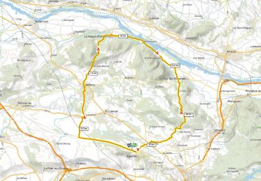
Trail Walking of 4.6 km to be discovered at Provence-Alpes-Côte d'Azur, Bouches-du-Rhône, Aix-en-Provence. This trail is proposed by clerouin.
Positioning
Country:
France
Region :
Provence-Alpes-Côte d'Azur
Department/Province :
Bouches-du-Rhône
Municipality :
Aix-en-Provence
Location:
Unknown
Start:(Dec)
Start:(UTM)
693056 ; 4831731 (31T) N.
Comments
Trails nearby
PF-Eguilles, balade dans les collines
Walking
Easy
(1)
Éguilles,
Provence-Alpes-Côte d'Azur,
Bouches-du-Rhône,
France
3h 29min
Yes
l étape. cricri....
Walking
Very easy
Saint-Cannat,
Provence-Alpes-Côte d'Azur,
Bouches-du-Rhône,
France
8.6 km | 10.2 km-effort
2h 12min
Yes
st canadet
Walking
Very easy
Le Puy-Sainte-Réparade,
Provence-Alpes-Côte d'Azur,
Bouches-du-Rhône,
France
4.8 km | 6.3 km-effort
1h 59min
No
tour-Rognes/ le Puy
Mountain bike
Medium
Rognes,
Provence-Alpes-Côte d'Azur,
Bouches-du-Rhône,
France
22 km | 29 km-effort
2h 1min
Yes
de
Walking
Medium
Le Puy-Sainte-Réparade,
Provence-Alpes-Côte d'Azur,
Bouches-du-Rhône,
France
4.9 km | 6.3 km-effort
2h 40min
No
Randonnée du 20/11/2023 à 19:20
Walking
Easy
Éguilles,
Provence-Alpes-Côte d'Azur,
Bouches-du-Rhône,
France
9.1 km | 11.6 km-effort
3h 0min
Yes
Eguilles La Roque D+840m
Road bike
Very difficult
Éguilles,
Provence-Alpes-Côte d'Azur,
Bouches-du-Rhône,
France
55 km | 66 km-effort
4h 0min
Yes
Puyricard St Christope D+720m
Road bike
Very difficult
Aix-en-Provence,
Provence-Alpes-Côte d'Azur,
Bouches-du-Rhône,
France
53 km | 62 km-effort
3h 46min
Yes
Château du Seuil
Walking
Easy
Aix-en-Provence,
Provence-Alpes-Côte d'Azur,
Bouches-du-Rhône,
France
9.7 km | 12.3 km-effort
2h 4min
Yes