![](/images/other/stat-length.png)
![Trail Walking Beaucroissant - Beaucroissant-Galaboutemps - Photo](https://media.geolcdn.com/t/1900/400/ext.pjpeg?maxdim=2&url=https%3A%2F%2Fstatic1.geolcdn.com%2Fsiteimages%2Fupload%2Ffiles%2F1553511878bg_sport_marche.png)
Beaucroissant-Galaboutemps
raymondfn
User
![Length](/images/other/stat-length.png)
Length
7.2 km
![Max alt](https://static1.geolcdn.com/siteimages/upload/files/1508320355ic_sort_altitude_max_24dp.png)
Max alt
445 m
![Uphill gradient](https://static1.geolcdn.com/siteimages/upload/files/1508320355ic_sort_den_pos_24dp.png)
Uphill gradient
35 m
![Km-Effort](/images/other/stat-length.png)
Km-Effort
7.6 km
![Min alt](https://static1.geolcdn.com/siteimages/upload/files/1508320355ic_sort_altitude_min_24dp.png)
Min alt
428 m
![Downhill gradient](https://static1.geolcdn.com/siteimages/upload/files/1508320355ic_sort_den_neg_24dp.png)
Downhill gradient
35 m
![Boucle](https://static1.geolcdn.com/siteimages/upload/files/16400158638029165_repeat_loop_refresh_sync_direction_icon.png)
Boucle
Yes
Creation date :
2021-05-13 08:51:24.303
Updated on :
2021-05-16 16:02:07.838
![Walking](https://static1.geolcdn.com/sitytour/trail-icons/101.png)
1h33
Difficulty : Medium
![Scan this QR Code to open this trail in the SityTrail application](https://capi.geolives.com/qq0zvz2zws4bq2lad0pu/sitytour/trails/2784250/qr.png?size=200)
FREE GPS app for hiking
About
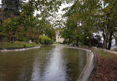
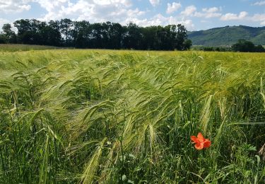
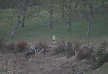
Trail Walking of 7.2 km to be discovered at Auvergne-Rhône-Alpes, Isère, Beaucroissant. This trail is proposed by raymondfn.
Description
Parking : venant d'Izeaux quitter la déviation de Beaucroissant pour aller vers le village, puis tourner sur la 3ième rue à droite, et se garer sur la gauche de cette rue.
Positioning
Country:
France
Region :
Auvergne-Rhône-Alpes
Department/Province :
Isère
Municipality :
Beaucroissant
Location:
Unknown
Start:(Dec)
Start:(UTM)
693254 ; 5024008 (31T) N.
Comments
Trails nearby
![Trail Walking Tullins - Clos des Chartreux Parmenie 2 - Photo](https://media.geolcdn.com/t/375/260/3e5993b5-a74b-4c7a-a6d9-a420eaf80d04.jpg&format=jpg&maxdim=2)
![Walking Walking](https://static1.geolcdn.com/sitytour/trail-icons/101.png)
Clos des Chartreux Parmenie 2
Walking
Medium
Tullins,
Auvergne-Rhône-Alpes,
Isère,
France
![](/images/other/stat-length.png)
14.1 km | 23 km-effort
5h 29min
![](https://static1.geolcdn.com/siteimages/upload/files/16400158638029165_repeat_loop_refresh_sync_direction_icon.png)
Yes
![Trail Walking Saint-Blaise-du-Buis - Le tour des Voyes - Photo](https://media.geolcdn.com/t/375/260/52e090e6-02ac-4fdb-b326-05575f2c58a3.jpg&format=jpg&maxdim=2)
![Walking Walking](https://static1.geolcdn.com/sitytour/trail-icons/101.png)
Le tour des Voyes
Walking
Easy
Saint-Blaise-du-Buis,
Auvergne-Rhône-Alpes,
Isère,
France
![](/images/other/stat-length.png)
8.5 km | 10.6 km-effort
2h 24min
![](https://static1.geolcdn.com/siteimages/upload/files/16400158638029165_repeat_loop_refresh_sync_direction_icon.png)
Yes
![Trail Running Beaucroissant - Sacré Trail des Collines - Col de Parménie - Photo](https://media.geolcdn.com/t/375/260/ext.jpg?maxdim=2&url=https%3A%2F%2Fservices.sitytrail.com%2FGeolivesWS%2FDownloadMedia.ashx%3FTrailID%3D118853%26Media%3D13068_2.jpg)
![Running Running](https://static1.geolcdn.com/sitytour/trail-icons/103.png)
Sacré Trail des Collines - Col de Parménie
Running
Difficult
Beaucroissant,
Auvergne-Rhône-Alpes,
Isère,
France
![](/images/other/stat-length.png)
35 km | 57 km-effort
4h 0min
![](https://static1.geolcdn.com/siteimages/upload/files/16400158638029165_repeat_loop_refresh_sync_direction_icon.png)
Yes
![Trail Walking Beaucroissant - SityTrail - RS-Beaucroissant-Les étangs - Photo](https://media.geolcdn.com/t/375/260/ext.jpg?maxdim=2&url=https%3A%2F%2Fstatic1.geolcdn.com%2Fsiteimages%2Fupload%2Ffiles%2F1553511878bg_sport_marche.png)
![Walking Walking](https://static1.geolcdn.com/sitytour/trail-icons/101.png)
SityTrail - RS-Beaucroissant-Les étangs
Walking
Easy
Beaucroissant,
Auvergne-Rhône-Alpes,
Isère,
France
![](/images/other/stat-length.png)
4.2 km | 5.1 km-effort
1h 9min
![](https://static1.geolcdn.com/siteimages/upload/files/16400158638029165_repeat_loop_refresh_sync_direction_icon.png)
Yes
![Trail sport Tullins - Plaine de tullins - Photo](https://media.geolcdn.com/t/375/260/ext.jpg?maxdim=2&url=https%3A%2F%2Fsecurestorage.geolives.com%2Fsitytour%2Ftrail-bg%2Fdefault.jpg)
Plaine de tullins
sport
Very easy
Tullins,
Auvergne-Rhône-Alpes,
Isère,
France
![](/images/other/stat-length.png)
32 km | 34 km-effort
Unknown
![](https://static1.geolcdn.com/siteimages/upload/files/16400158638029165_repeat_loop_refresh_sync_direction_icon.png)
Yes
![Trail Walking Beaucroissant - SityTrail - RS-Beaucroissant-Les étangs - Photo](https://media.geolcdn.com/t/375/260/ext.jpg?maxdim=2&url=https%3A%2F%2Fstatic1.geolcdn.com%2Fsiteimages%2Fupload%2Ffiles%2F1553511878bg_sport_marche.png)
![Walking Walking](https://static1.geolcdn.com/sitytour/trail-icons/101.png)
SityTrail - RS-Beaucroissant-Les étangs
Walking
Medium
Beaucroissant,
Auvergne-Rhône-Alpes,
Isère,
France
![](/images/other/stat-length.png)
7.8 km | 9.1 km-effort
2h 3min
![](https://static1.geolcdn.com/siteimages/upload/files/16400158638029165_repeat_loop_refresh_sync_direction_icon.png)
Yes
![Trail Walking Rives - Anniv Do - Photo](https://media.geolcdn.com/t/375/260/ext.jpg?maxdim=2&url=https%3A%2F%2Fstatic1.geolcdn.com%2Fsiteimages%2Fupload%2Ffiles%2F1553511878bg_sport_marche.png)
![Walking Walking](https://static1.geolcdn.com/sitytour/trail-icons/101.png)
Anniv Do
Walking
Medium
Rives,
Auvergne-Rhône-Alpes,
Isère,
France
![](/images/other/stat-length.png)
7.8 km | 9.8 km-effort
2h 12min
![](https://static1.geolcdn.com/siteimages/upload/files/16400158638029165_repeat_loop_refresh_sync_direction_icon.png)
Yes
![Trail Walking Beaucroissant - Beaucroissant - Photo](https://media.geolcdn.com/t/375/260/ext.jpg?maxdim=2&url=https%3A%2F%2Fstatic1.geolcdn.com%2Fsiteimages%2Fupload%2Ffiles%2F1553511878bg_sport_marche.png)
![Walking Walking](https://static1.geolcdn.com/sitytour/trail-icons/101.png)
Beaucroissant
Walking
Medium
Beaucroissant,
Auvergne-Rhône-Alpes,
Isère,
France
![](/images/other/stat-length.png)
7.5 km | 8 km-effort
3h 4min
![](https://static1.geolcdn.com/siteimages/upload/files/16400158638029165_repeat_loop_refresh_sync_direction_icon.png)
Yes
![Trail Walking Izeaux - Izeaux-le tour des carrières - Photo](https://media.geolcdn.com/t/375/260/ext.jpg?maxdim=2&url=https%3A%2F%2Fstatic1.geolcdn.com%2Fsiteimages%2Fupload%2Ffiles%2F1553511878bg_sport_marche.png)
![Walking Walking](https://static1.geolcdn.com/sitytour/trail-icons/101.png)
Izeaux-le tour des carrières
Walking
Easy
Izeaux,
Auvergne-Rhône-Alpes,
Isère,
France
![](/images/other/stat-length.png)
5.4 km | 5.9 km-effort
1h 20min
![](https://static1.geolcdn.com/siteimages/upload/files/16400158638029165_repeat_loop_refresh_sync_direction_icon.png)
Yes