Trail Walking Newcastle upon Tyne - Engeland - Hadrian Wall - Photo
© OpenStreetMap contributors
Length
Length
332 km
Max alt
Max alt
336 m
Uphill gradient
Uphill gradient
4498 m
Km-Effort
Km-Effort  
392 km
Min alt
Min alt
-1 m
Downhill gradient
Downhill gradient
4526 m
Boucle
Boucle
No
Creation date :
2014-12-10 00:00:00.0
Updated on :
2014-12-10 00:00:00.0

(0 Reviews)

Walking
Walking
--
Difficulty : Unknown

Scan this QR Code to open this trail in the SityTrail application

FREE GPS app for hiking

Logo SityTrail SityTrail

IGN / Geographical institutes

Download SityTrail from the App Store Download SityTrail from Google Play

Logo SityTrail SityTrail World

The world is yours!

Download SityTrail from the App Store Download SityTrail from Google Play Download SityTrail on Huawei AppGallery

About

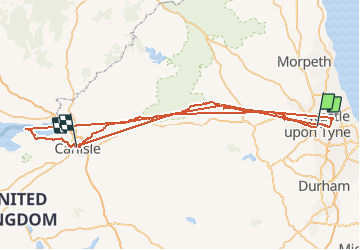
Trail Walking of 332 km to be discovered at England, Unknown, Newcastle upon Tyne. This trail is proposed by gpstracks.

Description

More information on GPStracks.nl : http://www.gpstracks.nl

Elevation profile

Points of interest

Point of interest Allerdale - START1 - Photo
gpstracks
ALLERDALE 
Point of interest Carlisle - START2 - Photo
gpstracks
CARLISLE 
Point of interest Carlisle - START3 - Photo
gpstracks
CARLISLE 
Point of interest  - START4 - Photo
gpstracks
Point of interest  - START5 - Photo
gpstracks
Point of interest  - START6 - Photo
gpstracks
Point of interest Newcastle upon Tyne - START7 - Photo
gpstracks
NEWCASTLE UPON TYNE 
Point of interest  - B&B 12 - Photo
gpstracks
Point of interest Carlisle - BANKSH - Photo
gpstracks
CARLISLE 
Point of interest Newcastle upon Tyne - Bus DF - Photo
gpstracks
NEWCASTLE UPON TYNE 
Point of interest  - CAMPIN - Photo
gpstracks
Point of interest  - CAMPIN - Photo
gpstracks
Point of interest  - CAMPIN - Photo
gpstracks
Point of interest Newcastle upon Tyne - CS NEW - Photo
gpstracks
NEWCASTLE UPON TYNE 
Point of interest North Tyneside - Metro - Photo
gpstracks
NORTH TYNESIDE 
Point of interest Carlisle - PUB - Photo
gpstracks
CARLISLE 
Point of interest  - PUB-OK - Photo
gpstracks
Point of interest  - VINDOL - Photo
gpstracks
Point of interest  - WINKEL - Photo
gpstracks
Point of interest  - WINKEL - Photo
gpstracks
Point of interest  - WINKEL - Photo
gpstracks

Positioning

Country:
United Kingdom
Region :
England
Department/Province :
Unknown
Municipality :
Newcastle upon Tyne
Location:
Unknown
Start:(UTM)
588416 ; 6092126 (30U) N.

Trails nearby

Trail Motor North Tyneside - a-schotland-rustige-rondrit-schotland - Photo
Motor
gpstracks

Motor

Very easy
North Tyneside, England, Unknown, United Kingdom
1123 km | 1644 km-effort
Unknown
Yes
Trail Motor North Tyneside - a-schotland-7-dagen-whiskey-en-kastelen - Photo
Motor
gpstracks

Motor

Very easy
North Tyneside, England, Unknown, United Kingdom
1247 km | 1707 km-effort
Unknown
Yes


Close
My subscriptions