![](/images/other/stat-length.png)
![Trail Walking Saverne - Saverne : rocher Rappenfels - grotte St Vit - château Greifenstein - Photo](https://media.geolcdn.com/t/1900/400/f8e09f2c-5063-4c7c-9b4c-31b168c00cc9.jpg&format=pjpeg&maxdim=2)
Saverne : rocher Rappenfels - grotte St Vit - château Greifenstein
Bart2015
User
![Length](/images/other/stat-length.png)
Length
12.2 km
![Max alt](https://static1.geolcdn.com/siteimages/upload/files/1508320355ic_sort_altitude_max_24dp.png)
Max alt
455 m
![Uphill gradient](https://static1.geolcdn.com/siteimages/upload/files/1508320355ic_sort_den_pos_24dp.png)
Uphill gradient
377 m
![Km-Effort](/images/other/stat-length.png)
Km-Effort
17.3 km
![Min alt](https://static1.geolcdn.com/siteimages/upload/files/1508320355ic_sort_altitude_min_24dp.png)
Min alt
204 m
![Downhill gradient](https://static1.geolcdn.com/siteimages/upload/files/1508320355ic_sort_den_neg_24dp.png)
Downhill gradient
377 m
![Boucle](https://static1.geolcdn.com/siteimages/upload/files/16400158638029165_repeat_loop_refresh_sync_direction_icon.png)
Boucle
Yes
Creation date :
2021-05-09 08:20:56.36
Updated on :
2021-08-20 10:51:30.685
![Walking](https://static1.geolcdn.com/sitytour/trail-icons/101.png)
3h35
Difficulty : Medium
![Scan this QR Code to open this trail in the SityTrail application](https://capi.geolives.com/qq0zvz2zws4bq2lad0pu/sitytour/trails/2781178/qr.png?size=200)
FREE GPS app for hiking
About
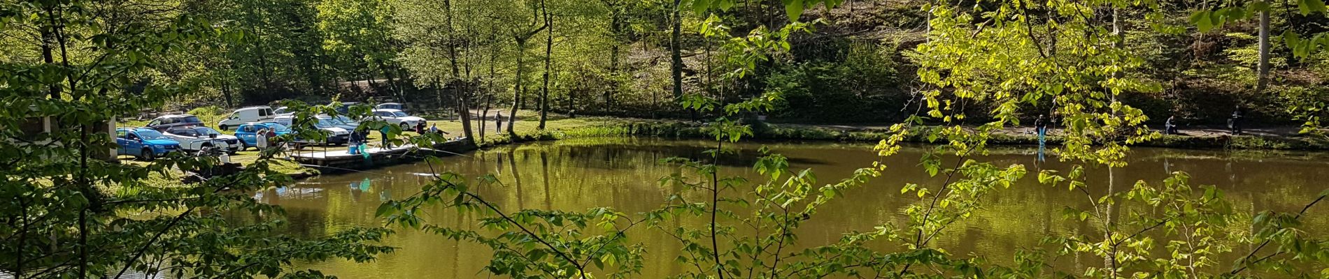
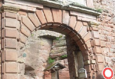
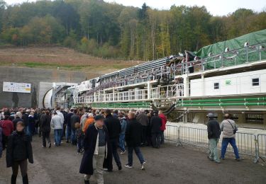
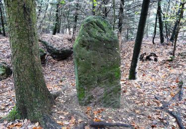
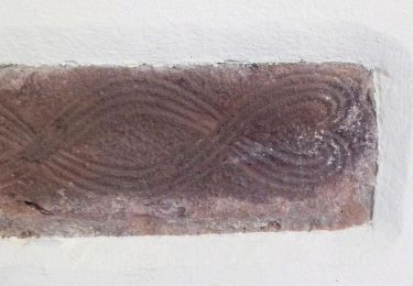
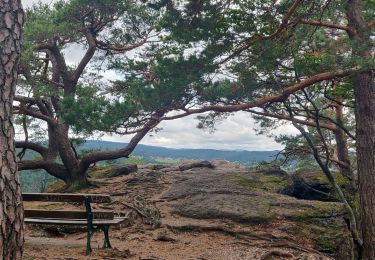
Trail Walking of 12.2 km to be discovered at Grand Est, Bas-Rhin, Saverne. This trail is proposed by Bart2015.
Description
Randonnée pour partir à la découverte de 3 merveilles depuis Saverne.
Bonne randonnée
Positioning
Country:
France
Region :
Grand Est
Department/Province :
Bas-Rhin
Municipality :
Saverne
Location:
Unknown
Start:(Dec)
Start:(UTM)
378232 ; 5399795 (32U) N.
Comments
Trails nearby
![Trail Mountain bike Saverne - Tour du Brotsch - Saverne - Photo](https://media.geolcdn.com/t/375/260/ext.jpg?maxdim=2&url=https%3A%2F%2Fservices.sitytrail.com%2FGeolivesWS%2FDownloadMedia.ashx%3FTrailID%3D105879%26Media%3D9858_4.jpg)
![Mountain bike Mountain bike](https://static1.geolcdn.com/sitytour/trail-icons/202.png)
Tour du Brotsch - Saverne
Mountain bike
Medium
(1)
Saverne,
Grand Est,
Bas-Rhin,
France
![](/images/other/stat-length.png)
13.1 km | 18.6 km-effort
1h 30min
![](https://static1.geolcdn.com/siteimages/upload/files/16400158638029165_repeat_loop_refresh_sync_direction_icon.png)
Yes
![Trail On foot Ernolsheim-lès-Saverne - Rectangle bleu barré de blanc - Photo](https://media.geolcdn.com/t/375/260/03314272-aa3e-4322-97f6-7afd0207efcf.jpeg&format=jpg&maxdim=2)
![On foot On foot](https://static1.geolcdn.com/sitytour/trail-icons/100.png)
Rectangle bleu barré de blanc
On foot
Easy
Ernolsheim-lès-Saverne,
Grand Est,
Bas-Rhin,
France
![](/images/other/stat-length.png)
5.6 km | 7.3 km-effort
1h 39min
![](https://static1.geolcdn.com/siteimages/upload/files/16400158638029165_repeat_loop_refresh_sync_direction_icon.png)
No
![Trail On foot Saint-Jean-Saverne - Chevalet rouge - Photo](https://media.geolcdn.com/t/375/260/0dd39903-a686-40c3-9785-4ead1bbebc8f.jpeg&format=jpg&maxdim=2)
![On foot On foot](https://static1.geolcdn.com/sitytour/trail-icons/100.png)
Chevalet rouge
On foot
Easy
Saint-Jean-Saverne,
Grand Est,
Bas-Rhin,
France
![](/images/other/stat-length.png)
3.6 km | 4.6 km-effort
1h 2min
![](https://static1.geolcdn.com/siteimages/upload/files/16400158638029165_repeat_loop_refresh_sync_direction_icon.png)
No
![Trail On foot Saint-Jean-Saverne - Circuit Archéologique d'Ernolsheim-lès-Saverne - Photo](https://media.geolcdn.com/t/375/260/60c6095c-d8e2-44d1-91f6-754fc6d8b002.jpeg&format=jpg&maxdim=2)
![On foot On foot](https://static1.geolcdn.com/sitytour/trail-icons/100.png)
Circuit Archéologique d'Ernolsheim-lès-Saverne
On foot
Easy
Saint-Jean-Saverne,
Grand Est,
Bas-Rhin,
France
![](/images/other/stat-length.png)
8.7 km | 12.1 km-effort
2h 45min
![](https://static1.geolcdn.com/siteimages/upload/files/16400158638029165_repeat_loop_refresh_sync_direction_icon.png)
Yes
![Trail On foot Saint-Jean-Saverne - Circuit du Frohnberg - Photo](https://media.geolcdn.com/t/375/260/7f477f52-186a-47be-97f3-d4b05d97d596.jpeg&format=jpg&maxdim=2)
![On foot On foot](https://static1.geolcdn.com/sitytour/trail-icons/100.png)
Circuit du Frohnberg
On foot
Easy
Saint-Jean-Saverne,
Grand Est,
Bas-Rhin,
France
![](/images/other/stat-length.png)
5.2 km | 6.5 km-effort
1h 28min
![](https://static1.geolcdn.com/siteimages/upload/files/16400158638029165_repeat_loop_refresh_sync_direction_icon.png)
Yes
![Trail On foot Saint-Jean-Saverne - Circuit de la Forêt des Dames - Photo](https://media.geolcdn.com/t/375/260/940f4f7a-5ffe-4be9-a519-9b1fc81fa3eb.jpeg&format=jpg&maxdim=2)
![On foot On foot](https://static1.geolcdn.com/sitytour/trail-icons/100.png)
Circuit de la Forêt des Dames
On foot
Easy
Saint-Jean-Saverne,
Grand Est,
Bas-Rhin,
France
![](/images/other/stat-length.png)
4 km | 5 km-effort
1h 8min
![](https://static1.geolcdn.com/siteimages/upload/files/16400158638029165_repeat_loop_refresh_sync_direction_icon.png)
No
![Trail Walking Reinhardsmunster - 2019-08-15 Marche Schaerferplatz Geissfels Ochsenstein - Photo](https://media.geolcdn.com/t/375/260/99549163-8418-49ab-b342-9e77b4e4ebca.jpg&format=jpg&maxdim=2)
![Walking Walking](https://static1.geolcdn.com/sitytour/trail-icons/101.png)
2019-08-15 Marche Schaerferplatz Geissfels Ochsenstein
Walking
Very difficult
Reinhardsmunster,
Grand Est,
Bas-Rhin,
France
![](/images/other/stat-length.png)
15 km | 23 km-effort
4h 49min
![](https://static1.geolcdn.com/siteimages/upload/files/16400158638029165_repeat_loop_refresh_sync_direction_icon.png)
Yes
![Trail Walking Haegen - Haut Barr-Obersteigen-Haut Barr - Photo](https://media.geolcdn.com/t/375/260/ext.jpg?maxdim=2&url=https%3A%2F%2Fstatic1.geolcdn.com%2Fsiteimages%2Fupload%2Ffiles%2F1553511878bg_sport_marche.png)
![Walking Walking](https://static1.geolcdn.com/sitytour/trail-icons/101.png)
Haut Barr-Obersteigen-Haut Barr
Walking
Medium
(2)
Haegen,
Grand Est,
Bas-Rhin,
France
![](/images/other/stat-length.png)
27 km | 40 km-effort
6h 7min
![](https://static1.geolcdn.com/siteimages/upload/files/16400158638029165_repeat_loop_refresh_sync_direction_icon.png)
Yes
![Trail Equestrian Eckartswiller - eline - Photo](https://media.geolcdn.com/t/375/260/ext.jpg?maxdim=2&url=https%3A%2F%2Fstatic1.geolcdn.com%2Fsiteimages%2Fupload%2Ffiles%2F1524743154cheval.jpg)
![Equestrian Equestrian](https://static1.geolcdn.com/sitytour/trail-icons/300.png)
eline
Equestrian
Easy
(1)
Eckartswiller,
Grand Est,
Bas-Rhin,
France
![](/images/other/stat-length.png)
18.6 km | 25 km-effort
3h 50min
![](https://static1.geolcdn.com/siteimages/upload/files/16400158638029165_repeat_loop_refresh_sync_direction_icon.png)
No