Trail Walking Garrigues-Sainte-Eulalie - Garrigues. - Photo
 G.DAUMET
G.DAUMET

User

© OpenStreetMap contributors
Length
Length
10.6 km
Max alt
Max alt
216 m
Uphill gradient
Uphill gradient
156 m
Km-Effort
Km-Effort  
12.6 km
Min alt
Min alt
103 m
Downhill gradient
Downhill gradient
148 m
Boucle
Boucle
Yes
Creation date :
2021-05-09 12:27:12.048
Updated on :
2021-05-09 15:26:42.958

(0 Reviews)

Walking
Walking
2h47
Difficulty : Easy

Scan this QR Code to open this trail in the SityTrail application

FREE GPS app for hiking

Logo SityTrail SityTrail

IGN / Geographical institutes

Download SityTrail from the App Store Download SityTrail from Google Play

Logo SityTrail SityTrail World

The world is yours!

Download SityTrail from the App Store Download SityTrail from Google Play Download SityTrail on Huawei AppGallery

About

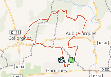
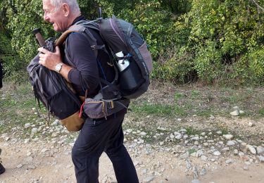
Trail Walking of 10.6 km to be discovered at Occitania, Gard, Garrigues-Sainte-Eulalie. This trail is proposed by G.DAUMET.

Description

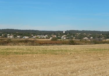
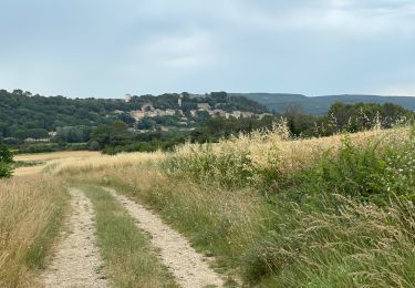
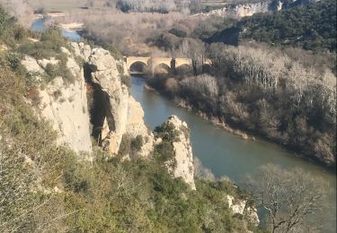
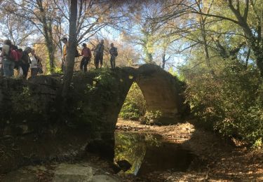
Garrigue  Aubussargues la Madone, Collorgues. Garrigue.

Elevation profile

Positioning

Country:
France
Region :
Occitania
Department/Province :
Gard
Municipality :
Garrigues-Sainte-Eulalie
Location:
Unknown
Start:(UTM)
605647 ; 4872018 (31T) N.

Trails nearby

Trail Walking Collorgues - Château de Castelnau - Collorgues - Photo
Walking
tracegps

Walking

Medium
(1)
Collorgues, Occitania, Gard, France
14.1 km | 17.3 km-effort
4h 0min
Yes
Trail Walking Collorgues - Collorgues dalles  - Photo
Walking
caroline116

Walking

Very easy
(1)
Collorgues, Occitania, Gard, France
7.9 km | 9.7 km-effort
46min
Yes
Trail Walking Blauzac - Les capitelles de Blauzac - Photo
Walking
GUIDE
Roger Philippe Wallez

Walking

Difficult
Blauzac, Occitania, Gard, France
13.7 km | 16.5 km-effort
4h 15min
Yes
Trail Mountain bike Arpaillargues-et-Aureillac - 20210628 Arpaillargues Saint Quentin Saint Siffret - Photo
Mountain bike
NanardPet

Mountain bike

Difficult
Arpaillargues-et-Aureillac, Occitania, Gard, France
38 km | 44 km-effort
2h 59min
Yes
Trail Walking Collorgues - Aubussargues 2ème parcours - Photo
Walking
caroline116

Walking

Medium
(1)
Collorgues, Occitania, Gard, France
7 km | 8.8 km-effort
1h 50min
Yes
Trail Walking Blauzac - arsel de blauzac au pont saint nicolas - Photo
Walking
labarone

Walking

Easy
Blauzac, Occitania, Gard, France
23 km | 28 km-effort
6h 41min
Yes
Trail Walking Collorgues - Aubussargues 2ème parcours - Photo
Walking
caroline116

Walking

Medium
(1)
Collorgues, Occitania, Gard, France
7 km | 8.8 km-effort
1h 50min
Yes
Trail Walking Blauzac - blauzac, les gorges du gardon, le pont St NIcolas - Photo
Walking
daniel34

Walking

Medium
Blauzac, Occitania, Gard, France
14.1 km | 17.3 km-effort
5h 2min
Yes
Trail Walking Blauzac - Les capitales de Blauzac - Photo
Walking
daniel34

Walking

Medium
Blauzac, Occitania, Gard, France
14.8 km | 18.1 km-effort
4h 7min
Yes


Close
My subscriptions