![](/images/other/stat-length.png)
![Trail Walking La Bauche - Ballade vers la Bauche - Photo](https://media.geolcdn.com/t/1900/400/beac6041-f762-4265-baf1-b8a107f85ed8.jpg&format=pjpeg&maxdim=2)
Ballade vers la Bauche
nadd73
User GUIDE
![Length](/images/other/stat-length.png)
Length
11.7 km
![Max alt](https://static1.geolcdn.com/siteimages/upload/files/1508320355ic_sort_altitude_max_24dp.png)
Max alt
1321 m
![Uphill gradient](https://static1.geolcdn.com/siteimages/upload/files/1508320355ic_sort_den_pos_24dp.png)
Uphill gradient
839 m
![Km-Effort](/images/other/stat-length.png)
Km-Effort
23 km
![Min alt](https://static1.geolcdn.com/siteimages/upload/files/1508320355ic_sort_altitude_min_24dp.png)
Min alt
589 m
![Downhill gradient](https://static1.geolcdn.com/siteimages/upload/files/1508320355ic_sort_den_neg_24dp.png)
Downhill gradient
853 m
![Boucle](https://static1.geolcdn.com/siteimages/upload/files/16400158638029165_repeat_loop_refresh_sync_direction_icon.png)
Boucle
Yes
Creation date :
2021-05-08 08:42:48.233
Updated on :
2021-05-09 07:29:02.413
![Walking](https://static1.geolcdn.com/sitytour/trail-icons/101.png)
6h19
Difficulty : Easy
![Scan this QR Code to open this trail in the SityTrail application](https://capi.geolives.com/qq0zvz2zws4bq2lad0pu/sitytour/trails/2778731/qr.png?size=200)
FREE GPS app for hiking
About
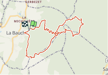
Trail Walking of 11.7 km to be discovered at Auvergne-Rhône-Alpes, Savoy, La Bauche. This trail is proposed by nadd73.
Description
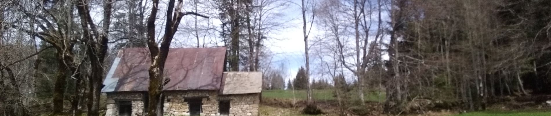
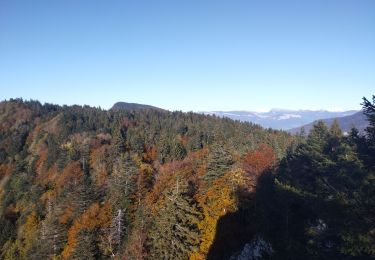
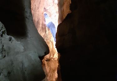
Départ de la Bauche petit tour Le tourner, le Souhait et les Sollières. Parfois je suis passée hors sentier pour observer : sanglier, grive, écureuil ...
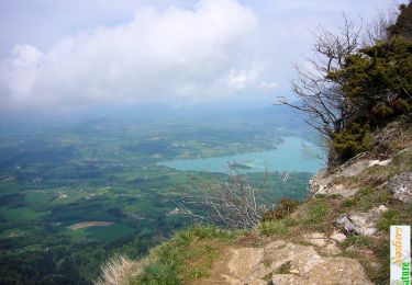
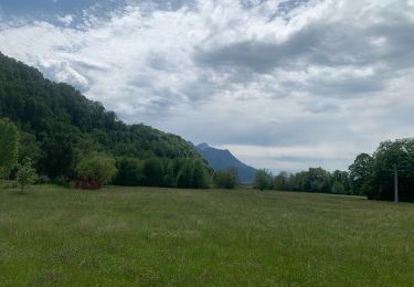
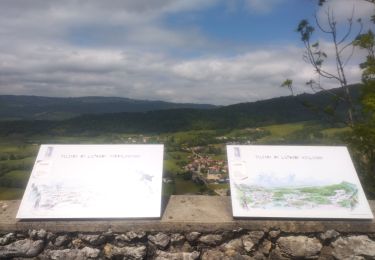
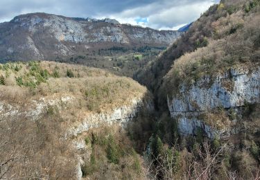
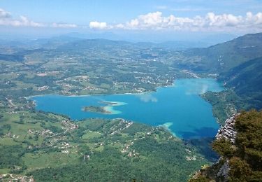
vue sur le petit et Grand som et col de Mauvernais
Positioning
Country:
France
Region :
Auvergne-Rhône-Alpes
Department/Province :
Savoy
Municipality :
La Bauche
Location:
Unknown
Start:(Dec)
Start:(UTM)
716650 ; 5040346 (31T) N.
Comments
Trails nearby
![Trail Walking Attignat-Oncin - Le Mont Grelle 1425m, depuis Attignat - Oncin - Photo](https://media.geolcdn.com/t/375/260/ext.jpg?maxdim=2&url=https%3A%2F%2Fservices.sitytrail.com%2FGeolivesWS%2FDownloadMedia.ashx%3FTrailID%3D102436%26Media%3D3086_1.jpg)
![Walking Walking](https://static1.geolcdn.com/sitytour/trail-icons/101.png)
Le Mont Grelle 1425m, depuis Attignat - Oncin
Walking
Medium
(3)
Attignat-Oncin,
Auvergne-Rhône-Alpes,
Savoy,
France
![](/images/other/stat-length.png)
9.6 km | 17.6 km-effort
4h 30min
![](https://static1.geolcdn.com/siteimages/upload/files/16400158638029165_repeat_loop_refresh_sync_direction_icon.png)
Yes
![Trail Walking Saint-Christophe - 38 st Christophe sur guiers grottes guiers vif - Photo](https://media.geolcdn.com/t/375/260/b80de980-1ba2-4651-878b-a9fe13ee8ba9.jpg&format=jpg&maxdim=2)
![Walking Walking](https://static1.geolcdn.com/sitytour/trail-icons/101.png)
38 st Christophe sur guiers grottes guiers vif
Walking
Medium
Saint-Christophe,
Auvergne-Rhône-Alpes,
Savoy,
France
![](/images/other/stat-length.png)
7.3 km | 12.7 km-effort
3h 24min
![](https://static1.geolcdn.com/siteimages/upload/files/16400158638029165_repeat_loop_refresh_sync_direction_icon.png)
Yes
![Trail sport Saint-Christophe - La grotte - Photo](https://media.geolcdn.com/t/375/260/7cc75393-f761-46d1-becb-3cd7fb47c0ce.jpg&format=jpg&maxdim=2)
La grotte
sport
Very easy
Saint-Christophe,
Auvergne-Rhône-Alpes,
Savoy,
France
![](/images/other/stat-length.png)
8.9 km | 14.1 km-effort
Unknown
![](https://static1.geolcdn.com/siteimages/upload/files/16400158638029165_repeat_loop_refresh_sync_direction_icon.png)
No
![Trail Trail Saint-Christophe - au dessus de la grotte des échelles - Photo](https://media.geolcdn.com/t/375/260/beed80db-3abc-4986-b62a-c1a9ab3b5b40.jpg&format=jpg&maxdim=2)
![Trail Trail](https://static1.geolcdn.com/sitytour/trail-icons/104.png)
au dessus de la grotte des échelles
Trail
Very easy
Saint-Christophe,
Auvergne-Rhône-Alpes,
Savoy,
France
![](/images/other/stat-length.png)
8 km | 11.8 km-effort
1h 11min
![](https://static1.geolcdn.com/siteimages/upload/files/16400158638029165_repeat_loop_refresh_sync_direction_icon.png)
Yes
![Trail Trail La Bauche - Mont Beauvoir - Photo](https://media.geolcdn.com/t/375/260/d3426012-2a94-4a47-accc-9d6f7ade0a85.jpg&format=jpg&maxdim=2)
![Trail Trail](https://static1.geolcdn.com/sitytour/trail-icons/104.png)
Mont Beauvoir
Trail
Easy
La Bauche,
Auvergne-Rhône-Alpes,
Savoy,
France
![](/images/other/stat-length.png)
9.2 km | 18.7 km-effort
1h 47min
![](https://static1.geolcdn.com/siteimages/upload/files/16400158638029165_repeat_loop_refresh_sync_direction_icon.png)
Yes
![Walking Walking](https://static1.geolcdn.com/sitytour/trail-icons/101.png)
la voie SARDE / tunnel des l'Echelles /st Christophe sur Guiers
Walking
Very difficult
Saint-Christophe,
Auvergne-Rhône-Alpes,
Savoy,
France
![](/images/other/stat-length.png)
15.1 km | 23 km-effort
5h 12min
![](https://static1.geolcdn.com/siteimages/upload/files/16400158638029165_repeat_loop_refresh_sync_direction_icon.png)
Yes
![Trail Walking Saint-Christophe - 190323 Boucle voie Sarde - Photo](https://media.geolcdn.com/t/375/260/73c09b18-e12a-4062-a718-c9e9afd93b05.jpg&format=jpg&maxdim=2)
![Walking Walking](https://static1.geolcdn.com/sitytour/trail-icons/101.png)
190323 Boucle voie Sarde
Walking
Difficult
Saint-Christophe,
Auvergne-Rhône-Alpes,
Savoy,
France
![](/images/other/stat-length.png)
9.7 km | 15.6 km-effort
3h 50min
![](https://static1.geolcdn.com/siteimages/upload/files/16400158638029165_repeat_loop_refresh_sync_direction_icon.png)
Yes
![Trail Walking Saint-Christophe - Grottes des Echelles - Photo](https://media.geolcdn.com/t/375/260/f2889bde-9656-4c7e-b17e-05cfcb9808a9.jpg&format=jpg&maxdim=2)
![Walking Walking](https://static1.geolcdn.com/sitytour/trail-icons/101.png)
Grottes des Echelles
Walking
Medium
Saint-Christophe,
Auvergne-Rhône-Alpes,
Savoy,
France
![](/images/other/stat-length.png)
7.4 km | 12.1 km-effort
3h 16min
![](https://static1.geolcdn.com/siteimages/upload/files/16400158638029165_repeat_loop_refresh_sync_direction_icon.png)
Yes
![Trail Walking Attignat-Oncin - Le Mont Grelle (Boucle) - Photo](https://media.geolcdn.com/t/375/260/ext.jpg?maxdim=2&url=https%3A%2F%2Fservices.sitytrail.com%2FGeolivesWS%2FDownloadMedia.ashx%3FTrailID%3D961370%26Media%3Dfix__20180508124323.jpg)
![Walking Walking](https://static1.geolcdn.com/sitytour/trail-icons/101.png)
Le Mont Grelle (Boucle)
Walking
Medium
Attignat-Oncin,
Auvergne-Rhône-Alpes,
Savoy,
France
![](/images/other/stat-length.png)
14.2 km | 26 km-effort
5h 16min
![](https://static1.geolcdn.com/siteimages/upload/files/16400158638029165_repeat_loop_refresh_sync_direction_icon.png)
Yes