


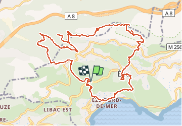


10.9 km | 14 km-effort

User


FREE GPS app for hiking
 SityTrail
IGN / Geographical institutes
SityTrail World
The world is yours!
Trail Walking of 16.9 km to be discovered at Provence-Alpes-Côte d'Azur, Maritime Alps, Èze. This trail is proposed by ETMU5496.
Départ de la moyenne corniche suite difficultés de stationnement en Bord de mer.
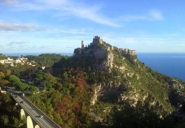
superbe randonnée avec de jolis points de vue, la visite du village de Eze, des forts de la Révère et de la Drette.


38 photos in total. Please click on a photo to see them all in the gallery.

Walking
On foot

Walking

Other activity
Walking
Walking

Walking

Walking
Walking