


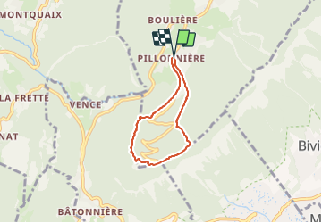

10.9 km | 26 km-effort

User


FREE GPS app for hiking
 SityTrail
IGN / Geographical institutes
SityTrail World
The world is yours!
Trail Walking of 4.9 km to be discovered at Auvergne-Rhône-Alpes, Isère, Le Sappey-en-Chartreuse. This trail is proposed by patjobou.
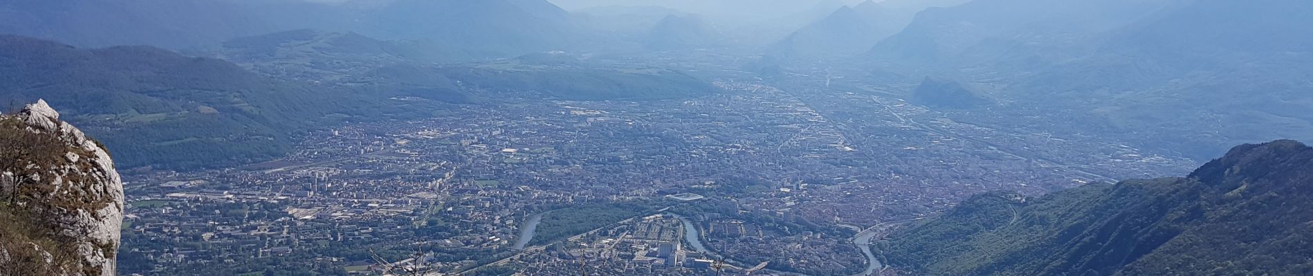
Une belle boucle pour atteindre le fort du St Eynard par un itinéraire de montée original, et peu connu. Montée tranquille en presque deux heures, par un sentier soutenu, et parfois technique; il faut mettre un peu les mains à la fin, mais la récompense est au sommet: vue à 360° !
Même si il n'est pas porté sur la carte IGN, le sentier est toujours présent, très proche de la crête, sur le versant Est.
Itinéraire réservé aux pieds sûrs, non sujets au vertige.
Agréable sentier de retour, pour rejoindre Pillonnière. Merci à Marité, Rémy, Louis de m'avoir accompagné pour reconnaitre cet itinéraire.
Sur la photo 8, on peut apercevoir l'arrivée du sentier du Pas Guiguet, aujourd'hui interdit.


Walking

Walking

On foot

Touring skiing

Walking

Mountain bike

Walking

Walking
Touring skiing