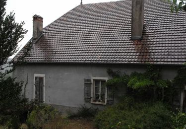
16.8 km | 24 km-effort
Grange du liège
cecilelaurencot
User
Length
73 km
Max alt
485 m
Uphill gradient
1131 m
Km-Effort
88 km
Min alt
223 m
Downhill gradient
1131 m
Boucle
Yes
Creation date :
2021-04-25 08:20:44.88
Updated on :
2021-04-25 17:01:52.029
5h50
Difficulty : Easy
FREE GPS app for hiking
About
Trail Bicycle tourism of 73 km to be discovered at Bourgogne-Franche-Comté, Doubs, Avanne-Aveney. This trail is proposed by cecilelaurencot.
Description
tandem dans nos 10 km
Positioning
Country:
France
Region :
Bourgogne-Franche-Comté
Department/Province :
Doubs
Municipality :
Avanne-Aveney
Location:
Unknown
Start:(Dec)
Start:(UTM)
723812 ; 5232056 (31T) N.
Comments
Trails nearby
Beure de la pisseur au mercureau
Walking
Difficult
(1)
Beure,
Bourgogne-Franche-Comté,
Doubs,
France
3h 48min
Yes
serre les sapins la ménère
Walking
Very easy
(1)
Serre-les-Sapins,
Bourgogne-Franche-Comté,
Doubs,
France
10.4 km | 12.6 km-effort
1h 48min
Yes
"De grottes en grottes par voies celtiques" Chabui Fontain
Walking
Medium
(1)
Beure,
Bourgogne-Franche-Comté,
Doubs,
France
15.7 km | 22 km-effort
6h 35min
Yes
Sentier de la Pierre de Vorges
On foot
Easy
Busy,
Bourgogne-Franche-Comté,
Doubs,
France
7.2 km | 9.4 km-effort
2h 8min
Yes
Sentier des Grands Prés
On foot
Easy
Fontain,
Bourgogne-Franche-Comté,
Doubs,
France
6.6 km | 9.6 km-effort
2h 10min
Yes
Sentier de Béthanier-la-Marne
On foot
Easy
Grandfontaine,
Bourgogne-Franche-Comté,
Doubs,
France
8.5 km | 10.2 km-effort
2h 18min
Yes
Circuit de Planoise
On foot
Easy
Besançon,
Bourgogne-Franche-Comté,
Doubs,
France
4.6 km | 7.6 km-effort
1h 43min
Yes
Sentier de Crête et Bois Rapin
On foot
Easy
(1)
Montferrand-le-Château,
Bourgogne-Franche-Comté,
Doubs,
France
10.1 km | 14.1 km-effort
3h 11min
Yes
Sentier de Notre Dame du Mont
On foot
Easy
Thoraise,
Bourgogne-Franche-Comté,
Doubs,
France
5.2 km | 7.7 km-effort
1h 44min
Yes