![](/images/other/stat-length.png)
![Trail Walking Gaudreville-la-Rivière - circuit de la fosse dame - Photo](https://media.geolcdn.com/t/1900/400/ext.pjpeg?maxdim=2&url=https%3A%2F%2Fstatic1.geolcdn.com%2Fsiteimages%2Fupload%2Ffiles%2F1553511878bg_sport_marche.png)
circuit de la fosse dame
jdebain
User
![Length](/images/other/stat-length.png)
Length
8.6 km
![Max alt](https://static1.geolcdn.com/siteimages/upload/files/1508320355ic_sort_altitude_max_24dp.png)
Max alt
153 m
![Uphill gradient](https://static1.geolcdn.com/siteimages/upload/files/1508320355ic_sort_den_pos_24dp.png)
Uphill gradient
153 m
![Km-Effort](/images/other/stat-length.png)
Km-Effort
10.6 km
![Min alt](https://static1.geolcdn.com/siteimages/upload/files/1508320355ic_sort_altitude_min_24dp.png)
Min alt
86 m
![Downhill gradient](https://static1.geolcdn.com/siteimages/upload/files/1508320355ic_sort_den_neg_24dp.png)
Downhill gradient
152 m
![Boucle](https://static1.geolcdn.com/siteimages/upload/files/16400158638029165_repeat_loop_refresh_sync_direction_icon.png)
Boucle
Yes
Creation date :
2021-04-21 12:27:32.948
Updated on :
2021-04-21 14:35:05.494
![Walking](https://static1.geolcdn.com/sitytour/trail-icons/101.png)
2h06
Difficulty : Medium
![Scan this QR Code to open this trail in the SityTrail application](https://capi.geolives.com/qq0zvz2zws4bq2lad0pu/sitytour/trails/2756341/qr.png?size=200)
FREE GPS app for hiking
About
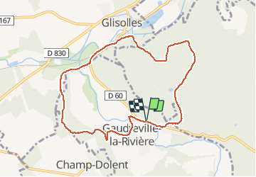
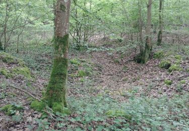
Trail Walking of 8.6 km to be discovered at Normandy, Eure, Gaudreville-la-Rivière. This trail is proposed by jdebain.
Description
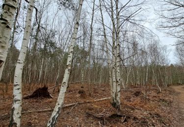
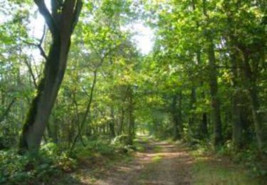
pour aller à la fosse au dame.a glisolles prendre le chemin en bas le long de la rivière sur 500m avant de monter dans la forêt,puis faire demis tour.
Positioning
Country:
France
Region :
Normandy
Department/Province :
Eure
Municipality :
Gaudreville-la-Rivière
Location:
Unknown
Start:(Dec)
Start:(UTM)
355621 ; 5425796 (31U) N.
Comments
Trails nearby
![Trail Walking Les Ventes - Petit circuit de la Pierre de Courcoulée.20/03/23 - Photo](https://media.geolcdn.com/t/375/260/914b69b2-bbec-487d-b2eb-519e3d4739f2.jpg&format=jpg&maxdim=2)
![Walking Walking](https://static1.geolcdn.com/sitytour/trail-icons/101.png)
Petit circuit de la Pierre de Courcoulée.20/03/23
Walking
Very easy
Les Ventes,
Normandy,
Eure,
France
![](/images/other/stat-length.png)
3.7 km | 4.1 km-effort
1h 13min
![](https://static1.geolcdn.com/siteimages/upload/files/16400158638029165_repeat_loop_refresh_sync_direction_icon.png)
Yes
![Trail Mountain bike Aulnay-sur-Iton - Garrel-Arrière-Evreux-Garel - Photo](https://media.geolcdn.com/t/375/260/ext.jpg?maxdim=2&url=https%3A%2F%2Fservices.sitytrail.com%2FGeolivesWS%2FDownloadMedia.ashx%3FTrailID%3D448880%26Media%3Dfix__20140519171138.jpg)
![Mountain bike Mountain bike](https://static1.geolcdn.com/sitytour/trail-icons/202.png)
Garrel-Arrière-Evreux-Garel
Mountain bike
Easy
Aulnay-sur-Iton,
Normandy,
Eure,
France
![](/images/other/stat-length.png)
17.6 km | 21 km-effort
1h 16min
![](https://static1.geolcdn.com/siteimages/upload/files/16400158638029165_repeat_loop_refresh_sync_direction_icon.png)
No
![Trail Walking Sylvains-lès-Moulins - Circuit des Rouliers - Villalet - Photo](https://media.geolcdn.com/t/375/260/ext.jpg?maxdim=2&url=https%3A%2F%2Fservices.sitytrail.com%2FGeolivesWS%2FDownloadMedia.ashx%3FTrailID%3D112482%26Media%3D10655_3.jpg)
![Walking Walking](https://static1.geolcdn.com/sitytour/trail-icons/101.png)
Circuit des Rouliers - Villalet
Walking
Easy
(1)
Sylvains-lès-Moulins,
Normandy,
Eure,
France
![](/images/other/stat-length.png)
6.7 km | 7.8 km-effort
1h 40min
![](https://static1.geolcdn.com/siteimages/upload/files/16400158638029165_repeat_loop_refresh_sync_direction_icon.png)
Yes
![Trail Walking Les Ventes - Forêt des Ventes - Photo](https://media.geolcdn.com/t/375/260/ad607410-9c41-468c-8e4b-988c945aacf4.jpg&format=jpg&maxdim=2)
![Walking Walking](https://static1.geolcdn.com/sitytour/trail-icons/101.png)
Forêt des Ventes
Walking
Easy
Les Ventes,
Normandy,
Eure,
France
![](/images/other/stat-length.png)
5.1 km | 6.1 km-effort
1h 22min
![](https://static1.geolcdn.com/siteimages/upload/files/16400158638029165_repeat_loop_refresh_sync_direction_icon.png)
Yes
![Trail Walking Les Ventes - La tringale - Villalet - Photo](https://media.geolcdn.com/t/375/260/8ba89c86-5160-406d-8434-a9cc0ad2fe9e.jpg&format=jpg&maxdim=2)
![Walking Walking](https://static1.geolcdn.com/sitytour/trail-icons/101.png)
La tringale - Villalet
Walking
Medium
Les Ventes,
Normandy,
Eure,
France
![](/images/other/stat-length.png)
13.5 km | 15.5 km-effort
3h 34min
![](https://static1.geolcdn.com/siteimages/upload/files/16400158638029165_repeat_loop_refresh_sync_direction_icon.png)
Yes
![Trail Walking Gaudreville-la-Rivière - Aller simple Gaudreville - Conches - Photo](https://media.geolcdn.com/t/375/260/b1a26270-7d32-4192-b6fd-683522ec6fa4.jpg&format=jpg&maxdim=2)
![Walking Walking](https://static1.geolcdn.com/sitytour/trail-icons/101.png)
Aller simple Gaudreville - Conches
Walking
Medium
Gaudreville-la-Rivière,
Normandy,
Eure,
France
![](/images/other/stat-length.png)
11.9 km | 14.6 km-effort
3h 7min
![](https://static1.geolcdn.com/siteimages/upload/files/16400158638029165_repeat_loop_refresh_sync_direction_icon.png)
No
![Trail Equestrian La Croisille - les boscherons - Photo](https://media.geolcdn.com/t/375/260/ext.jpg?maxdim=2&url=https%3A%2F%2Fservices.sitytrail.com%2FGeolivesWS%2FDownloadMedia.ashx%3FTrailID%3D238492%26Media%3Dfix__20131222113833.jpg)
![Equestrian Equestrian](https://static1.geolcdn.com/sitytour/trail-icons/300.png)
les boscherons
Equestrian
Easy
La Croisille,
Normandy,
Eure,
France
![](/images/other/stat-length.png)
18 km | 22 km-effort
2h 22min
![](https://static1.geolcdn.com/siteimages/upload/files/16400158638029165_repeat_loop_refresh_sync_direction_icon.png)
Yes
![Trail Walking Les Baux-Sainte-Croix - Les baux - Photo](https://media.geolcdn.com/t/375/260/0bbe3da8-fc2a-45b6-8048-58e1ec4f22a6.jpg&format=jpg&maxdim=2)
![Walking Walking](https://static1.geolcdn.com/sitytour/trail-icons/101.png)
Les baux
Walking
Medium
Les Baux-Sainte-Croix,
Normandy,
Eure,
France
![](/images/other/stat-length.png)
10.8 km | 12 km-effort
2h 52min
![](https://static1.geolcdn.com/siteimages/upload/files/16400158638029165_repeat_loop_refresh_sync_direction_icon.png)
Yes
![Trail Walking Sylvains-lès-Moulins - Villalet - Photo](https://media.geolcdn.com/t/375/260/31295d12-bf2a-4cfd-845b-cc7458727cd1.jpg&format=jpg&maxdim=2)
![Walking Walking](https://static1.geolcdn.com/sitytour/trail-icons/101.png)
Villalet
Walking
Easy
Sylvains-lès-Moulins,
Normandy,
Eure,
France
![](/images/other/stat-length.png)
8.5 km | 10 km-effort
2h 22min
![](https://static1.geolcdn.com/siteimages/upload/files/16400158638029165_repeat_loop_refresh_sync_direction_icon.png)
Yes