Trail Walking Brunoy - Boucle Brunoy St Pierre - Tigery 25 km - Photo

Boucle Brunoy St Pierre - Tigery 25 km

 chessyca
chessyca

User GUIDE

© OpenStreetMap contributors
Length
Length
25 km
Max alt
Max alt
100 m
Uphill gradient
Uphill gradient
197 m
Km-Effort
Km-Effort  
27 km
Min alt
Min alt
59 m
Downhill gradient
Downhill gradient
197 m
Boucle
Boucle
Yes
Creation date :
2021-04-21 06:18:23.657
Updated on :
2021-04-21 15:16:33.383

(0 Reviews)

Walking
Walking
6h53
Difficulty : Unknown

Scan this QR Code to open this trail in the SityTrail application

FREE GPS app for hiking

Logo SityTrail SityTrail

IGN / Geographical institutes

Download SityTrail from the App Store Download SityTrail from Google Play

Logo SityTrail SityTrail World

The world is yours!

Download SityTrail from the App Store Download SityTrail from Google Play Download SityTrail on Huawei AppGallery

About

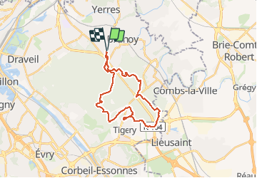
Trail Walking of 25 km to be discovered at Ile-de-France, Essonne, Brunoy. This trail is proposed by chessyca.

Description

Balade menée par Pierre par une super météo .
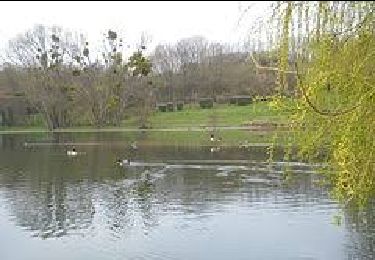
Aucune difficulté et déjeuner sympa au bord du lac
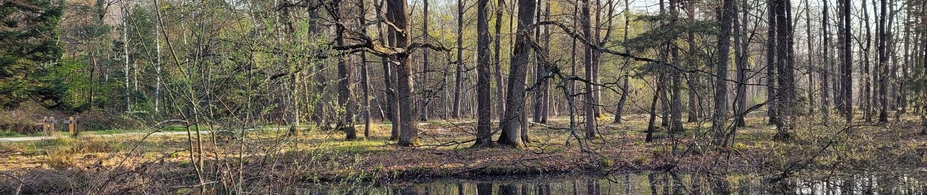
De nombreuses familles de chevreuils sur le parcours

Elevation profile

Photos

Positioning

Country:
France
Region :
Ile-de-France
Department/Province :
Essonne
Municipality :
Brunoy
Location:
Unknown
Start:(UTM)
462456 ; 5393130 (31U) N.

Trails nearby

Trail Walking Boussy-Saint-Antoine - GRP CV-IDF 04 - Photo
Walking
clalaur

Walking

Difficult
(1)
Boussy-Saint-Antoine, Ile-de-France, Essonne, France
16.8 km | 18.6 km-effort
4h 13min
No
Trail Walking Mandres-les-Roses - J 26 Mandres, Boussy , Brunoy le chemin des fresques  - Photo
Walking

Walking

Medium
(2)
Mandres-les-Roses, Ile-de-France, Val-de-Marne, France
12.2 km | 13.8 km-effort
3h 7min
Yes
Trail Walking Yerres - BM Foret Regionale de Grobois 10km - Photo
Walking
GUIDE
jeanmarcMasson

Walking

Medium
(1)
Yerres, Ile-de-France, Essonne, France
10.4 km | 11 km-effort
2h 30min
Yes
Trail Walking Yerres - BM Foret Regionale Grosbois 10km - Photo
Walking
GUIDE
jeanmarcMasson

Walking

Medium
(1)
Yerres, Ile-de-France, Essonne, France
9.8 km | 10.5 km-effort
2h 23min
Yes
Trail On foot Brunoy - L 39 Brunoy, les bords de l'Yerres - Photo
On foot

On foot

Very easy
(4)
Brunoy, Ile-de-France, Essonne, France
5.4 km | 6.1 km-effort
1h 49min
Yes
Trail Walking Montgeron - J 38 Montgeron la Pelouse, forêt de Sénart - Photo
Walking

Walking

Difficult
(3)
Montgeron, Ile-de-France, Essonne, France
12.4 km | 13.3 km-effort
3h 1min
Yes
Trail On foot Quincy-sous-Sénart - J 77 Tigery, Allée Royale - Photo
On foot

On foot

Medium
(3)
Quincy-sous-Sénart, Ile-de-France, Essonne, France
10.6 km | 12 km-effort
2h 44min
Yes
Trail On foot Boussy-Saint-Antoine - L 32: Boussy St Antoine l'Yerres et le Gord - Photo
On foot

On foot

Very easy
(3)
Boussy-Saint-Antoine, Ile-de-France, Essonne, France
6.2 km | 7.2 km-effort
1h 38min
Yes
Trail Walking Yerres - J 43  Yerres Parc Caillebotte, île des Prévôts - Photo
Walking

Walking

Medium
(2)
Yerres, Ile-de-France, Essonne, France
11.4 km | 13.1 km-effort
2h 59min
Yes


Close
My subscriptions