![](/images/other/stat-length.png)
![Trail Walking Seur - seur fougères sur bievre - Photo](https://media.geolcdn.com/t/1900/400/5d771a75-33af-4508-ab11-7629c86467f5.jpg&format=pjpeg&maxdim=2)
seur fougères sur bievre
kasyope
User
![Length](/images/other/stat-length.png)
Length
21 km
![Max alt](https://static1.geolcdn.com/siteimages/upload/files/1508320355ic_sort_altitude_max_24dp.png)
Max alt
111 m
![Uphill gradient](https://static1.geolcdn.com/siteimages/upload/files/1508320355ic_sort_den_pos_24dp.png)
Uphill gradient
150 m
![Km-Effort](/images/other/stat-length.png)
Km-Effort
23 km
![Min alt](https://static1.geolcdn.com/siteimages/upload/files/1508320355ic_sort_altitude_min_24dp.png)
Min alt
69 m
![Downhill gradient](https://static1.geolcdn.com/siteimages/upload/files/1508320355ic_sort_den_neg_24dp.png)
Downhill gradient
149 m
![Boucle](https://static1.geolcdn.com/siteimages/upload/files/16400158638029165_repeat_loop_refresh_sync_direction_icon.png)
Boucle
Yes
Creation date :
2021-04-18 09:43:56.885
Updated on :
2021-04-18 14:17:21.07
![Walking](https://static1.geolcdn.com/sitytour/trail-icons/101.png)
4h00
Difficulty : Medium
![Scan this QR Code to open this trail in the SityTrail application](https://capi.geolives.com/qq0zvz2zws4bq2lad0pu/sitytour/trails/2752465/qr.png?size=200)
FREE GPS app for hiking
About
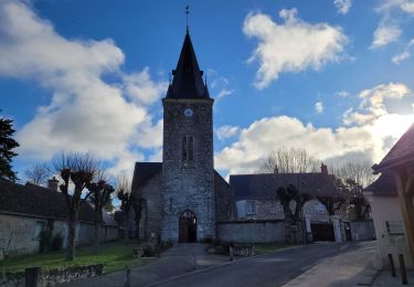
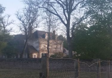
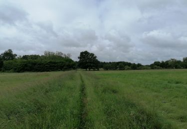
Trail Walking of 21 km to be discovered at Centre-Loire Valley, Loir-et-Cher, Seur. This trail is proposed by kasyope.
Description
attention difficulté pour trouver le passage à la petite ardoise. On a l'impression de rentrer dans une propriété. voir les photos du passage
Positioning
Country:
France
Region :
Centre-Loire Valley
Department/Province :
Loir-et-Cher
Municipality :
Seur
Location:
Unknown
Start:(Dec)
Start:(UTM)
374554 ; 5262624 (31T) N.
Comments
Trails nearby
![Trail Road bike Cellettes - Entre vignoble et châteaux - Photo](https://media.geolcdn.com/t/375/260/fd76316a-e28d-4952-828d-db3e12d1d6c9.jpg&format=jpg&maxdim=2)
![Road bike Road bike](https://static1.geolcdn.com/sitytour/trail-icons/201.png)
Entre vignoble et châteaux
Road bike
Medium
(1)
Cellettes,
Centre-Loire Valley,
Loir-et-Cher,
France
![](/images/other/stat-length.png)
25 km | 28 km-effort
1h 42min
![](https://static1.geolcdn.com/siteimages/upload/files/16400158638029165_repeat_loop_refresh_sync_direction_icon.png)
Yes
![Trail On foot Seur - seur, cande sur beuvron, madon, chailles,la haye,la boissiere,seur - Photo](https://media.geolcdn.com/t/375/260/ext.jpg?maxdim=2&url=https%3A%2F%2Fstatic1.geolcdn.com%2Fsiteimages%2Fupload%2Ffiles%2F1545311037marcheuse_200dpi.jpg)
![On foot On foot](https://static1.geolcdn.com/sitytour/trail-icons/100.png)
seur, cande sur beuvron, madon, chailles,la haye,la boissiere,seur
On foot
Medium
(1)
Seur,
Centre-Loire Valley,
Loir-et-Cher,
France
![](/images/other/stat-length.png)
26 km | 29 km-effort
6h 34min
![](https://static1.geolcdn.com/siteimages/upload/files/16400158638029165_repeat_loop_refresh_sync_direction_icon.png)
Yes
![Trail Walking Le Controis-en-Sologne - BBR 2024-03-27 Ouchamps 15 km - Photo](https://media.geolcdn.com/t/375/260/feb1ebb1-765f-4bed-98d5-c72d6d0beadd.jpg&format=jpg&maxdim=2)
![Walking Walking](https://static1.geolcdn.com/sitytour/trail-icons/101.png)
BBR 2024-03-27 Ouchamps 15 km
Walking
Medium
Le Controis-en-Sologne,
Centre-Loire Valley,
Loir-et-Cher,
France
![](/images/other/stat-length.png)
14.7 km | 16.3 km-effort
1h 14min
![](https://static1.geolcdn.com/siteimages/upload/files/16400158638029165_repeat_loop_refresh_sync_direction_icon.png)
Yes
![Trail Walking Seur - seur.cande sur beuvron.chailles.seur - Photo](https://media.geolcdn.com/t/375/260/63e5c44b-68e2-438b-ba05-41f8acdb9a0f.jpg&format=jpg&maxdim=2)
![Walking Walking](https://static1.geolcdn.com/sitytour/trail-icons/101.png)
seur.cande sur beuvron.chailles.seur
Walking
Difficult
Seur,
Centre-Loire Valley,
Loir-et-Cher,
France
![](/images/other/stat-length.png)
27 km | 30 km-effort
5h 16min
![](https://static1.geolcdn.com/siteimages/upload/files/16400158638029165_repeat_loop_refresh_sync_direction_icon.png)
Yes
![Trail Walking Cellettes - Cellettes 10Km en campagne - Photo](https://media.geolcdn.com/t/375/260/ext.jpg?maxdim=2&url=https%3A%2F%2Fstatic1.geolcdn.com%2Fsiteimages%2Fupload%2Ffiles%2F1553511878bg_sport_marche.png)
![Walking Walking](https://static1.geolcdn.com/sitytour/trail-icons/101.png)
Cellettes 10Km en campagne
Walking
Medium
Cellettes,
Centre-Loire Valley,
Loir-et-Cher,
France
![](/images/other/stat-length.png)
10.6 km | 11.9 km-effort
2h 12min
![](https://static1.geolcdn.com/siteimages/upload/files/16400158638029165_repeat_loop_refresh_sync_direction_icon.png)
Yes
![Trail Walking Cellettes - Cellettes 2024-05-30 - Photo](https://media.geolcdn.com/t/375/260/e0d655ed-df76-4cb5-852f-2dfda39e603d.jpg&format=jpg&maxdim=2)
![Walking Walking](https://static1.geolcdn.com/sitytour/trail-icons/101.png)
Cellettes 2024-05-30
Walking
Easy
Cellettes,
Centre-Loire Valley,
Loir-et-Cher,
France
![](/images/other/stat-length.png)
14 km | 15.7 km-effort
2h 51min
![](https://static1.geolcdn.com/siteimages/upload/files/16400158638029165_repeat_loop_refresh_sync_direction_icon.png)
Yes
![Trail Walking Cellettes - cellettes - Photo](https://media.geolcdn.com/t/375/260/ext.jpg?maxdim=2&url=https%3A%2F%2Fstatic1.geolcdn.com%2Fsiteimages%2Fupload%2Ffiles%2F1553511878bg_sport_marche.png)
![Walking Walking](https://static1.geolcdn.com/sitytour/trail-icons/101.png)
cellettes
Walking
Difficult
(1)
Cellettes,
Centre-Loire Valley,
Loir-et-Cher,
France
![](/images/other/stat-length.png)
14.6 km | 16.5 km-effort
3h 20min
![](https://static1.geolcdn.com/siteimages/upload/files/16400158638029165_repeat_loop_refresh_sync_direction_icon.png)
Yes
![Trail Walking Monthou-sur-Bièvre - BBR 2023-09-06 Monthou sur Bièvre - Photo](https://media.geolcdn.com/t/375/260/ext.jpg?maxdim=2&url=https%3A%2F%2Fstatic1.geolcdn.com%2Fsiteimages%2Fupload%2Ffiles%2F1553511878bg_sport_marche.png)
![Walking Walking](https://static1.geolcdn.com/sitytour/trail-icons/101.png)
BBR 2023-09-06 Monthou sur Bièvre
Walking
Medium
Monthou-sur-Bièvre,
Centre-Loire Valley,
Loir-et-Cher,
France
![](/images/other/stat-length.png)
14.8 km | 16.7 km-effort
3h 47min
![](https://static1.geolcdn.com/siteimages/upload/files/16400158638029165_repeat_loop_refresh_sync_direction_icon.png)
Yes
![Trail Walking Cellettes - GR Loire de Cellettes au château de Chaumont - Photo](https://media.geolcdn.com/t/375/260/ext.jpg?maxdim=2&url=https%3A%2F%2Fstatic1.geolcdn.com%2Fsiteimages%2Fupload%2Ffiles%2F1553511878bg_sport_marche.png)
![Walking Walking](https://static1.geolcdn.com/sitytour/trail-icons/101.png)
GR Loire de Cellettes au château de Chaumont
Walking
Very difficult
Cellettes,
Centre-Loire Valley,
Loir-et-Cher,
France
![](/images/other/stat-length.png)
24 km | 28 km-effort
9h 59min
![](https://static1.geolcdn.com/siteimages/upload/files/16400158638029165_repeat_loop_refresh_sync_direction_icon.png)
No