16.6 km | 18.2 km-effort
Entre l'Ill et la forêt
zazie
User
Length
7.4 km
Max alt
189 m
Uphill gradient
40 m
Km-Effort
7.9 km
Min alt
174 m
Downhill gradient
40 m
Boucle
Yes
Creation date :
2021-04-17 13:47:24.169
Updated on :
2021-04-17 15:14:29.072
1h26
Difficulty : Very easy
FREE GPS app for hiking
About
Trail Walking of 7.4 km to be discovered at Grand Est, Haut-Rhin, Colmar. This trail is proposed by zazie.
Description
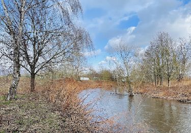
Randonnée en plaine alluviale et dans la forêt communale de Colmar
Positioning
Country:
France
Region :
Grand Est
Department/Province :
Haut-Rhin
Municipality :
Colmar
Location:
Unknown
Start:(Dec)
Start:(UTM)
382644 ; 5334276 (32U) N.
Comments
Trails nearby
Sur les sentiers d'Holtzwihr et de Riedwihr
Walking
Very easy
Porte-du-Ried,
Grand Est,
Haut-Rhin,
France
3h 12min
Yes
Sentiers botaniques d'Holtzwihr et de Riedwihr
Walking
Very easy
Porte-du-Ried,
Grand Est,
Haut-Rhin,
France
16.6 km | 18.2 km-effort
3h 12min
Yes
Bergheim - Entre vignes et crèches
Walking
Very easy
Bergheim,
Grand Est,
Haut-Rhin,
France
6.5 km | 7.3 km-effort
1h 25min
Yes
Le long de la rivière Fecht à Ostheim en France
Walking
Easy
Ostheim,
Grand Est,
Haut-Rhin,
France
2.3 km | 2.5 km-effort
33min
Yes
Illhausern Le sentier des Ried, voie romaine
Walking
Very easy
Illhaeusern,
Grand Est,
Haut-Rhin,
France
7.9 km | 8.6 km-effort
1h 31min
Yes
Canoé-descente de l'ill
Canoe - kayak
Medium
Colmar,
Grand Est,
Haut-Rhin,
France
13.3 km | 14.3 km-effort
3h 0min
No
Boucle sentiers de découverte Holtzwihr
Walking
Easy
Porte-du-Ried,
Grand Est,
Haut-Rhin,
France
13.2 km | 14.4 km-effort
3h 0min
Yes