![](/images/other/stat-length.png)
![Trail Walking Monschau - Kalterherberg - rocher du Bieley - Photo](https://media.geolcdn.com/t/1900/400/ext.pjpeg?maxdim=2&url=https%3A%2F%2Fmedia.geolcdn.com%2Ff%2F7ef35b5c-9f92-4bf9-8045-5f850f37b3d1.jpg)
Kalterherberg - rocher du Bieley
ericferon
User
![Length](/images/other/stat-length.png)
Length
17 km
![Max alt](https://static1.geolcdn.com/siteimages/upload/files/1508320355ic_sort_altitude_max_24dp.png)
Max alt
619 m
![Uphill gradient](https://static1.geolcdn.com/siteimages/upload/files/1508320355ic_sort_den_pos_24dp.png)
Uphill gradient
317 m
![Km-Effort](/images/other/stat-length.png)
Km-Effort
21 km
![Min alt](https://static1.geolcdn.com/siteimages/upload/files/1508320355ic_sort_altitude_min_24dp.png)
Min alt
505 m
![Downhill gradient](https://static1.geolcdn.com/siteimages/upload/files/1508320355ic_sort_den_neg_24dp.png)
Downhill gradient
318 m
![Boucle](https://static1.geolcdn.com/siteimages/upload/files/16400158638029165_repeat_loop_refresh_sync_direction_icon.png)
Boucle
Yes
Creation date :
2021-04-15 09:29:54.552
Updated on :
2021-04-19 17:11:36.724
![Walking](https://static1.geolcdn.com/sitytour/trail-icons/101.png)
6h24
Difficulty : Difficult
![Scan this QR Code to open this trail in the SityTrail application](https://capi.geolives.com/qq0zvz2zws4bq2lad0pu/sitytour/trails/2748553/qr.png?size=200)
FREE GPS app for hiking
About
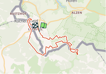
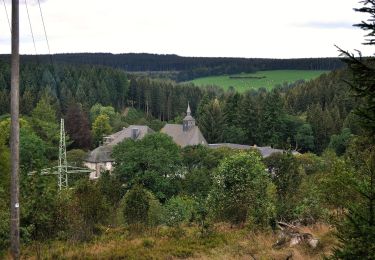
Trail Walking of 17 km to be discovered at North Rhine-Westphalia, Städteregion Aachen, Monschau. This trail is proposed by ericferon.
Description
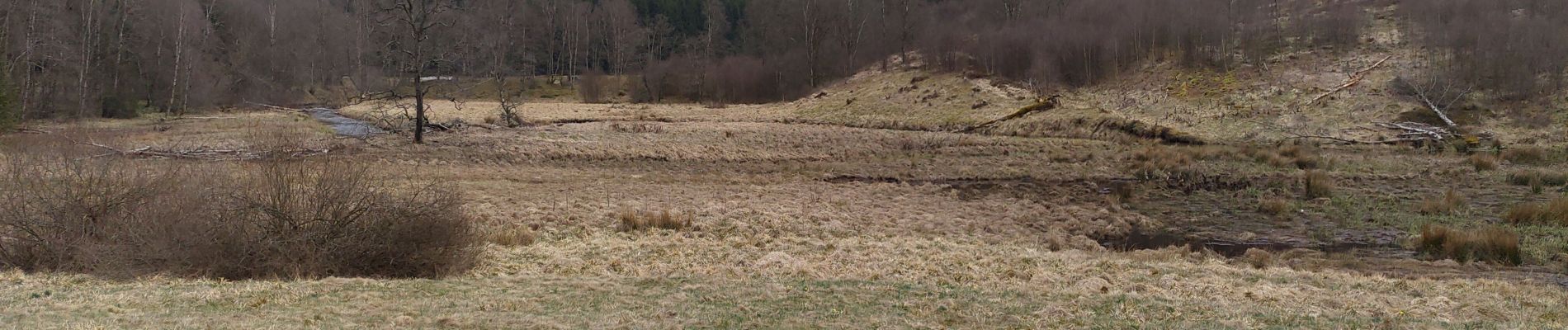
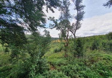
Promenade aux confins du camp militaire d'Elsenborn, via une vallée remplie de jonquilles (en saison), jusqu'à un rocher avec un très beau point de vue.
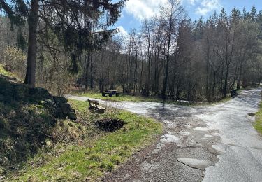
Départ au railbike des Hautes-Fagnes (et non de l'endroit indiqué par Sitytrail !)
Positioning
Country:
Germany
Region :
North Rhine-Westphalia
Department/Province :
Städteregion Aachen
Municipality :
Monschau
Location:
Unknown
Start:(Dec)
Start:(UTM)
302885 ; 5599230 (32U) N.
Comments
Trails nearby
![Trail Walking Monschau - 2024-03-28_17h00m40_partnerweg-des-eifelsteigs-narzissenroute (1) - Photo](https://media.geolcdn.com/t/375/260/ext.jpg?maxdim=2&url=https%3A%2F%2Fmedia.geolcdn.com%2Ff%2Ff78b6422-c27b-477b-b695-82eecbd61b40.jpg)
![Walking Walking](https://static1.geolcdn.com/sitytour/trail-icons/101.png)
2024-03-28_17h00m40_partnerweg-des-eifelsteigs-narzissenroute (1)
Walking
Medium
(1)
Monschau,
North Rhine-Westphalia,
Städteregion Aachen,
Germany
![](/images/other/stat-length.png)
14.8 km | 18.2 km-effort
4h 8min
![](https://static1.geolcdn.com/siteimages/upload/files/16400158638029165_repeat_loop_refresh_sync_direction_icon.png)
Yes
![Trail Walking Monschau - Montjoie - Ternell en ligne - Photo](https://media.geolcdn.com/t/375/260/ext.jpg?maxdim=2&url=https%3A%2F%2Fmedia.geolcdn.com%2Ff%2Fd0229e76-e80b-4ee0-af20-8e96d215cea3.jpg)
![Walking Walking](https://static1.geolcdn.com/sitytour/trail-icons/101.png)
Montjoie - Ternell en ligne
Walking
Medium
(1)
Monschau,
North Rhine-Westphalia,
Städteregion Aachen,
Germany
![](/images/other/stat-length.png)
13.2 km | 17.1 km-effort
3h 52min
![](https://static1.geolcdn.com/siteimages/upload/files/16400158638029165_repeat_loop_refresh_sync_direction_icon.png)
No
![Trail Walking Bütgenbach - 2021-08-07_23h49m19_kalterherberg - Photo](https://media.geolcdn.com/t/375/260/ext.jpg?maxdim=2&url=https%3A%2F%2Fmedia.geolcdn.com%2Ff%2Ff30f3eaf-c1e4-41d4-bcfb-42e5cbece161.jpg)
![Walking Walking](https://static1.geolcdn.com/sitytour/trail-icons/101.png)
2021-08-07_23h49m19_kalterherberg
Walking
Easy
(2)
Bütgenbach,
Wallonia,
Liège,
Belgium
![](/images/other/stat-length.png)
13.8 km | 17.3 km-effort
3h 56min
![](https://static1.geolcdn.com/siteimages/upload/files/16400158638029165_repeat_loop_refresh_sync_direction_icon.png)
Yes
![Trail Walking Monschau - Rando Eifel des jonquilles narcisses 18,3 - Photo](https://media.geolcdn.com/t/375/260/ext.jpg?maxdim=2&url=https%3A%2F%2Fmedia.geolcdn.com%2Ff%2F29cf751c-7851-449b-b365-4b88ea56faf3.jpg)
![Walking Walking](https://static1.geolcdn.com/sitytour/trail-icons/101.png)
Rando Eifel des jonquilles narcisses 18,3
Walking
Medium
Monschau,
North Rhine-Westphalia,
Städteregion Aachen,
Germany
![](/images/other/stat-length.png)
18.6 km | 23 km-effort
4h 57min
![](https://static1.geolcdn.com/siteimages/upload/files/16400158638029165_repeat_loop_refresh_sync_direction_icon.png)
Yes
![Trail On foot Monschau - Eifelverein Rohren - Weg 57 - Photo](https://media.geolcdn.com/t/375/260/ext.jpg?maxdim=2&url=https%3A%2F%2Fmedia.geolcdn.com%2Ff%2Fa620ba14-736e-46ad-b0d4-965dfc1d4df3.jpeg)
![On foot On foot](https://static1.geolcdn.com/sitytour/trail-icons/100.png)
Eifelverein Rohren - Weg 57
On foot
Medium
(1)
Monschau,
North Rhine-Westphalia,
Städteregion Aachen,
Germany
![](/images/other/stat-length.png)
15.1 km | 20 km-effort
4h 34min
![](https://static1.geolcdn.com/siteimages/upload/files/16400158638029165_repeat_loop_refresh_sync_direction_icon.png)
Yes
![Trail On foot Monschau - Monschauer Nationalpark-Wanderweg](https://media.geolcdn.com/t/375/260/ext.jpg?maxdim=2&url=https%3A%2F%2Fmedia.geolcdn.com%2Ff%2F6ecae744-a5e1-4d67-8c65-d4bc2433654d.jpeg)
![On foot On foot](https://static1.geolcdn.com/sitytour/trail-icons/100.png)
Monschauer Nationalpark-Wanderweg "Wasser, Wolle, Schieferstein"
On foot
Easy
Monschau,
North Rhine-Westphalia,
Städteregion Aachen,
Germany
![](/images/other/stat-length.png)
5.9 km | 8.6 km-effort
1h 57min
![](https://static1.geolcdn.com/siteimages/upload/files/16400158638029165_repeat_loop_refresh_sync_direction_icon.png)
No
![Trail On foot Monschau - Narzissenroute Höfen (Eifel) - Photo](https://media.geolcdn.com/t/375/260/ext.jpg?maxdim=2&url=https%3A%2F%2Fmedia.geolcdn.com%2Ff%2F4209bd6d-0e5a-4c94-aa91-ecdefe50dbb3.jpeg)
![On foot On foot](https://static1.geolcdn.com/sitytour/trail-icons/100.png)
Narzissenroute Höfen (Eifel)
On foot
Easy
Monschau,
North Rhine-Westphalia,
Städteregion Aachen,
Germany
![](/images/other/stat-length.png)
8.6 km | 11 km-effort
2h 29min
![](https://static1.geolcdn.com/siteimages/upload/files/16400158638029165_repeat_loop_refresh_sync_direction_icon.png)
No
![Trail On foot Monschau - Klosterroute - Photo](https://media.geolcdn.com/t/375/260/ext.jpg?maxdim=2&url=https%3A%2F%2Fmedia.geolcdn.com%2Ff%2Fd4896ddf-a189-42c6-b0a5-59bf65f3272d.jpeg)
![On foot On foot](https://static1.geolcdn.com/sitytour/trail-icons/100.png)
Klosterroute
On foot
Medium
Monschau,
North Rhine-Westphalia,
Städteregion Aachen,
Germany
![](/images/other/stat-length.png)
22 km | 30 km-effort
6h 48min
![](https://static1.geolcdn.com/siteimages/upload/files/16400158638029165_repeat_loop_refresh_sync_direction_icon.png)
Yes
![Trail Walking Monschau - 2021-12-01_19h44m48_804 - Photo](https://media.geolcdn.com/t/375/260/ext.jpg?maxdim=2&url=https%3A%2F%2Fmedia.geolcdn.com%2Ff%2Fd1f17d7d-8df2-4115-bdce-e0c85ad6eaa6.jpg)
![Walking Walking](https://static1.geolcdn.com/sitytour/trail-icons/101.png)
2021-12-01_19h44m48_804
Walking
Difficult
Monschau,
North Rhine-Westphalia,
Städteregion Aachen,
Germany
![](/images/other/stat-length.png)
10.7 km | 15.3 km-effort
3h 28min
![](https://static1.geolcdn.com/siteimages/upload/files/16400158638029165_repeat_loop_refresh_sync_direction_icon.png)
Yes