![](/images/other/stat-length.png)
![Trail Walking Manzat - A proximité de l'étang de Lachamp - Photo](https://media.geolcdn.com/t/1900/400/ext.pjpeg?maxdim=2&url=https%3A%2F%2Fstatic1.geolcdn.com%2Fsiteimages%2Fupload%2Ffiles%2F1553511878bg_sport_marche.png)
A proximité de l'étang de Lachamp
Gegetop
User
![Length](/images/other/stat-length.png)
Length
9.3 km
![Max alt](https://static1.geolcdn.com/siteimages/upload/files/1508320355ic_sort_altitude_max_24dp.png)
Max alt
888 m
![Uphill gradient](https://static1.geolcdn.com/siteimages/upload/files/1508320355ic_sort_den_pos_24dp.png)
Uphill gradient
272 m
![Km-Effort](/images/other/stat-length.png)
Km-Effort
12.9 km
![Min alt](https://static1.geolcdn.com/siteimages/upload/files/1508320355ic_sort_altitude_min_24dp.png)
Min alt
743 m
![Downhill gradient](https://static1.geolcdn.com/siteimages/upload/files/1508320355ic_sort_den_neg_24dp.png)
Downhill gradient
276 m
![Boucle](https://static1.geolcdn.com/siteimages/upload/files/16400158638029165_repeat_loop_refresh_sync_direction_icon.png)
Boucle
Yes
Creation date :
2018-01-18 00:00:00.0
Updated on :
2018-01-18 00:00:00.0
![Walking](https://static1.geolcdn.com/sitytour/trail-icons/101.png)
2h30
Difficulty : Easy
![Scan this QR Code to open this trail in the SityTrail application](https://capi.geolives.com/qq0zvz2zws4bq2lad0pu/sitytour/trails/274791/qr.png?size=200)
FREE GPS app for hiking
About
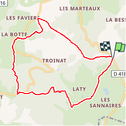
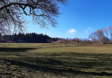
Trail Walking of 9.3 km to be discovered at Auvergne-Rhône-Alpes, Puy-de-Dôme, Manzat. This trail is proposed by Gegetop.
Description
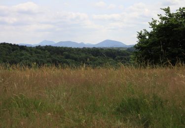
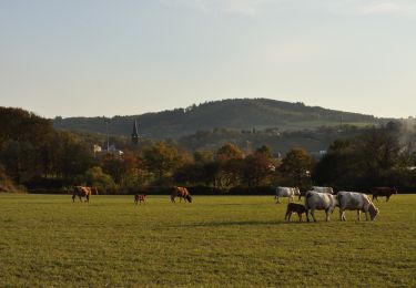
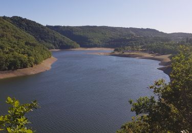
Balade facile et très agréable alternant des chemins ombragés et des chemins dégagés permettant de profiter du soleil et de la nature.
Positioning
Country:
France
Region :
Auvergne-Rhône-Alpes
Department/Province :
Puy-de-Dôme
Municipality :
Manzat
Location:
Unknown
Start:(Dec)
Start:(UTM)
496033 ; 5086841 (31T) N.
Comments
Trails nearby
![Trail On foot Charbonnières-les-Vieilles - Le Gour de Tazenat - circuit bleu - Photo](https://media.geolcdn.com/t/375/260/8230f2b0-ccfb-4cd9-8aa4-51b5081b9b49.jpeg&format=jpg&maxdim=2)
![On foot On foot](https://static1.geolcdn.com/sitytour/trail-icons/100.png)
Le Gour de Tazenat - circuit bleu
On foot
Easy
Charbonnières-les-Vieilles,
Auvergne-Rhône-Alpes,
Puy-de-Dôme,
France
![](/images/other/stat-length.png)
6.4 km | 8.3 km-effort
1h 53min
![](https://static1.geolcdn.com/siteimages/upload/files/16400158638029165_repeat_loop_refresh_sync_direction_icon.png)
Yes
![Trail On foot Manzat - Aux Sources de la Morge - Photo](https://media.geolcdn.com/t/375/260/5410179d-bc75-4fce-aa40-6165831bf324.jpeg&format=jpg&maxdim=2)
![On foot On foot](https://static1.geolcdn.com/sitytour/trail-icons/100.png)
Aux Sources de la Morge
On foot
Medium
Manzat,
Auvergne-Rhône-Alpes,
Puy-de-Dôme,
France
![](/images/other/stat-length.png)
16.3 km | 23 km-effort
5h 8min
![](https://static1.geolcdn.com/siteimages/upload/files/16400158638029165_repeat_loop_refresh_sync_direction_icon.png)
Yes
![Trail On foot Charbonnières-les-Vieilles - Le Gour de Tazenat - Photo](https://media.geolcdn.com/t/375/260/20ada79d-32ef-4fe6-85b1-bd8631813a01.jpeg&format=jpg&maxdim=2)
![On foot On foot](https://static1.geolcdn.com/sitytour/trail-icons/100.png)
Le Gour de Tazenat
On foot
Easy
Charbonnières-les-Vieilles,
Auvergne-Rhône-Alpes,
Puy-de-Dôme,
France
![](/images/other/stat-length.png)
3.9 km | 5.2 km-effort
1h 11min
![](https://static1.geolcdn.com/siteimages/upload/files/16400158638029165_repeat_loop_refresh_sync_direction_icon.png)
Yes
![Trail Mountain bike Loubeyrat - camping GCU loubeyrat, gour de tazenat - Photo](https://media.geolcdn.com/t/375/260/c16b9fbd-4727-4221-a9c8-7acae4d3d0c3.jpg&format=jpg&maxdim=2)
![Mountain bike Mountain bike](https://static1.geolcdn.com/sitytour/trail-icons/202.png)
camping GCU loubeyrat, gour de tazenat
Mountain bike
Difficult
Loubeyrat,
Auvergne-Rhône-Alpes,
Puy-de-Dôme,
France
![](/images/other/stat-length.png)
25 km | 31 km-effort
2h 41min
![](https://static1.geolcdn.com/siteimages/upload/files/16400158638029165_repeat_loop_refresh_sync_direction_icon.png)
Yes
![Trail On foot Manzat - La Roche de Sauterre - Photo](https://media.geolcdn.com/t/375/260/8dba4542-9ef0-4bdf-8b1f-a5675463ca16.jpeg&format=jpg&maxdim=2)
![On foot On foot](https://static1.geolcdn.com/sitytour/trail-icons/100.png)
La Roche de Sauterre
On foot
Easy
Manzat,
Auvergne-Rhône-Alpes,
Puy-de-Dôme,
France
![](/images/other/stat-length.png)
4.2 km | 5.8 km-effort
1h 18min
![](https://static1.geolcdn.com/siteimages/upload/files/16400158638029165_repeat_loop_refresh_sync_direction_icon.png)
Yes
![Trail Walking Charbonnières-les-Varennes - Charbonnieres_Manoir - Photo](https://media.geolcdn.com/t/375/260/cfb40e0d-7db6-4903-ba3b-6861e6d3cd75.jpg&format=jpg&maxdim=2)
![Walking Walking](https://static1.geolcdn.com/sitytour/trail-icons/101.png)
Charbonnieres_Manoir
Walking
Easy
Charbonnières-les-Varennes,
Auvergne-Rhône-Alpes,
Puy-de-Dôme,
France
![](/images/other/stat-length.png)
7.2 km | 9 km-effort
2h 15min
![](https://static1.geolcdn.com/siteimages/upload/files/16400158638029165_repeat_loop_refresh_sync_direction_icon.png)
Yes
![Trail Running Loubeyrat - jour 11 CAP Jeanot - Photo](https://media.geolcdn.com/t/375/260/ebbe0f7f-e642-4e04-8c2f-02adf97172ae.jpg&format=jpg&maxdim=2)
![Running Running](https://static1.geolcdn.com/sitytour/trail-icons/103.png)
jour 11 CAP Jeanot
Running
Very easy
Loubeyrat,
Auvergne-Rhône-Alpes,
Puy-de-Dôme,
France
![](/images/other/stat-length.png)
35 km | 45 km-effort
4h 22min
![](https://static1.geolcdn.com/siteimages/upload/files/16400158638029165_repeat_loop_refresh_sync_direction_icon.png)
No
![Trail Walking Loubeyrat - Loubeyrat_Cathedrale_Montagnes - Photo](https://media.geolcdn.com/t/375/260/d6acc471-cdd1-42f5-bdc8-63627d48071b.jpg&format=jpg&maxdim=2)
![Walking Walking](https://static1.geolcdn.com/sitytour/trail-icons/101.png)
Loubeyrat_Cathedrale_Montagnes
Walking
Medium
Loubeyrat,
Auvergne-Rhône-Alpes,
Puy-de-Dôme,
France
![](/images/other/stat-length.png)
12.7 km | 16.2 km-effort
3h 45min
![](https://static1.geolcdn.com/siteimages/upload/files/16400158638029165_repeat_loop_refresh_sync_direction_icon.png)
Yes
![Trail Walking Charbonnières-les-Varennes - Beaunit_Narse_JG_02 - Photo](https://media.geolcdn.com/t/375/260/2347cc26-eafa-4011-be79-b7d07d478152.jpg&format=jpg&maxdim=2)
![Walking Walking](https://static1.geolcdn.com/sitytour/trail-icons/101.png)
Beaunit_Narse_JG_02
Walking
Easy
Charbonnières-les-Varennes,
Auvergne-Rhône-Alpes,
Puy-de-Dôme,
France
![](/images/other/stat-length.png)
8.2 km | 10.4 km-effort
2h 30min
![](https://static1.geolcdn.com/siteimages/upload/files/16400158638029165_repeat_loop_refresh_sync_direction_icon.png)
Yes