13.2 km | 18.9 km-effort
Tour Col de Bluffy. Col des Contrebandiers. Mont Barey
olivecoco
User
Length
11.4 km
Max alt
1234 m
Uphill gradient
878 m
Km-Effort
23 km
Min alt
688 m
Downhill gradient
879 m
Boucle
Yes
Creation date :
2021-04-08 08:36:37.108
Updated on :
2021-04-08 13:16:37.384
4h16
Difficulty : Very difficult
FREE GPS app for hiking
About
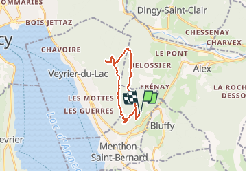
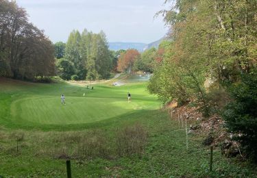
Trail Walking of 11.4 km to be discovered at Auvergne-Rhône-Alpes, Upper Savoy, Menthon-Saint-Bernard. This trail is proposed by olivecoco.
Description
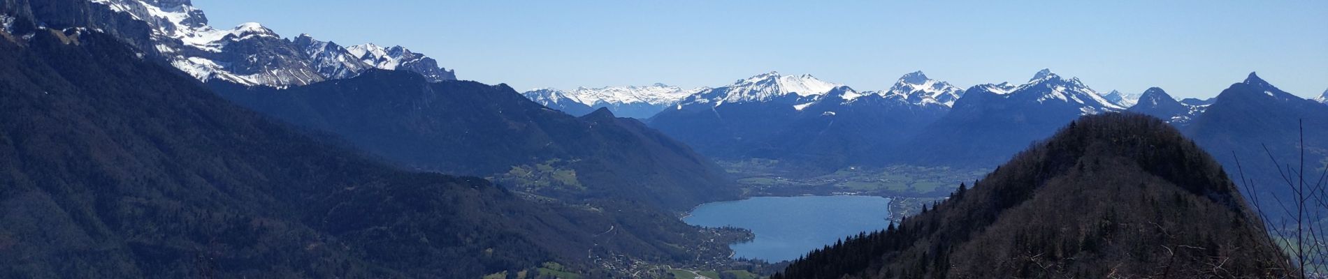
Très jolie boucle avec vues inhabituelles sur lac et montagnes
Positioning
Country:
France
Region :
Auvergne-Rhône-Alpes
Department/Province :
Upper Savoy
Municipality :
Menthon-Saint-Bernard
Location:
Unknown
Start:(Dec)
Start:(UTM)
283215 ; 5083770 (32T) N.
Comments
Trails nearby
Saint Jorioz - Boucle du Laudon
Walking
Easy
Saint-Jorioz,
Auvergne-Rhône-Alpes,
Upper Savoy,
France
3h 13min
Yes
Talloires ermitage
Walking
Talloires-Montmin,
Auvergne-Rhône-Alpes,
Upper Savoy,
France
7 km | 11.8 km-effort
2h 5min
Yes
Aulp-La Tournette
Walking
Difficult
(1)
Talloires-Montmin,
Auvergne-Rhône-Alpes,
Upper Savoy,
France
8.1 km | 21 km-effort
4h 14min
Yes
Annecy
Walking
Difficult
Talloires-Montmin,
Auvergne-Rhône-Alpes,
Upper Savoy,
France
10.4 km | 14.2 km-effort
2h 53min
Yes
74 Mt Veyrier 26.06.23
Walking
Medium
Veyrier-du-Lac,
Auvergne-Rhône-Alpes,
Upper Savoy,
France
8.1 km | 18.5 km-effort
4h 19min
Yes
260523 Monr Veyrier
Walking
Difficult
Annecy,
Auvergne-Rhône-Alpes,
Upper Savoy,
France
12.6 km | 25 km-effort
4h 24min
Yes
BORNES: UN PEU DE DENIVELE AU DEPART DE PLANFAIT
Walking
Difficult
Talloires-Montmin,
Auvergne-Rhône-Alpes,
Upper Savoy,
France
16.6 km | 35 km-effort
5h 23min
Yes
Tour du Lac d’Annecy
Road bike
Easy
Saint-Jorioz,
Auvergne-Rhône-Alpes,
Upper Savoy,
France
39 km | 46 km-effort
2h 48min
Yes
tour du lac d annecy
Bicycle tourism
Very difficult
Veyrier-du-Lac,
Auvergne-Rhône-Alpes,
Upper Savoy,
France
39 km | 45 km-effort
2h 57min
Yes