![](/images/other/stat-length.png)
![Trail On foot Angaïs - ANGAIS dans le bois pour LPC durant le confinement 04/2021 - Photo](https://media.geolcdn.com/t/1900/400/ext.pjpeg?maxdim=2&url=https%3A%2F%2Fstatic1.geolcdn.com%2Fsiteimages%2Fupload%2Ffiles%2F1545311037marcheuse_200dpi.jpg)
ANGAIS dans le bois pour LPC durant le confinement 04/2021
marmotte65
User GUIDE
![Length](/images/other/stat-length.png)
Length
12.6 km
![Max alt](https://static1.geolcdn.com/siteimages/upload/files/1508320355ic_sort_altitude_max_24dp.png)
Max alt
409 m
![Uphill gradient](https://static1.geolcdn.com/siteimages/upload/files/1508320355ic_sort_den_pos_24dp.png)
Uphill gradient
383 m
![Km-Effort](/images/other/stat-length.png)
Km-Effort
17.7 km
![Min alt](https://static1.geolcdn.com/siteimages/upload/files/1508320355ic_sort_altitude_min_24dp.png)
Min alt
227 m
![Downhill gradient](https://static1.geolcdn.com/siteimages/upload/files/1508320355ic_sort_den_neg_24dp.png)
Downhill gradient
383 m
![Boucle](https://static1.geolcdn.com/siteimages/upload/files/16400158638029165_repeat_loop_refresh_sync_direction_icon.png)
Boucle
Yes
Creation date :
2021-04-06 15:47:06.318
Updated on :
2021-04-06 15:52:41.922
![On foot](https://static1.geolcdn.com/sitytour/trail-icons/100.png)
4h00
Difficulty : Easy
![Scan this QR Code to open this trail in the SityTrail application](https://capi.geolives.com/qq0zvz2zws4bq2lad0pu/sitytour/trails/2737533/qr.png?size=200)
FREE GPS app for hiking
About
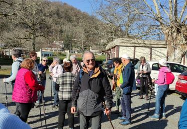
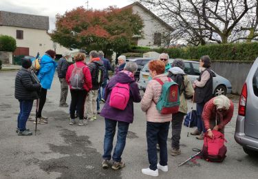
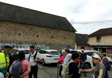
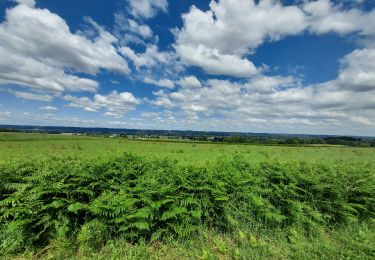
Trail On foot of 12.6 km to be discovered at New Aquitaine, Pyrénées-Atlantiques, Angaïs. This trail is proposed by marmotte65.
Description
Une escapade dans le bois d'Angais pour que les LPC restent en forme.
revu a la baisse de 21 km elle passe a 13km reconnue avec PT le 3/05/2012
Positioning
Country:
France
Region :
New Aquitaine
Department/Province :
Pyrénées-Atlantiques
Municipality :
Angaïs
Location:
Unknown
Start:(Dec)
Start:(UTM)
723427 ; 4790814 (30T) N.
Comments
Trails nearby
![Trail Walking Assat - BALISAGE GR 782 OUSSE / PONT DU14 JUILLET le 4/04/2023](https://media.geolcdn.com/t/375/260/eb1c9c16-be7e-4360-bd65-bc0bfd1108bb.jpg&format=jpg&maxdim=2)
![Walking Walking](https://static1.geolcdn.com/sitytour/trail-icons/101.png)
BALISAGE GR 782 OUSSE / PONT DU14 JUILLET le 4/04/2023 "3608855"
Walking
Difficult
Assat,
New Aquitaine,
Pyrénées-Atlantiques,
France
![](/images/other/stat-length.png)
11.3 km | 12.9 km-effort
2h 56min
![](https://static1.geolcdn.com/siteimages/upload/files/16400158638029165_repeat_loop_refresh_sync_direction_icon.png)
No
![Trail Walking Assat - OUSSE a la rencontre de Cesar M2 - Photo](https://media.geolcdn.com/t/375/260/be0f19de-b432-4b6e-a08d-e17178e1c230.jpg&format=jpg&maxdim=2)
![Walking Walking](https://static1.geolcdn.com/sitytour/trail-icons/101.png)
OUSSE a la rencontre de Cesar M2
Walking
Easy
Assat,
New Aquitaine,
Pyrénées-Atlantiques,
France
![](/images/other/stat-length.png)
8.3 km | 10.2 km-effort
2h 5min
![](https://static1.geolcdn.com/siteimages/upload/files/16400158638029165_repeat_loop_refresh_sync_direction_icon.png)
Yes
![Trail Mountain bike Bordères - Petite boucle rapide - Photo](https://media.geolcdn.com/t/375/260/ext.jpg?maxdim=2&url=https%3A%2F%2Fstatic1.geolcdn.com%2Fsiteimages%2Fupload%2Ffiles%2F1524743154velo.jpg)
![Mountain bike Mountain bike](https://static1.geolcdn.com/sitytour/trail-icons/202.png)
Petite boucle rapide
Mountain bike
Easy
(1)
Bordères,
New Aquitaine,
Pyrénées-Atlantiques,
France
![](/images/other/stat-length.png)
9.4 km | 11.9 km-effort
46min
![](https://static1.geolcdn.com/siteimages/upload/files/16400158638029165_repeat_loop_refresh_sync_direction_icon.png)
Yes
![Trail Walking Baliros - BALIROS RS](https://media.geolcdn.com/t/375/260/31690ab5-5d02-4c9a-a234-d556a720ad25.jpg&format=jpg&maxdim=2)
![Walking Walking](https://static1.geolcdn.com/sitytour/trail-icons/101.png)
BALIROS RS "3933114"
Walking
Easy
Baliros,
New Aquitaine,
Pyrénées-Atlantiques,
France
![](/images/other/stat-length.png)
5 km | 5.5 km-effort
2h 27min
![](https://static1.geolcdn.com/siteimages/upload/files/16400158638029165_repeat_loop_refresh_sync_direction_icon.png)
Yes
![Trail Walking Assat - ASSAT RS](https://media.geolcdn.com/t/375/260/e0a2260f-fa80-470c-87ea-b647d7cf9a88.jpg&format=jpg&maxdim=2)
![Walking Walking](https://static1.geolcdn.com/sitytour/trail-icons/101.png)
ASSAT RS "3860975"
Walking
Easy
Assat,
New Aquitaine,
Pyrénées-Atlantiques,
France
![](/images/other/stat-length.png)
5.2 km | 5.6 km-effort
1h 46min
![](https://static1.geolcdn.com/siteimages/upload/files/16400158638029165_repeat_loop_refresh_sync_direction_icon.png)
Yes
![Trail Walking Baudreix - BAUDREIX RS Le tour de la saligue](https://media.geolcdn.com/t/375/260/eb1b4863-415e-4c07-bbee-331e0d538026.jpg&format=jpg&maxdim=2)
![Walking Walking](https://static1.geolcdn.com/sitytour/trail-icons/101.png)
BAUDREIX RS Le tour de la saligue "3592973"
Walking
Easy
Baudreix,
New Aquitaine,
Pyrénées-Atlantiques,
France
![](/images/other/stat-length.png)
4.7 km | 5.2 km-effort
1h 39min
![](https://static1.geolcdn.com/siteimages/upload/files/16400158638029165_repeat_loop_refresh_sync_direction_icon.png)
Yes
![Trail Walking Nousty - NOUSTY RS en boucle - Photo](https://media.geolcdn.com/t/375/260/620c941d-a78b-44ac-862c-a45dabacc2fb.jpg&format=jpg&maxdim=2)
![Walking Walking](https://static1.geolcdn.com/sitytour/trail-icons/101.png)
NOUSTY RS en boucle
Walking
Easy
Nousty,
New Aquitaine,
Pyrénées-Atlantiques,
France
![](/images/other/stat-length.png)
4.6 km | 5.2 km-effort
1h 19min
![](https://static1.geolcdn.com/siteimages/upload/files/16400158638029165_repeat_loop_refresh_sync_direction_icon.png)
Yes
![Trail Mountain bike Lucgarier - Lucgarier RShoun de moussu reconnu - Photo](https://media.geolcdn.com/t/375/260/3af7f174-175d-4fa4-acc1-040b1ab78bdd.jpg&format=jpg&maxdim=2)
![Mountain bike Mountain bike](https://static1.geolcdn.com/sitytour/trail-icons/202.png)
Lucgarier RShoun de moussu reconnu
Mountain bike
Easy
Lucgarier,
New Aquitaine,
Pyrénées-Atlantiques,
France
![](/images/other/stat-length.png)
4.9 km | 6.1 km-effort
30min
![](https://static1.geolcdn.com/siteimages/upload/files/16400158638029165_repeat_loop_refresh_sync_direction_icon.png)
Yes
![Trail Walking Artigueloutan - ARTIGUELOUTAN Artigousse - Photo](https://media.geolcdn.com/t/375/260/ffa13bf5-e0a6-4887-b09e-01a47f0be52c.jpg&format=jpg&maxdim=2)
![Walking Walking](https://static1.geolcdn.com/sitytour/trail-icons/101.png)
ARTIGUELOUTAN Artigousse
Walking
Medium
Artigueloutan,
New Aquitaine,
Pyrénées-Atlantiques,
France
![](/images/other/stat-length.png)
7.6 km | 9.5 km-effort
2h 11min
![](https://static1.geolcdn.com/siteimages/upload/files/16400158638029165_repeat_loop_refresh_sync_direction_icon.png)
Yes