![](/images/other/stat-length.png)
![Trail On foot Gergueil - Gergueuil-GISSEY sur Ouche - Photo](https://media.geolcdn.com/t/1900/400/ext.pjpeg?maxdim=2&url=https%3A%2F%2Fstatic1.geolcdn.com%2Fsiteimages%2Fupload%2Ffiles%2F1545311037marcheuse_200dpi.jpg)
Gergueuil-GISSEY sur Ouche
mpstoop
User
![Length](/images/other/stat-length.png)
![Max alt](https://static1.geolcdn.com/siteimages/upload/files/1508320355ic_sort_altitude_max_24dp.png)
![Uphill gradient](https://static1.geolcdn.com/siteimages/upload/files/1508320355ic_sort_den_pos_24dp.png)
![Km-Effort](/images/other/stat-length.png)
![Min alt](https://static1.geolcdn.com/siteimages/upload/files/1508320355ic_sort_altitude_min_24dp.png)
![Downhill gradient](https://static1.geolcdn.com/siteimages/upload/files/1508320355ic_sort_den_neg_24dp.png)
![Boucle](https://static1.geolcdn.com/siteimages/upload/files/16400158638029165_repeat_loop_refresh_sync_direction_icon.png)
![On foot](https://static1.geolcdn.com/sitytour/trail-icons/100.png)
5h16
Difficulty : Medium
![Mountain bike](https://static1.geolcdn.com/sitytour/trail-icons/202.png)
1h36
Difficulty : Medium
![Scan this QR Code to open this trail in the SityTrail application](https://capi.geolives.com/qq0zvz2zws4bq2lad0pu/sitytour/trails/2736920/qr.png?size=200)
FREE GPS app for hiking
About
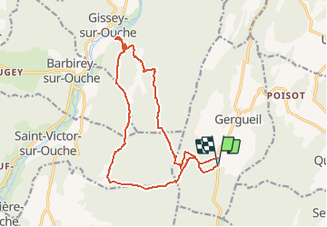
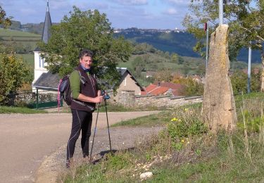
Trail On foot of 17.2 km to be discovered at Bourgogne-Franche-Comté, Côte-d'Or, Gergueil. This trail is proposed by mpstoop.
Description
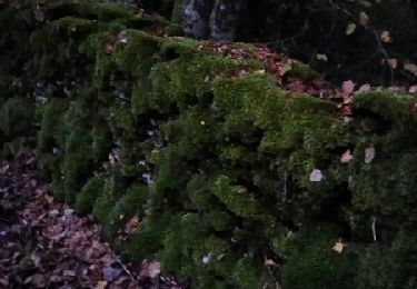
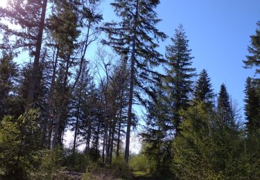
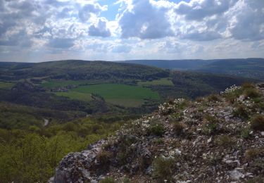
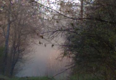
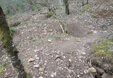
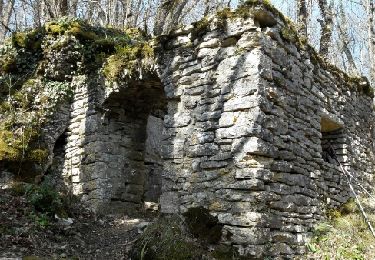
Rando facile en pleine forêt vallonée et rocheuse , peuplée de cerfs , chevreuils et lièvres . Combes, détours et roches dans ces chemins très bien entretenus, aux minuscules clairière, donnent à ce biotope un aspect de parc paysager . Le passage en plateau calcaire, plus austère, est propice à l'observation animale . Vue sur la vallée de l'Ouche par la croix surplombant une grotte . A PROSCRIRE EN PERIODE DE CHASSE .
Positioning
Comments
Trails nearby
![Trail Walking Semezanges - circuit des vestiges disparus - Photo](https://media.geolcdn.com/t/375/260/ext.jpg?maxdim=2&url=https%3A%2F%2Fservices.sitytrail.com%2FGeolivesWS%2FDownloadMedia.ashx%3FTrailID%3D658184%26Media%3Dfix__20161026182707.jpg)
![Walking Walking](https://static1.geolcdn.com/sitytour/trail-icons/101.png)
Walking
![](/images/other/stat-length.png)
![](https://static1.geolcdn.com/siteimages/upload/files/16400158638029165_repeat_loop_refresh_sync_direction_icon.png)
![Trail Walking Urcy - Les environs d'Urcy - Photo](https://media.geolcdn.com/t/375/260/ext.jpg?maxdim=2&url=https%3A%2F%2Fservices.sitytrail.com%2FGeolivesWS%2FDownloadMedia.ashx%3FTrailID%3D104689%26Media%3D8092_1.jpg)
![Walking Walking](https://static1.geolcdn.com/sitytour/trail-icons/101.png)
Walking
![](/images/other/stat-length.png)
![](https://static1.geolcdn.com/siteimages/upload/files/16400158638029165_repeat_loop_refresh_sync_direction_icon.png)
![Trail Walking Barbirey-sur-Ouche - Le Tour de Barbiriacum - Barbirey sur Ouche - Photo](https://media.geolcdn.com/t/375/260/ext.jpg?maxdim=2&url=https%3A%2F%2Fservices.sitytrail.com%2FGeolivesWS%2FDownloadMedia.ashx%3FTrailID%3D104688%26Media%3D8091_1.jpg)
![Walking Walking](https://static1.geolcdn.com/sitytour/trail-icons/101.png)
Walking
![](/images/other/stat-length.png)
![](https://static1.geolcdn.com/siteimages/upload/files/16400158638029165_repeat_loop_refresh_sync_direction_icon.png)
![Trail Walking Antheuil - Saint JeandeBoeuf- Antheuil-Crugey-Labussièresur Ouche - Photo](https://media.geolcdn.com/t/375/260/cfbbfa30-225e-4285-b48a-0a8696c4b14b.jpg&format=jpg&maxdim=2)
![Walking Walking](https://static1.geolcdn.com/sitytour/trail-icons/101.png)
Walking
![](/images/other/stat-length.png)
![](https://static1.geolcdn.com/siteimages/upload/files/16400158638029165_repeat_loop_refresh_sync_direction_icon.png)
![Trail Walking Urcy - Plain de Suzanne-Roche d'Anse-Urcy - Photo](https://media.geolcdn.com/t/375/260/da81d08b-9d2b-49f3-a96a-8ac3acb15f29.jpg&format=jpg&maxdim=2)
![Walking Walking](https://static1.geolcdn.com/sitytour/trail-icons/101.png)
Walking
![](/images/other/stat-length.png)
![](https://static1.geolcdn.com/siteimages/upload/files/16400158638029165_repeat_loop_refresh_sync_direction_icon.png)
![Trail Walking Gergueil - balcon de l'Ouche - Photo](https://media.geolcdn.com/t/375/260/946ea50b-5544-4ca8-84ea-d0bce9713232.jpg&format=jpg&maxdim=2)
![Walking Walking](https://static1.geolcdn.com/sitytour/trail-icons/101.png)
Walking
![](/images/other/stat-length.png)
![](https://static1.geolcdn.com/siteimages/upload/files/16400158638029165_repeat_loop_refresh_sync_direction_icon.png)
![Trail Walking Détain-et-Bruant - blockhaus de Saint-Jean de Boeuf - Photo](https://media.geolcdn.com/t/375/260/7b6e17cc-c96f-42ca-91f7-e764a111d3f2.jpg&format=jpg&maxdim=2)
![Walking Walking](https://static1.geolcdn.com/sitytour/trail-icons/101.png)
Walking
![](/images/other/stat-length.png)
![](https://static1.geolcdn.com/siteimages/upload/files/16400158638029165_repeat_loop_refresh_sync_direction_icon.png)
![Trail On foot Barbirey-sur-Ouche - barbirey - Photo](https://media.geolcdn.com/t/375/260/d6bd1c62-1edb-4936-a48f-393652ec8299.jpg&format=jpg&maxdim=2)
![On foot On foot](https://static1.geolcdn.com/sitytour/trail-icons/100.png)
On foot
![](/images/other/stat-length.png)
![](https://static1.geolcdn.com/siteimages/upload/files/16400158638029165_repeat_loop_refresh_sync_direction_icon.png)
![Trail Walking Semezanges - Autour de Semezanges et Ternant - Photo](https://media.geolcdn.com/t/375/260/ext.jpg?maxdim=2&url=https%3A%2F%2Fservices.sitytrail.com%2FGeolivesWS%2FDownloadMedia.ashx%3FTrailID%3D712649%26Media%3Dfix__20170312135731.jpg)
![Walking Walking](https://static1.geolcdn.com/sitytour/trail-icons/101.png)
Walking
![](/images/other/stat-length.png)
![](https://static1.geolcdn.com/siteimages/upload/files/16400158638029165_repeat_loop_refresh_sync_direction_icon.png)