


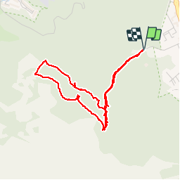

28 km | 35 km-effort


User


FREE GPS app for hiking
 SityTrail
IGN / Geographical institutes
SityTrail World
The world is yours!
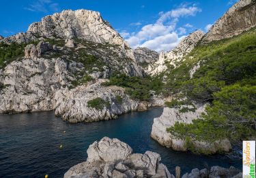
Trail Walking of 4.9 km to be discovered at Provence-Alpes-Côte d'Azur, Bouches-du-Rhône, Marseille. This trail is proposed by cyclopat42600.
Petite promenade sympa avec de beaux points de vue sur Marseille. Attention avec des enfants, certains passages sont en bord de falaise.


Mountain bike

Walking

Walking

Walking

Walking

Walking
Walking

Running

Walking