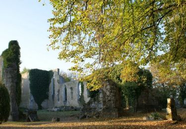
19.1 km | 22 km-effort
Thiaucourt
PhilippeC54
User
Length
26 km
Max alt
342 m
Uphill gradient
408 m
Km-Effort
31 km
Min alt
205 m
Downhill gradient
408 m
Boucle
Yes
Creation date :
2021-03-28 06:21:44.121
Updated on :
2021-03-28 09:16:24.123
2h00
Difficulty : Difficult
FREE GPS app for hiking
About
Trail Mountain bike of 26 km to be discovered at Grand Est, Meurthe-et-Moselle, Thiaucourt-Regniéville. This trail is proposed by PhilippeC54.
Positioning
Country:
France
Region :
Grand Est
Department/Province :
Meurthe-et-Moselle
Municipality :
Thiaucourt-Regniéville
Location:
Unknown
Start:(Dec)
Start:(UTM)
709394 ; 5426120 (31U) N.
Comments
Trails nearby
La vallée du Rupt de Mad - Circuit n° 14 - Jaulny
Cycle
Easy
Jaulny,
Grand Est,
Meurthe-et-Moselle,
France
1h 0min
Yes
Les paysages de l'Histoire (option Flirey) - Circuit n° 13
Cycle
Difficult
Thiaucourt-Regniéville,
Grand Est,
Meurthe-et-Moselle,
France
60 km | 68 km-effort
3h 0min
Yes
Les paysages de l'Histoire - Circuit n° 13 - Thiaucourt Regniéville
Cycle
Medium
Thiaucourt-Regniéville,
Grand Est,
Meurthe-et-Moselle,
France
49 km | 56 km-effort
2h 30min
Yes
Jaulny Ancy sur Moselle
Horseback riding
Difficult
Jaulny,
Grand Est,
Meurthe-et-Moselle,
France
27 km | 37 km-effort
4h 53min
No
Thiaucourt viaduc Bouillonville
Walking
Difficult
Thiaucourt-Regniéville,
Grand Est,
Meurthe-et-Moselle,
France
10 km | 12.3 km-effort
2h 47min
Yes
Thiaucourt Jaulny Rembercourt
Mountain bike
Easy
Thiaucourt-Regniéville,
Grand Est,
Meurthe-et-Moselle,
France
16.9 km | 21 km-effort
1h 36min
Yes
Euvezin Bouillonville Thiaucourt et retour par les hauts
Walking
Medium
Euvezin,
Grand Est,
Meurthe-et-Moselle,
France
10.9 km | 13.5 km-effort
3h 4min
Yes
circuit des Rappes
Walking
Easy
Viéville-en-Haye,
Grand Est,
Meurthe-et-Moselle,
France
13.6 km | 16.2 km-effort
2h 33min
No
rembercourt/thiaucourt/AR
Mountain bike
Medium
Rembercourt-sur-Mad,
Grand Est,
Meurthe-et-Moselle,
France
19.7 km | 25 km-effort
2h 29min
Yes