Trail Electric bike Aubenas - VAE COL DE SARRAZET - Photo
© OpenStreetMap contributors
Length
Length
53 km
Max alt
Max alt
875 m
Uphill gradient
Uphill gradient
1289 m
Km-Effort
Km-Effort  
70 km
Min alt
Min alt
193 m
Downhill gradient
Downhill gradient
1287 m
Boucle
Boucle
Yes
Creation date :
2021-03-27 09:21:54.44
Updated on :
2021-03-27 15:09:48.865

(0 Reviews)

Electric bike
Electric bike
5h44
Difficulty : Medium

Scan this QR Code to open this trail in the SityTrail application

FREE GPS app for hiking

Logo SityTrail SityTrail

IGN / Geographical institutes

Download SityTrail from the App Store Download SityTrail from Google Play

Logo SityTrail SityTrail World

The world is yours!

Download SityTrail from the App Store Download SityTrail from Google Play Download SityTrail on Huawei AppGallery

About

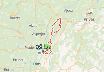
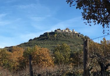
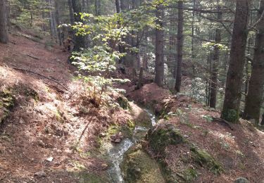
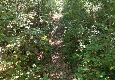
Trail Electric bike of 53 km to be discovered at Auvergne-Rhône-Alpes, Ardèche, Aubenas. This trail is proposed by Mariecoco.

Description

VAE   Nath
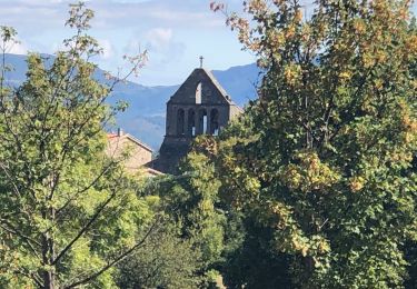
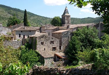
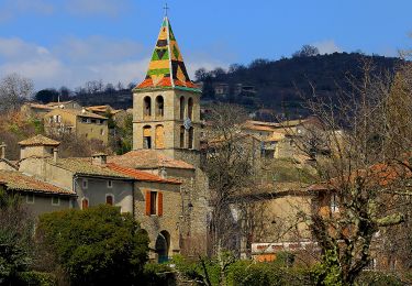
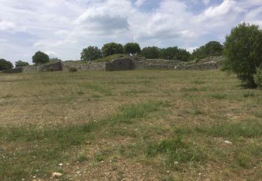
Aubenas, st Julien du Serre ,St Michel et St Étienne de Boulogne ,col de Sarrazet...
52 km 1300 m de dénivelé


Elevation profile

Positioning

Country:
France
Region :
Auvergne-Rhône-Alpes
Department/Province :
Ardèche
Municipality :
Aubenas
Location:
Unknown
Start:(UTM)
609440 ; 4941609 (31T) N.

Trails nearby

Trail Walking Saint-Privat - Trace St Privat  autour du Canyon de la  Louyre (partie Basse) 19-03-2018 - Photo
Walking
coureursdecretes

Walking

Difficult
(1)
Saint-Privat, Auvergne-Rhône-Alpes, Ardèche, France
12.1 km | 16.9 km-effort
3h 49min
Yes
Trail Walking Vals-les-Bains - 07 vals les bains 27.10.2022 - Photo
Walking
GUIDE
randodyssée

Walking

Easy
Vals-les-Bains, Auvergne-Rhône-Alpes, Ardèche, France
17.6 km | 29 km-effort
7h 24min
Yes
Trail Walking Lussas - 07 loutre gorges 09.07.2033 - Photo
Walking
GUIDE
randodyssée

Walking

Medium
Lussas, Auvergne-Rhône-Alpes, Ardèche, France
10.8 km | 14.1 km-effort
5h 7min
Yes
Trail Walking Ailhon - 2024-09-25_21h25m23_Ailhon 9km - Photo
Walking
GUIDE
chancha

Walking

Medium
Ailhon, Auvergne-Rhône-Alpes, Ardèche, France
8.3 km | 11.7 km-effort
2h 39min
Yes
Trail Walking Vesseaux - 2022-09-25_13h46m35_Vesseaux La Louyre 19km.gpx.xml - Photo
Walking
GUIDE
chancha

Walking

Difficult
Vesseaux, Auvergne-Rhône-Alpes, Ardèche, France
18.3 km | 26 km-effort
6h 0min
Yes
Trail Walking Vesseaux - 2022-09-25_13h46m12_Vesseaux-St Julien du Serre 15km.gpx (1).xml - Photo
Walking
GUIDE
chancha

Walking

Difficult
Vesseaux, Auvergne-Rhône-Alpes, Ardèche, France
15 km | 21 km-effort
4h 49min
Yes
Trail Walking Lussas - Le canyon de la Louyre - Photo
Walking
cousam

Walking

Difficult
Lussas, Auvergne-Rhône-Alpes, Ardèche, France
10.9 km | 14.1 km-effort
4h 25min
Yes
Trail Walking Vesseaux - Vesseaux 8km - Photo
Walking
GUIDE
chancha

Walking

Medium
Vesseaux, Auvergne-Rhône-Alpes, Ardèche, France
7.8 km | 10.3 km-effort
2h 20min
Yes
Trail Walking Lussas - 07 canyon de la loutre  - Photo
Walking
silvestreclaudine

Walking

Difficult
Lussas, Auvergne-Rhône-Alpes, Ardèche, France
14.1 km | 17.2 km-effort
6h 46min
Yes


Close
My subscriptions