Trail Walking Réaup-Lisse - la pomme d'or - Photo
 Forsans
Forsans

User

© OpenStreetMap contributors
Length
Length
8.3 km
Max alt
Max alt
160 m
Uphill gradient
Uphill gradient
123 m
Km-Effort
Km-Effort  
10 km
Min alt
Min alt
90 m
Downhill gradient
Downhill gradient
129 m
Boucle
Boucle
Yes
Creation date :
2021-03-24 13:19:05.422
Updated on :
2021-03-24 20:46:05.578

(1 Reviews)

Walking
Walking
2h09
Difficulty : Easy

Scan this QR Code to open this trail in the SityTrail application

FREE GPS app for hiking

Logo SityTrail SityTrail

IGN / Geographical institutes

Download SityTrail from the App Store Download SityTrail from Google Play

Logo SityTrail SityTrail World

The world is yours!

Download SityTrail from the App Store Download SityTrail from Google Play Download SityTrail on Huawei AppGallery

About

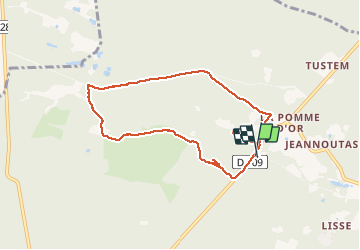
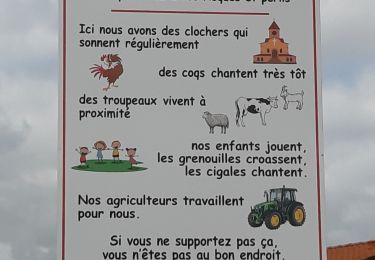
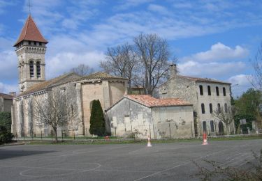
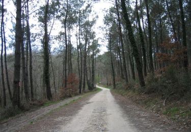
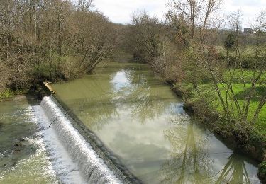
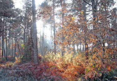
Trail Walking of 8.3 km to be discovered at New Aquitaine, Lot-et-Garonne, Réaup-Lisse. This trail is proposed by Forsans.

Description

balade foret

Elevation profile

Positioning

Country:
France
Region :
New Aquitaine
Department/Province :
Lot-et-Garonne
Municipality :
Réaup-Lisse
Location:
Unknown
Start:(UTM)
277410 ; 4888429 (31T) N.

Comments

Please log in to post a review or rate the element


Bosrijke route maar je loopt 1/3 over asfalt. Jammer. Verder prima te doen.


Trails nearby

Trail Walking Barbaste - le Beas Barbaste - Photo
Walking
Forsans

Walking

Easy
Barbaste, New Aquitaine, Lot-et-Garonne, France
9.5 km | 11.1 km-effort
2h 35min
No
Trail Walking Andiran - circuit Andiran forêt du Padoue Andiran - Photo
Walking
Forsans

Walking

Easy
Andiran, New Aquitaine, Lot-et-Garonne, France
8.9 km | 11.1 km-effort
2h 26min
Yes
Trail Walking Réaup-Lisse - col d'Azet - Photo
Walking
Forsans

Walking

Easy
Réaup-Lisse, New Aquitaine, Lot-et-Garonne, France
165 km | 278 km-effort
4h 35min
No
Trail Walking Réaup-Lisse - La Sabliere Andiran la sablière  - Photo
Walking
Forsans

Walking

Very easy
Réaup-Lisse, New Aquitaine, Lot-et-Garonne, France
5.6 km | 7 km-effort
1h 35min
Yes
Trail Equestrian Andiran - Andiran, randonnée entre l'Osse et la Gélise - Photo
Equestrian
tracegps

Equestrian

Medium
Andiran, New Aquitaine, Lot-et-Garonne, France
13.6 km | 16.8 km-effort
2h 25min
Yes
Trail Mountain bike Andiran - Andiran, randonnée entre l'Osse et la Gélise - Photo
Mountain bike
tracegps

Mountain bike

Easy
Andiran, New Aquitaine, Lot-et-Garonne, France
13.6 km | 16.8 km-effort
1h 45min
Yes
Trail Walking Andiran - Andiran, randonnée entre l'Osse et la Gélise - Photo
Walking
tracegps

Walking

Medium
Andiran, New Aquitaine, Lot-et-Garonne, France
13.6 km | 16.8 km-effort
3h 34min
Yes
Trail Equestrian Réaup-Lisse - Lisse, aux portes de la forêt Landaise - Photo
Equestrian
tracegps

Equestrian

Medium
Réaup-Lisse, New Aquitaine, Lot-et-Garonne, France
17.9 km | 22 km-effort
3h 0min
Yes
Trail Mountain bike Réaup-Lisse - Lisse, aux portes de la forêt Landaise - Photo
Mountain bike
tracegps

Mountain bike

Medium
Réaup-Lisse, New Aquitaine, Lot-et-Garonne, France
17.9 km | 22 km-effort
2h 15min
Yes


Close
My subscriptions