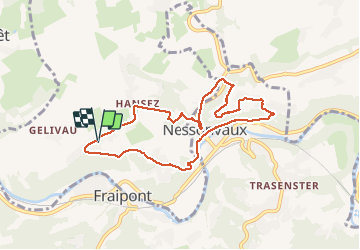

22 km | 29 km-effort

User


FREE GPS app for hiking
 SityTrail
IGN / Geographical institutes
SityTrail World
The world is yours!
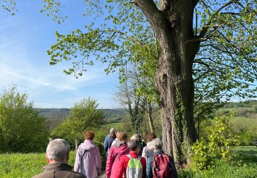
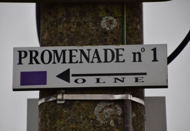
Trail Walking of 7.5 km to be discovered at Wallonia, Liège, Olne. This trail is proposed by amyrose.
chemin des meuniers descendre par le ruisseau qui mène aux réformés aller à Nessonvaux traverser la route jusqu'à Imperia
monter à Grihanster
au banc tourner à gauche redescendre par les escaliers à partir de voie Cola remonter par les prés de Straet


Walking

Walking

Walking

Walking

Walking

Walking

Walking
Walking