Trail Walking Mauvezin-d'Armagnac - Mauvezin d’Armagnac réalisé  - Photo

Mauvezin d’Armagnac réalisé

© OpenStreetMap contributors
Length
Length
10.5 km
Max alt
Max alt
141 m
Uphill gradient
Uphill gradient
137 m
Km-Effort
Km-Effort  
12.3 km
Min alt
Min alt
93 m
Downhill gradient
Downhill gradient
138 m
Boucle
Boucle
Yes
Creation date :
2021-03-22 13:49:52.0
Updated on :
2021-03-24 15:17:32.074

(0 Reviews)

Walking
Walking
2h49
Difficulty : Easy

Scan this QR Code to open this trail in the SityTrail application

FREE GPS app for hiking

Logo SityTrail SityTrail

IGN / Geographical institutes

Download SityTrail from the App Store Download SityTrail from Google Play

Logo SityTrail SityTrail World

The world is yours!

Download SityTrail from the App Store Download SityTrail from Google Play Download SityTrail on Huawei AppGallery

About

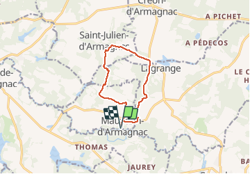
Trail Walking of 10.5 km to be discovered at New Aquitaine, Landes, Mauvezin-d'Armagnac. This trail is proposed by 611686735.

Elevation profile

Photos

Positioning

Country:
France
Region :
New Aquitaine
Department/Province :
Landes
Municipality :
Mauvezin-d'Armagnac
Location:
Unknown
Start:(UTM)
731007 ; 4870538 (30T) N.

Trails nearby

Trail Walking Mauvezin-d'Armagnac - CIRCUIT DE BRIAT - Mauvezin d'Armagnac - Photo
Walking
611686735

Walking

Easy
(2)
Mauvezin-d'Armagnac, New Aquitaine, Landes, France
9.6 km | 11.3 km-effort
2h 34min
Yes
Trail Mountain bike Créon-d'Armagnac - Autour de Créon d'Armagnac - Photo
Mountain bike
tracegps

Mountain bike

Difficult
Créon-d'Armagnac, New Aquitaine, Landes, France
31 km | 36 km-effort
3h 0min
Yes


Close
My subscriptions