Trail Mountain bike Meyrargues - De Meyrargues au Jas du Ligourès et au Vallon du Puits - Photo

De Meyrargues au Jas du Ligourès et au Vallon du Puits

 Coqorico
Coqorico

User

© OpenStreetMap contributors
Length
Length
25 km
Max alt
Max alt
546 m
Uphill gradient
Uphill gradient
556 m
Km-Effort
Km-Effort  
32 km
Min alt
Min alt
221 m
Downhill gradient
Downhill gradient
557 m
Boucle
Boucle
Yes
Creation date :
2021-03-21 09:31:55.564
Updated on :
2021-03-21 18:23:25.571

(1 Reviews)

Mountain bike
Mountain bike
1h51
Difficulty : Easy

Scan this QR Code to open this trail in the SityTrail application

FREE GPS app for hiking

Logo SityTrail SityTrail

IGN / Geographical institutes

Download SityTrail from the App Store Download SityTrail from Google Play

Logo SityTrail SityTrail World

The world is yours!

Download SityTrail from the App Store Download SityTrail from Google Play Download SityTrail on Huawei AppGallery

About

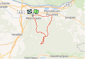
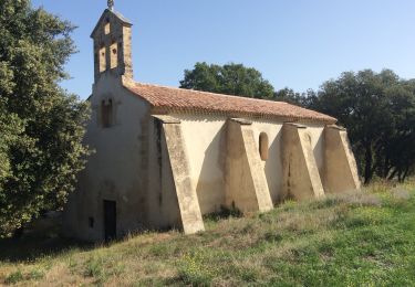
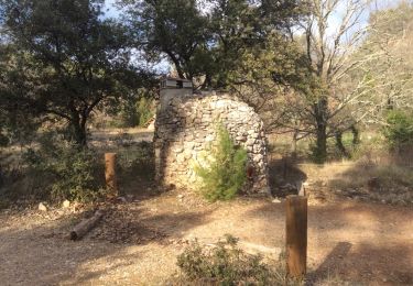
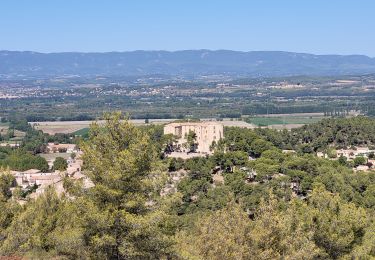
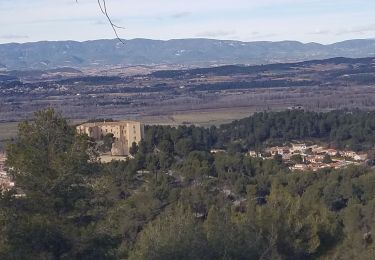
Trail Mountain bike of 25 km to be discovered at Provence-Alpes-Côte d'Azur, Bouches-du-Rhône, Meyrargues. This trail is proposed by Coqorico.

Description

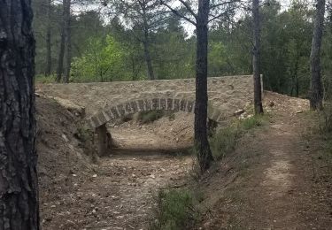
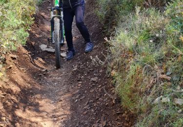
Départ de Meyrargues le long du canal EDF pour emprunter la montée des Lavandes et le chemin du Bès jusqu'au jas de Ligourès. De là descente par le single du Puits et remontée par la piste main droite pour enfin redescendre sur Meyrargues par le pas de l'Étroit.
Il est possible selon l'envie de varier la descente (le Brûlé et le single du Petit, le Lauvas, etc.)
Pas de difficulté particulière en-dehors du single du Puits qui reste facile (VTT semi-rigide).

Elevation profile

Positioning

Country:
France
Region :
Provence-Alpes-Côte d'Azur
Department/Province :
Bouches-du-Rhône
Municipality :
Meyrargues
Location:
Unknown
Start:(UTM)
703887 ; 4834722 (31T) N.

Comments

Please log in to post a review or rate the element


Trails nearby

Trail Walking Meyrargues - Meyrargue Camp chinois Vallon du petit  - Photo
Walking
Migueldefrance

Walking

Medium
Meyrargues, Provence-Alpes-Côte d'Azur, Bouches-du-Rhône, France
11.4 km | 17 km-effort
4h 2min
Yes
Trail Walking Peyrolles-en-Provence - GB tour du  lac de Peyrolles  - Photo
Walking
Ghislaine Blanchet

Walking

Easy
(1)
Peyrolles-en-Provence, Provence-Alpes-Côte d'Azur, Bouches-du-Rhône, France
3.8 km | 4.2 km-effort
1h 23min
No
Trail Walking Peyrolles-en-Provence - Ancien canal du Verdon 1.5.22 - Photo
Walking
GUIDE
fredetpascale

Walking

Easy
Peyrolles-en-Provence, Provence-Alpes-Côte d'Azur, Bouches-du-Rhône, France
11.5 km | 14.9 km-effort
3h 40min
Yes
Trail Walking Peyrolles-en-Provence - loubatas-Camp Chinois-retour par les vallons - Photo
Walking
Berpav

Walking

Very difficult
(2)
Peyrolles-en-Provence, Provence-Alpes-Côte d'Azur, Bouches-du-Rhône, France
15.3 km | 20 km-effort
3h 23min
Yes
Trail Walking Meyrargues - PF-Meyrargues - Les Calanques - Photo
Walking
MicDul

Walking

Easy
Meyrargues, Provence-Alpes-Côte d'Azur, Bouches-du-Rhône, France
14 km | 20 km-effort
4h 11min
Yes
Trail Mountain bike Venelles - venelles isa jeff - Photo
Mountain bike
jefflesmilles

Mountain bike

Medium
Venelles, Provence-Alpes-Côte d'Azur, Bouches-du-Rhône, France
19.7 km | 25 km-effort
2h 40min
Yes
Trail Walking Meyrargues - 2023_01_15 galette ligoures AEP - Photo
Walking
Chri13

Walking

Easy
Meyrargues, Provence-Alpes-Côte d'Azur, Bouches-du-Rhône, France
14.6 km | 20 km-effort
7h 8min
Yes
Trail Walking Meyrargues - alentours de Meyrargues tracé bleu - Photo
Walking
GUIDE
amiral13

Walking

Very easy
Meyrargues, Provence-Alpes-Côte d'Azur, Bouches-du-Rhône, France
10.4 km | 14.4 km-effort
3h 20min
Yes
Trail Walking Meyrargues - Meyrargues - Par vallon de Lazare - Photo
Walking
Berpav

Walking

Difficult
(2)
Meyrargues, Provence-Alpes-Côte d'Azur, Bouches-du-Rhône, France
9.8 km | 13.2 km-effort
2h 4min
Yes


Close
My subscriptions