Trail Walking Montbozon - Montbozon 18 mars 2021  IBP 61  - Photo

Montbozon 18 mars 2021 IBP 61

© OpenStreetMap contributors
Length
Length
23 km
Max alt
Max alt
346 m
Uphill gradient
Uphill gradient
427 m
Km-Effort
Km-Effort  
28 km
Min alt
Min alt
243 m
Downhill gradient
Downhill gradient
426 m
Boucle
Boucle
Yes
Creation date :
2021-03-18 07:37:49.757
Updated on :
2021-03-21 18:17:11.171

(0 Reviews)

Walking
Walking
5h57
Difficulty : Medium

Scan this QR Code to open this trail in the SityTrail application

FREE GPS app for hiking

Logo SityTrail SityTrail

IGN / Geographical institutes

Download SityTrail from the App Store Download SityTrail from Google Play

Logo SityTrail SityTrail World

The world is yours!

Download SityTrail from the App Store Download SityTrail from Google Play Download SityTrail on Huawei AppGallery

About

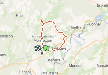
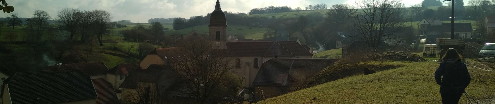
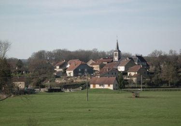
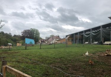
Trail Walking of 23 km to be discovered at Bourgogne-Franche-Comté, Haute-Saône, Montbozon. This trail is proposed by TRIMAILLE.

Description

Jolie boucle entre fontaines et lavoirs.

Elevation profile

Photos

Positioning

Country:
France
Region :
Bourgogne-Franche-Comté
Department/Province :
Haute-Saône
Municipality :
Montbozon
Location:
Unknown
Start:(UTM)
291567 ; 5259828 (32T) N.

Trails nearby

Trail Cycle Montbozon - Boucle de l'Avant Doubs - Montbozon  - Photo
Cycle
tracegps

Cycle

Medium
Montbozon, Bourgogne-Franche-Comté, Haute-Saône, France
32 km | 37 km-effort
1h 30min
Yes
Trail Walking Montbozon - La goutte d'eau - Montbozon - Photo
Walking
tracegps

Walking

Easy
(1)
Montbozon, Bourgogne-Franche-Comté, Haute-Saône, France
4.5 km | 5.6 km-effort
1h 10min
Yes
Trail Other activity Filain - Parc de guiguitte en folie ( les ridets) - Photo
Other activity
nicolasdresse

Other activity

Filain, Bourgogne-Franche-Comté, Haute-Saône, France
1.5 km | 1.8 km-effort
1h 7min
Yes
Trail sport Avilley - La tour du bois  - Photo
sport
berruyer

sport

Very easy
Avilley, Bourgogne-Franche-Comté, Doubs, France
32 km | 41 km-effort
Unknown
No
Trail Bicycle tourism Montbozon - 39 Besançon entre Saône & Doubs J 4/6 - Photo
Bicycle tourism
ericf64

Bicycle tourism

Medium
Montbozon, Bourgogne-Franche-Comté, Haute-Saône, France
55 km | 64 km-effort
6h 10min
No
Trail sport Loulans-Verchamp - Retour - Bulle étoile. - Photo
sport
norbertmarteau

sport

Very easy
Loulans-Verchamp, Bourgogne-Franche-Comté, Haute-Saône, France
39 km | 48 km-effort
Unknown
No
Trail Walking Montbozon - SityTrail - Montbozon Dampierre-sur-Linotte - Photo
Walking
gerardmicheline

Walking

Very difficult
Montbozon, Bourgogne-Franche-Comté, Haute-Saône, France
22 km | 27 km-effort
6h 10min
Yes
Trail Walking Thiénans - Tour de thienans - Photo
Walking
JJPGP

Walking

Easy
Thiénans, Bourgogne-Franche-Comté, Haute-Saône, France
1.5 km | 1.9 km-effort
28min
Yes
Trail Walking Thiénans - Rando cimetiere - Photo
Walking
JJPGP

Walking

Easy
Thiénans, Bourgogne-Franche-Comté, Haute-Saône, France
2.8 km | 3.4 km-effort
1h 18min
No


Close
My subscriptions