

Belvedere de Surmontant

HB01
User

Length
9.8 km

Max alt
1052 m

Uphill gradient
513 m

Km-Effort
16.7 km

Min alt
759 m

Downhill gradient
512 m
Boucle
Yes
Creation date :
2021-03-06 09:18:50.505
Updated on :
2021-03-06 19:03:33.644
3h06
Difficulty : Difficult

FREE GPS app for hiking
About
Trail Walking of 9.8 km to be discovered at Bourgogne-Franche-Comté, Jura, Saint-Claude. This trail is proposed by HB01.
Description
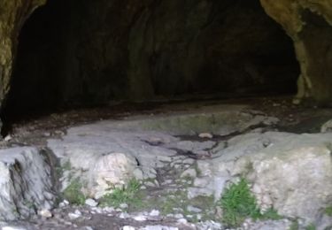
Départ Ranchette: parking en continuant sur la "route des trois fontaines"; belvédère de Surmontant; grotte du maquis (du Mont).
Des montée et descente très pentues et des passages en forêt délicats à déteminer.
Positioning
Country:
France
Region :
Bourgogne-Franche-Comté
Department/Province :
Jura
Municipality :
Saint-Claude
Location:
Unknown
Start:(Dec)
Start:(UTM)
716015 ; 5136963 (31T) N.
Comments
Trails nearby
cascade de flumen - saut du chien - retour en partie par la route


Walking
Medium
Villard-Saint-Sauveur,
Bourgogne-Franche-Comté,
Jura,
France

9.4 km | 14.4 km-effort
3h 3min
Yes

Belvd. Pontoux depuis Rue des Perrieres à St-Claude 39200


Walking
Medium
Saint-Claude,
Bourgogne-Franche-Comté,
Jura,
France

14 km | 21 km-effort
3h 30min
Yes

St Claude Cascade de la Vouivre


Walking
Easy
Saint-Claude,
Bourgogne-Franche-Comté,
Jura,
France

7 km | 9.9 km-effort
1h 52min
Yes

De St-Claude à Vaucluse


Walking
Medium
Saint-Claude,
Bourgogne-Franche-Comté,
Jura,
France

12.6 km | 18.7 km-effort
2h 55min
Yes
Le mont bayard a Saint claude


Walking
Difficult
Saint-Claude,
Bourgogne-Franche-Comté,
Jura,
France

7.3 km | 14.1 km-effort
5h 14min
Yes
Sous La Joux


Walking
Easy
Les Moussières,
Bourgogne-Franche-Comté,
Jura,
France

6 km | 7.9 km-effort
3h 10min
Yes

molinges-st-romain


Walking
Easy
(1)
Chassal-Molinges,
Bourgogne-Franche-Comté,
Jura,
France

9.5 km | 15.4 km-effort
3h 5min
Yes
gorges du flumen


Walking
Medium
(1)
Villard-Saint-Sauveur,
Bourgogne-Franche-Comté,
Jura,
France

10.8 km | 17 km-effort
2h 54min
Yes
Mont Bayard


Walking
Very difficult
Saint-Claude,
Bourgogne-Franche-Comté,
Jura,
France

7.5 km | 15.1 km-effort
2h 51min
Yes


 SityTrail


