Trail Walking Saint-André-Capcèze - Capceze01 - Photo
 altair53
altair53

User

© OpenStreetMap contributors
Length
Length
6.6 km
Max alt
Max alt
704 m
Uphill gradient
Uphill gradient
258 m
Km-Effort
Km-Effort  
10.1 km
Min alt
Min alt
472 m
Downhill gradient
Downhill gradient
263 m
Boucle
Boucle
Yes
Creation date :
2014-12-10 00:00:00.0
Updated on :
2014-12-10 00:00:00.0

(0 Reviews)

Walking
Walking
2h20
Difficulty : Medium

Scan this QR Code to open this trail in the SityTrail application

FREE GPS app for hiking

Logo SityTrail SityTrail

IGN / Geographical institutes

Download SityTrail from the App Store Download SityTrail from Google Play

Logo SityTrail SityTrail World

The world is yours!

Download SityTrail from the App Store Download SityTrail from Google Play Download SityTrail on Huawei AppGallery

About

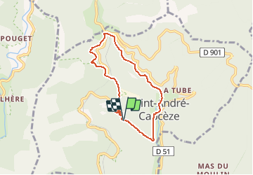
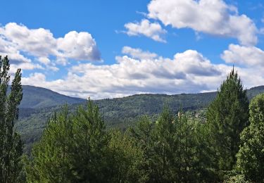
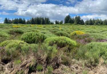
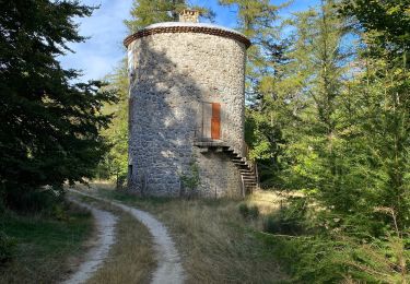
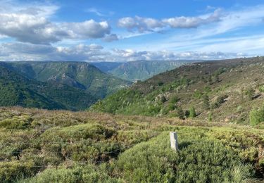
Trail Walking of 6.6 km to be discovered at Occitania, Lozère, Saint-André-Capcèze. This trail is proposed by altair53.

Description

Petit parking au point de départ (fin route asphaltée). Monter entre les 2 bâtiments (plusieurs  barrières à bien refermer après passage).

Elevation profile

Positioning

Country:
France
Region :
Occitania
Department/Province :
Lozère
Municipality :
Saint-André-Capcèze
Location:
Unknown
Start:(Dec)
Start:(UTM)
574844 ; 4918425 (31T) N.

Trails nearby

Trail Walking Pied-de-Borne - GRP Tour du Chassezac en 2 jours - Photo
Walking
GUIDE
nadinebondoux

Walking

Difficult
Pied-de-Borne, Occitania, Lozère, France
25 km | 36 km-effort
6h 50min
No
Trail Walking Concoules - 2023-01-22_15h09m14_Cirkwi-La_Virado_del_Ronc - Photo
Walking
Levant

Walking

Difficult
(1)
Concoules, Occitania, Gard, France
9.3 km | 15.6 km-effort
3h 32min
Yes
Trail On foot Malons-et-Elze - GR 44 - Photo
On foot
GUIDE+

On foot

Easy
Malons-et-Elze, Occitania, Gard, France
4.8 km | 6.4 km-effort
1h 26min
No
Trail Walking Ponteils-et-Brésis - Nord haute Vallee de la Cèze - Photo
Walking
GUIDE
nadinebondoux

Walking

Difficult
Ponteils-et-Brésis, Occitania, Gard, France
23 km | 34 km-effort
6h 50min
Yes
Trail Walking Ponteils-et-Brésis - Bour a es - Photo
Walking
GUIDE
Roger Philippe Wallez

Walking

Very difficult
Ponteils-et-Brésis, Occitania, Gard, France
24 km | 36 km-effort
7h 37min
Yes
Trail Walking Concoules - Mont Lozère au départ de Concoules  - Photo
Walking
GUIDE
nadinebondoux

Walking

Difficult
Concoules, Occitania, Gard, France
22 km | 35 km-effort
6h 42min
Yes
Trail Walking Concoules - Conclûmes - Photo
Walking
GUIDE
Roger Philippe Wallez

Walking

Very difficult
Concoules, Occitania, Gard, France
22 km | 37 km-effort
6h 20min
Yes
Trail Walking Pied-de-Borne - Le tour du Chassezac  - Photo
Walking
GUIDE
Roger Philippe Wallez

Walking

Very difficult
Pied-de-Borne, Occitania, Lozère, France
49 km | 72 km-effort
37h 28min
Yes
Trail Walking Pied-de-Borne - Le tour du chassezac - Photo
Walking
GUIDE
Roger Philippe Wallez

Walking

Very difficult
Pied-de-Borne, Occitania, Lozère, France
49 km | 72 km-effort
16h 34min
Yes


Close
My subscriptions