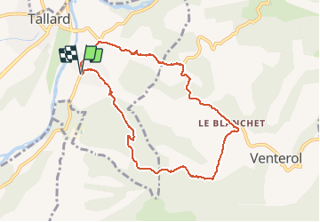
![](/images/other/stat-length.png)
![Trail Walking Tallard - Boucle Tallard - Venterol - Photo](https://media.geolcdn.com/t/1900/400/d2aca6a7-9b99-4189-94c8-b337d4562050.jpg&format=pjpeg&maxdim=2)
Boucle Tallard - Venterol
Daniel.BRUN-PICARD
User
![Length](/images/other/stat-length.png)
![Max alt](https://static1.geolcdn.com/siteimages/upload/files/1508320355ic_sort_altitude_max_24dp.png)
![Uphill gradient](https://static1.geolcdn.com/siteimages/upload/files/1508320355ic_sort_den_pos_24dp.png)
![Km-Effort](/images/other/stat-length.png)
![Min alt](https://static1.geolcdn.com/siteimages/upload/files/1508320355ic_sort_altitude_min_24dp.png)
![Downhill gradient](https://static1.geolcdn.com/siteimages/upload/files/1508320355ic_sort_den_neg_24dp.png)
![Boucle](https://static1.geolcdn.com/siteimages/upload/files/16400158638029165_repeat_loop_refresh_sync_direction_icon.png)
![Walking](https://static1.geolcdn.com/sitytour/trail-icons/101.png)
4h47
Difficulty : Medium
![Scan this QR Code to open this trail in the SityTrail application](https://capi.geolives.com/qq0zvz2zws4bq2lad0pu/sitytour/trails/2695708/qr.png?size=200)
FREE GPS app for hiking
About
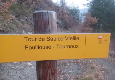
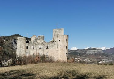
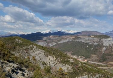
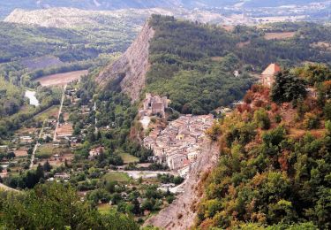
Trail Walking of 8.7 km to be discovered at Provence-Alpes-Côte d'Azur, Hautes-Alpes, Tallard. This trail is proposed by Daniel.BRUN-PICARD.
Description
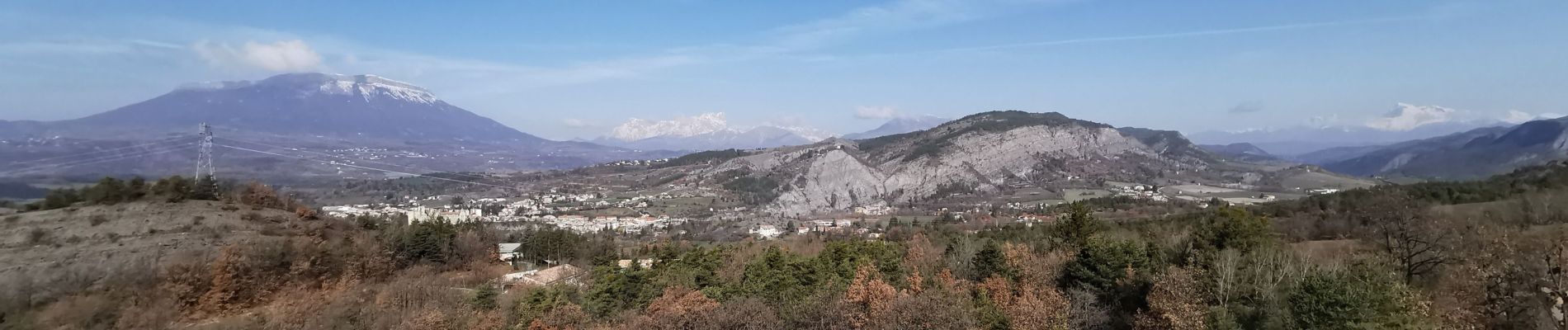
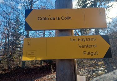
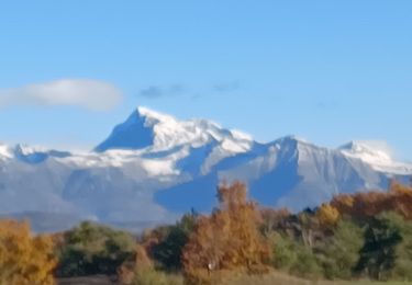
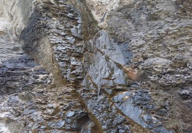
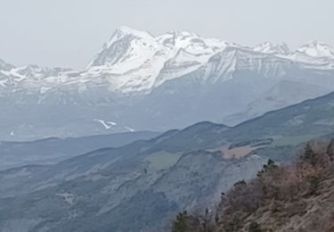
Belle randonnée avec de très beaux points de vue. Il y a un peu de route près du Blanchet, nous avons pu en éviter un peu en coupant à travers champ. Les sentiers sont abrupts. La descente caillouteuse est un peu difficile. Ce circuit est faisable avec des enfants d'au moins 8 ans, prudents et ayant le pied sûr.
Positioning
Comments
Trails nearby
![Trail Walking Venterol - URTIS . COL DE BUISSONET . SOM DE MONTSERIEUX . VENTEROL . O M S - Photo](https://media.geolcdn.com/t/375/260/66ad6ab3-2755-42db-980f-eb6a39873af4.jpg&format=jpg&maxdim=2)
![Walking Walking](https://static1.geolcdn.com/sitytour/trail-icons/101.png)
Walking
![](/images/other/stat-length.png)
![](https://static1.geolcdn.com/siteimages/upload/files/16400158638029165_repeat_loop_refresh_sync_direction_icon.png)
![Trail Walking Châteauvieux - CHATEAUVIEUX . BOIS DE CHRISTAYES LES MARINONS O S - Photo](https://media.geolcdn.com/t/375/260/670230d0-707b-4966-beff-b088375cc2f4.jpg&format=jpg&maxdim=2)
![Walking Walking](https://static1.geolcdn.com/sitytour/trail-icons/101.png)
Walking
![](/images/other/stat-length.png)
![](https://static1.geolcdn.com/siteimages/upload/files/16400158638029165_repeat_loop_refresh_sync_direction_icon.png)
![Trail Walking Tallard - Tallard - les Marinons 17.6.23 - Photo](https://media.geolcdn.com/t/375/260/81bcacf1-1621-4520-bae3-4d5019215e0c.jpg&format=jpg&maxdim=2)
![Walking Walking](https://static1.geolcdn.com/sitytour/trail-icons/101.png)
Walking
![](/images/other/stat-length.png)
![](https://static1.geolcdn.com/siteimages/upload/files/16400158638029165_repeat_loop_refresh_sync_direction_icon.png)
![Trail Walking La Saulce - LA SAULCE . BOUCLE DE SERRE SOLEILLE O M - Photo](https://media.geolcdn.com/t/375/260/d0086269-db58-459a-b019-0f7f1d8312a2.jpg&format=jpg&maxdim=2)
![Walking Walking](https://static1.geolcdn.com/sitytour/trail-icons/101.png)
Walking
![](/images/other/stat-length.png)
![](https://static1.geolcdn.com/siteimages/upload/files/16400158638029165_repeat_loop_refresh_sync_direction_icon.png)
![Trail Walking Tallard - TALLARD tête de Boursier o m s - Photo](https://media.geolcdn.com/t/375/260/ee8e87fe-5cd1-4067-9cf8-9a025ecb47fe.jpg&format=jpg&maxdim=2)
![Walking Walking](https://static1.geolcdn.com/sitytour/trail-icons/101.png)
Walking
![](/images/other/stat-length.png)
![](https://static1.geolcdn.com/siteimages/upload/files/16400158638029165_repeat_loop_refresh_sync_direction_icon.png)
![Trail Walking Tallard - Tour le long de la Durance et sur les crètes du château - Photo](https://media.geolcdn.com/t/375/260/504184d0-d7c4-4211-be7a-ed4a50921050.jpg&format=jpg&maxdim=2)
![Walking Walking](https://static1.geolcdn.com/sitytour/trail-icons/101.png)
Walking
![](/images/other/stat-length.png)
![](https://static1.geolcdn.com/siteimages/upload/files/16400158638029165_repeat_loop_refresh_sync_direction_icon.png)
![Trail Walking Tallard - Circuit les Marinons à Tallard.(25-03-18). - Photo](https://media.geolcdn.com/t/375/260/ext.jpg?maxdim=2&url=https%3A%2F%2Fservices.sitytrail.com%2FGeolivesWS%2FDownloadMedia.ashx%3FTrailID%3D930210%26Media%3Dfix__20180325163853.jpg)
![Walking Walking](https://static1.geolcdn.com/sitytour/trail-icons/101.png)
Walking
![](/images/other/stat-length.png)
![](https://static1.geolcdn.com/siteimages/upload/files/16400158638029165_repeat_loop_refresh_sync_direction_icon.png)
![Trail Walking Tallard - Circuit les Marinons à Tallard.(25-03-18). - Photo](https://media.geolcdn.com/t/375/260/ext.jpg?maxdim=2&url=https%3A%2F%2Fservices.sitytrail.com%2FGeolivesWS%2FDownloadMedia.ashx%3FTrailID%3D930013%26Media%3Dfix__20180325163853.jpg)
![Walking Walking](https://static1.geolcdn.com/sitytour/trail-icons/101.png)
Walking
![](/images/other/stat-length.png)
![](https://static1.geolcdn.com/siteimages/upload/files/16400158638029165_repeat_loop_refresh_sync_direction_icon.png)
![Walking Walking](https://static1.geolcdn.com/sitytour/trail-icons/101.png)
Walking
![](/images/other/stat-length.png)
![](https://static1.geolcdn.com/siteimages/upload/files/16400158638029165_repeat_loop_refresh_sync_direction_icon.png)