5.9 km | 8.1 km-effort
Trip 2020-07-18
Alain Derrives
User
Length
35 km
Max alt
633 m
Uphill gradient
1065 m
Km-Effort
49 km
Min alt
271 m
Downhill gradient
1064 m
Boucle
Yes
Creation date :
2021-03-01 18:34:06.719
Updated on :
2021-03-01 18:35:35.319
3h23
Difficulty : Very difficult
FREE GPS app for hiking
About
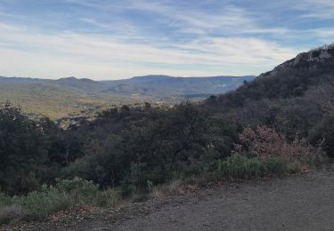
Trail Mountain bike of 35 km to be discovered at Provence-Alpes-Côte d'Azur, Bouches-du-Rhône, Mimet. This trail is proposed by Alain Derrives.
Positioning
Country:
France
Region :
Provence-Alpes-Côte d'Azur
Department/Province :
Bouches-du-Rhône
Municipality :
Mimet
Location:
Unknown
Start:(Dec)
Start:(UTM)
700218 ; 4811545 (31T) N.
Comments
Trails nearby
chemin de gui
Walking
Easy
(1)
Simiane-Collongue,
Provence-Alpes-Côte d'Azur,
Bouches-du-Rhône,
France
1h 45min
Yes
Balade à Bouc Bel Air
Running
Medium
(1)
Bouc-Bel-Air,
Provence-Alpes-Côte d'Azur,
Bouches-du-Rhône,
France
6.6 km | 8.7 km-effort
34min
Yes
MOUNINE
Mountain bike
Difficult
(2)
Bouc-Bel-Air,
Provence-Alpes-Côte d'Azur,
Bouches-du-Rhône,
France
20 km | 28 km-effort
3h 0min
Yes
Gréasque-Puits Hély d'Oissel-La Diote-Les Charbonnières
Walking
Difficult
(1)
Gréasque,
Provence-Alpes-Côte d'Azur,
Bouches-du-Rhône,
France
10 km | 13 km-effort
2h 56min
Yes
LES MARRES PILON DU ROI
Electric bike
Easy
Simiane-Collongue,
Provence-Alpes-Côte d'Azur,
Bouches-du-Rhône,
France
26 km | 36 km-effort
2h 18min
Yes
Bouc bel air
Walking
Medium
Bouc-Bel-Air,
Provence-Alpes-Côte d'Azur,
Bouches-du-Rhône,
France
8.9 km | 11.7 km-effort
2h 44min
Yes
St Savourin Col Ste Anne
Walking
Medium
Saint-Savournin,
Provence-Alpes-Côte d'Azur,
Bouches-du-Rhône,
France
9.2 km | 15.2 km-effort
2h 59min
Yes
Massif de l'Etoile: Col Ste Anne, Pilon, Col des Ouides
Walking
Very difficult
(1)
Mimet,
Provence-Alpes-Côte d'Azur,
Bouches-du-Rhône,
France
12.3 km | 19.4 km-effort
4h 49min
Yes
le Baou traouca et la grotte des fées
Walking
Medium
Mimet,
Provence-Alpes-Côte d'Azur,
Bouches-du-Rhône,
France
11.2 km | 17.7 km-effort
5h 11min
Yes