Trail Walking Soulan - Tour de Buleix - Photo

Tour de Buleix

 mccadars
mccadars

User

© OpenStreetMap contributors
Length
Length
8 km
Max alt
Max alt
822 m
Uphill gradient
Uphill gradient
286 m
Km-Effort
Km-Effort  
11.9 km
Min alt
Min alt
508 m
Downhill gradient
Downhill gradient
311 m
Boucle
Boucle
Yes
Creation date :
2021-02-24 14:02:40.0
Updated on :
2021-02-25 14:04:07.232

(0 Reviews)

Walking
Walking
3h00
Difficulty : Very easy

Scan this QR Code to open this trail in the SityTrail application

FREE GPS app for hiking

Logo SityTrail SityTrail

IGN / Geographical institutes

Download SityTrail from the App Store Download SityTrail from Google Play

Logo SityTrail SityTrail World

The world is yours!

Download SityTrail from the App Store Download SityTrail from Google Play Download SityTrail on Huawei AppGallery

About

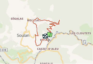
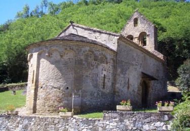
Trail Walking of 8 km to be discovered at Occitania, Ariège, Soulan. This trail is proposed by mccadars.

Description

Chemins forestiers ou portions de routes très peu fréquentées puis sentiers
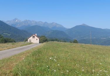
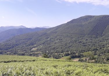
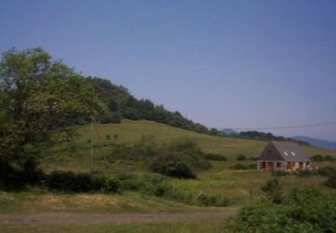
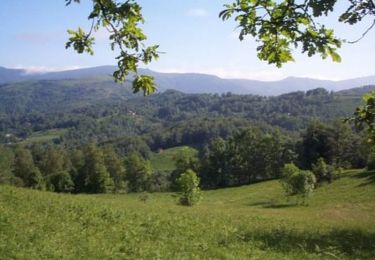
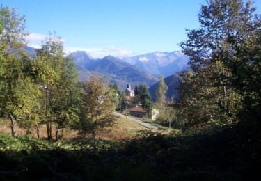
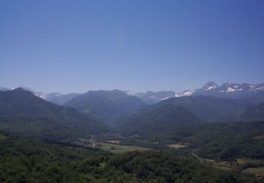
Vue sur les massifs tout le long de la randonnée

Elevation profile

Positioning

Country:
France
Region :
Occitania
Department/Province :
Ariège
Municipality :
Soulan
Location:
Unknown
Start:(UTM)
356996 ; 4752368 (31T) N.

Trails nearby

Trail Electric bike Soueix-Rogalle - st girons rogalle 21/06 - Photo
Electric bike
ra2000

Electric bike

Difficult
Soueix-Rogalle, Occitania, Ariège, France
27 km | 42 km-effort
5h 33min
No
Trail Mountain bike Soueix-Rogalle - La Vallée de Laspieng - Photo
Mountain bike
tracegps

Mountain bike

Medium
Soueix-Rogalle, Occitania, Ariège, France
10.3 km | 16.6 km-effort
1h 49min
Yes
Trail Walking Soueix-Rogalle - La Vallée de Laspieng - Photo
Walking
tracegps

Walking

Difficult
Soueix-Rogalle, Occitania, Ariège, France
10.3 km | 16.6 km-effort
3h 49min
Yes
Trail Walking Ercé - Le tour du Régudé - Photo
Walking
tracegps

Walking

Difficult
Ercé, Occitania, Ariège, France
14.7 km | 22 km-effort
4h 49min
Yes
Trail Mountain bike Soueix-Rogalle - La Passéjade - Photo
Mountain bike
tracegps

Mountain bike

Medium
Soueix-Rogalle, Occitania, Ariège, France
5.3 km | 8.3 km-effort
45min
Yes
Trail Walking Soueix-Rogalle - La Passéjade - Photo
Walking
tracegps

Walking

Medium
Soueix-Rogalle, Occitania, Ariège, France
5.3 km | 8.3 km-effort
1h 45min
Yes
Trail Walking Ercé - Les Ecureuils autour de Cominac - Photo
Walking
tracegps

Walking

Medium
Ercé, Occitania, Ariège, France
8.5 km | 12.9 km-effort
2h 30min
Yes
Trail Equestrian Oust - La Serre de Rapheu par le Pas de Sausech - Photo
Equestrian
tracegps

Equestrian

Difficult
Oust, Occitania, Ariège, France
7.1 km | 11.4 km-effort
1h 30min
Yes
Trail Mountain bike Oust - La Serre de Rapheu par le Pas de Sausech - Photo
Mountain bike
tracegps

Mountain bike

Medium
Oust, Occitania, Ariège, France
7.1 km | 11.4 km-effort
1h 0min
Yes


Close
My subscriptions