Trail Running Riedisheim - Circuit Footing - Photo
 JCLUTT
JCLUTT

User

© OpenStreetMap contributors
Length
Length
21 km
Max alt
Max alt
371 m
Uphill gradient
Uphill gradient
385 m
Km-Effort
Km-Effort  
26 km
Min alt
Min alt
258 m
Downhill gradient
Downhill gradient
385 m
Boucle
Boucle
Yes
Creation date :
2021-02-23 15:20:48.71
Updated on :
2021-05-26 13:19:21.28

(0 Reviews)

Running
Running
--
Difficulty : Difficult

Scan this QR Code to open this trail in the SityTrail application

FREE GPS app for hiking

Logo SityTrail SityTrail

IGN / Geographical institutes

Download SityTrail from the App Store Download SityTrail from Google Play

Logo SityTrail SityTrail World

The world is yours!

Download SityTrail from the App Store Download SityTrail from Google Play Download SityTrail on Huawei AppGallery

About

Trail Running of 21 km to be discovered at Grand Est, Haut-Rhin, Riedisheim. This trail is proposed by JCLUTT.

Elevation profile

Points of interest

Point of interest Riedisheim - Départ parking Cimetière - Photo
JCLUTT
Point of interest Rixheim - Terrain vélo-cross - Photo
JCLUTT
Point of interest Rixheim - Calvaire - Photo
JCLUTT
RIXHEIM 
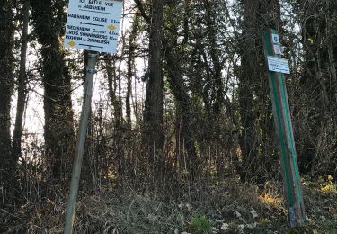
Point of interest Habsheim - Point de vue - Photo
JCLUTT
HABSHEIM 
Point of interest Zimmersheim - Réservoire d'eau - Photo
JCLUTT
ZIMMERSHEIM 
Point of interest Zimmersheim - Banc - Photo
JCLUTT
ZIMMERSHEIM 
Point of interest Zimmersheim - Ferme avec chien - Photo
JCLUTT
ZIMMERSHEIM 
Point of interest Rixheim - Source de Zielbrunnen - Photo
JCLUTT
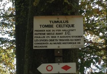
Point of interest Rixheim - Butte des Huns - Photo
JCLUTT
Point of interest Rixheim - Tennis EDF - Photo
JCLUTT
RIXHEIM 
Point of interest Riedisheim - Borne de Leibersheim - Photo
JCLUTT

Positioning

Country:
France
Region :
Grand Est
Department/Province :
Haut-Rhin
Municipality :
Riedisheim
Location:
Unknown
Start:(UTM)
378150 ; 5289494 (32T) N.

Trails nearby

Trail Walking Mulhouse - 20230904 - Mulhouse - Visite  - Photo
Walking
GUIDE
pierreh01

Walking

Easy
(1)
Mulhouse, Grand Est, Haut-Rhin, France
4.2 km | 4.6 km-effort
1h 23min
Yes
Trail On foot Mulhouse - Anneau rouge - Photo
On foot
GUIDE+

On foot

Easy
Mulhouse, Grand Est, Haut-Rhin, France
7.4 km | 9.7 km-effort
2h 11min
Yes
Trail Walking Riedisheim - Mulhouse / Ferrette..02/05/2024..les Marcheurs - Photo
Walking
boubou68

Walking

Very difficult
Riedisheim, Grand Est, Haut-Rhin, France
37 km | 48 km-effort
4h 9min
No
Trail Walking Riedisheim - circuit circulaire du Rothlaub - Photo
Walking
selevrich

Walking

Very easy
Riedisheim, Grand Est, Haut-Rhin, France
8.3 km | 10.7 km-effort
1h 45min
Yes
Trail Other activity Rixheim - promenade champêtre - Photo
Other activity
bemurix

Other activity

Very easy
Rixheim, Grand Est, Haut-Rhin, France
6.4 km | 8 km-effort
1h 50min
Yes
Trail Other activity Mulhouse - Grand Est - Ligne 4 - Paris Mulhouse (section de :Montreux-Vieux à Mulhouse) - Photo
Other activity
mich54

Other activity

Very easy
Mulhouse, Grand Est, Haut-Rhin, France
36 km | 39 km-effort
5min
No
Trail Walking Rixheim - JD 17/20 Collines de Habsheim - Photo
Walking
argonneuweg

Walking

Rixheim, Grand Est, Haut-Rhin, France
7.7 km | 9.7 km-effort
2h 0min
Yes
Trail Walking Kingersheim - découverte  - Photo
Walking
vuedumonde

Walking

Medium
Kingersheim, Grand Est, Haut-Rhin, France
9.4 km | 10.1 km-effort
2h 9min
Yes
Trail Cycle Mulhouse - waldeck - Photo
Cycle
olivier5960

Cycle

Very easy
Mulhouse, Grand Est, Haut-Rhin, France
12.2 km | 16.1 km-effort
1h 12min
No


Close
My subscriptions