

Les Andelys- Sentier du Mont Pivin

JMCMoreau
User

Length
12.7 km

Max alt
140 m

Uphill gradient
394 m

Km-Effort
18 km

Min alt
7 m

Downhill gradient
403 m
Boucle
Yes
Creation date :
2021-02-19 14:47:11.177
Updated on :
2021-06-05 06:36:05.809
4h00
Difficulty : Difficult

FREE GPS app for hiking
About
Trail Walking of 12.7 km to be discovered at Normandy, Eure, Les Andelys. This trail is proposed by JMCMoreau.
Description
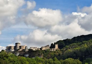
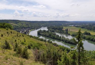
Boucle depuis le parking rue Guynemer des Andelys et au pied du GR2. Prendre le GR2 en direction de Le Thuit puis la Roquette revenir par les côtes du GR2 puis les bords de Seine. A faire par beau temps et à éviter en période pluvieuse.
Positioning
Country:
France
Region :
Normandy
Department/Province :
Eure
Municipality :
Les Andelys
Location:
Unknown
Start:(Dec)
Start:(UTM)
383415 ; 5456028 (31U) N.
Comments
Trails nearby

Les Andelys - Le Thuit et ND de Bellegarde


Walking
Difficult
(1)
Les Andelys,
Normandy,
Eure,
France

13.3 km | 16.2 km-effort
3h 40min
Yes

Les Andelys - Le Thuit var 2


Walking
Easy
(1)
Les Andelys,
Normandy,
Eure,
France

8.3 km | 10.3 km-effort
2h 14min
Yes
20230810-Heuqueville Jourrnée


Walking
Difficult
Heuqueville,
Normandy,
Eure,
France

20 km | 27 km-effort
5h 57min
Yes
Les Andelys le Mont Pivin


Walking
Difficult
Les Andelys,
Normandy,
Eure,
France

10.1 km | 14.4 km-effort
3h 16min
Yes
Les falaises de craies des Andelys


Walking
Difficult
Les Andelys,
Normandy,
Eure,
France

7.6 km | 11.3 km-effort
3h 21min
Yes
les Andelys du 11/09/2022


Walking
Very difficult
Les Andelys,
Normandy,
Eure,
France

18.1 km | 22 km-effort
4h 17min
Yes
20200521 GR2 Les Andelys


Walking
Medium
Les Andelys,
Normandy,
Eure,
France

11.1 km | 15.9 km-effort
3h 4min
Yes
les Andelys Bouafles Château Gaillard


Walking
Difficult
(1)
Les Andelys,
Normandy,
Eure,
France

13.6 km | 16.4 km-effort
7h 12min
No


 SityTrail


