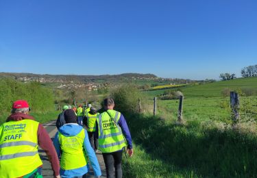

Bey sur Seille Brin sur Seille

joelclaudel
User

Length
11.9 km

Max alt
256 m

Uphill gradient
151 m

Km-Effort
13.9 km

Min alt
198 m

Downhill gradient
152 m
Boucle
Yes
Creation date :
2014-12-10 00:00:00.0
Updated on :
2014-12-10 00:00:00.0
3h02
Difficulty : Easy

FREE GPS app for hiking
About
Trail Walking of 11.9 km to be discovered at Grand Est, Meurthe-et-Moselle, Bey-sur-Seille. This trail is proposed by joelclaudel.
Description
Circuit disque vert (parfois bleu...) au départ de l'église de Bey sur Seille
Positioning
Country:
France
Region :
Grand Est
Department/Province :
Meurthe-et-Moselle
Municipality :
Bey-sur-Seille
Location:
Unknown
Start:(Dec)
Start:(UTM)
304786 ; 5409103 (32U) N.
Comments
Trails nearby

Amance 11 370m +209M


Nordic walking
Very easy
Amance,
Grand Est,
Meurthe-et-Moselle,
France

11.4 km | 14.2 km-effort
2h 20min
Yes

AUDAX Brin sur Seille


Walking
Very difficult
Brin-sur-Seille,
Grand Est,
Meurthe-et-Moselle,
France

99 km | 114 km-effort
16h 25min
Yes

Rando avec Marie


Horseback riding
Medium
Bouxières-aux-Chênes,
Grand Est,
Meurthe-et-Moselle,
France

20 km | 27 km-effort
3h 48min
No

Rando sur Bey


Horseback riding
Easy
Bouxières-aux-Chênes,
Grand Est,
Meurthe-et-Moselle,
France

16 km | 18.3 km-effort
2h 24min
Yes

Rando vers la bouzule et la fourasse


Horseback riding
Easy
Bouxières-aux-Chênes,
Grand Est,
Meurthe-et-Moselle,
France

16.3 km | 19.1 km-effort
2h 30min
Yes

visorando-etang-de-brin-sur-seille-et-sa-foret (1)


Walking
Difficult
(1)
Brin-sur-Seille,
Grand Est,
Meurthe-et-Moselle,
France

11.5 km | 13.5 km-effort
3h 3min
Yes

equilibre avril 24


Horseback riding
Medium
Leyr,
Grand Est,
Meurthe-et-Moselle,
France

17.8 km | 23 km-effort
3h 3min
Yes

leyr 14km diqiito nasco


Horseback riding
Easy
Leyr,
Grand Est,
Meurthe-et-Moselle,
France

12.4 km | 15.9 km-effort
2h 37min
Yes

Brin fresnes éoliennes Hampont Vic


Electric bike
Very easy
Brin-sur-Seille,
Grand Est,
Meurthe-et-Moselle,
France

55 km | 65 km-effort
Unknown
Yes


 SityTrail


