


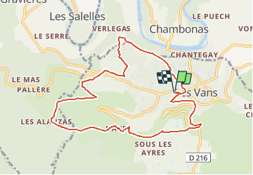


11.9 km | 20 km-effort


User


FREE GPS app for hiking
 SityTrail
IGN / Geographical institutes
SityTrail World
The world is yours!
Trail Walking of 10.3 km to be discovered at Auvergne-Rhône-Alpes, Ardèche, Les Vans. This trail is proposed by ganinette.
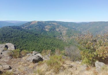
Belle randonné avec des beaux points de vue.
Pas de difficultés particulière.

Walking

Walking

Walking

Walking
Walking

Walking

Walking
Walking
Walking