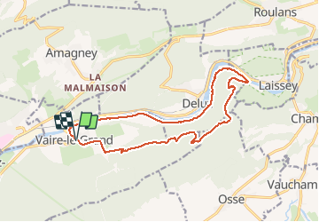
![](/images/other/stat-length.png)
![Trail Walking Vaire - vaire le grand - Photo](https://media.geolcdn.com/t/1900/400/b8a0300b-6151-49d6-b958-c234c4aa4032.jpg&format=pjpeg&maxdim=2)
vaire le grand
eltonnermou
User
![Length](/images/other/stat-length.png)
![Max alt](https://static1.geolcdn.com/siteimages/upload/files/1508320355ic_sort_altitude_max_24dp.png)
![Uphill gradient](https://static1.geolcdn.com/siteimages/upload/files/1508320355ic_sort_den_pos_24dp.png)
![Km-Effort](/images/other/stat-length.png)
![Min alt](https://static1.geolcdn.com/siteimages/upload/files/1508320355ic_sort_altitude_min_24dp.png)
![Downhill gradient](https://static1.geolcdn.com/siteimages/upload/files/1508320355ic_sort_den_neg_24dp.png)
![Boucle](https://static1.geolcdn.com/siteimages/upload/files/16400158638029165_repeat_loop_refresh_sync_direction_icon.png)
![Walking](https://static1.geolcdn.com/sitytour/trail-icons/101.png)
2h40
Difficulty : Medium
![Scan this QR Code to open this trail in the SityTrail application](https://capi.geolives.com/qq0zvz2zws4bq2lad0pu/sitytour/trails/2668301/qr.png?size=200)
FREE GPS app for hiking
About
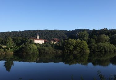
Trail Walking of 15.6 km to be discovered at Bourgogne-Franche-Comté, Doubs, Vaire. This trail is proposed by eltonnermou.
Description
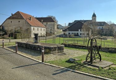
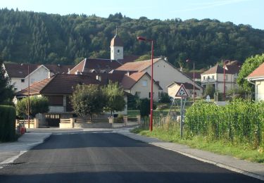
parking près de l'école
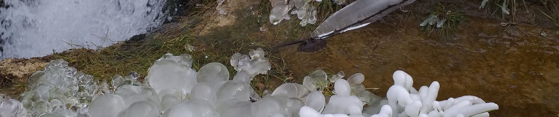
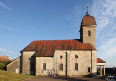
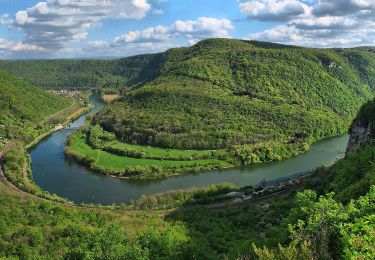
Très belle randonnée sur sol enneigé et bien gelé. Dans la montée prenez le temps de regarder la charmante fontaine champêtre des tilleuls. 2 cabanons pourront vous servir de lieux de pause/casse-croute. Plus loin dans la descente, ne passer pas à côté du point de vue de la roche blanche et sa croix ; faites le détour = 300m ; attention le site est non sécurisé et dangereux (inutile de monter la petite échelle de fer = il n'y a rien à voir de plus) point de vue sur Deluz, le Doubs en direction de Besançon.
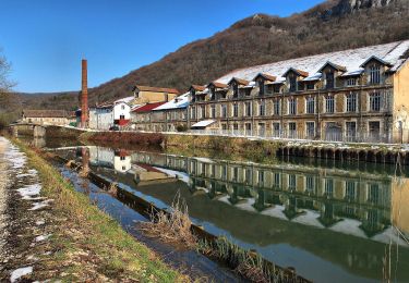
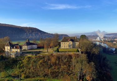
Le retour sur le chemin de hallage est agréable, ( hiver 2020) dommage que tous les arbres arrachés n'est pas encore été dégagés, cela complique fortement le cheminement.
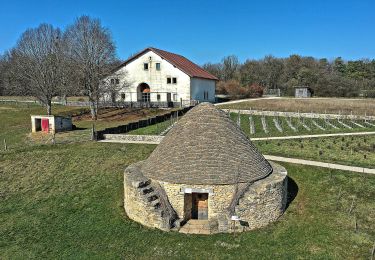
Positioning
Comments
Trails nearby
![Trail On foot Nancray - Circuit du Chêne Président - Photo](https://media.geolcdn.com/t/375/260/dc9e89f0-7636-4693-8413-5b50fbfab35e.jpeg&format=jpg&maxdim=2)
![On foot On foot](https://static1.geolcdn.com/sitytour/trail-icons/100.png)
On foot
![](/images/other/stat-length.png)
![](https://static1.geolcdn.com/siteimages/upload/files/16400158638029165_repeat_loop_refresh_sync_direction_icon.png)
![Trail On foot Nancray - Sentier du Fonteny - Photo](https://media.geolcdn.com/t/375/260/fd4c251e-f96c-43e9-888d-c44f200ccc2c.jpeg&format=jpg&maxdim=2)
![On foot On foot](https://static1.geolcdn.com/sitytour/trail-icons/100.png)
On foot
![](/images/other/stat-length.png)
![](https://static1.geolcdn.com/siteimages/upload/files/16400158638029165_repeat_loop_refresh_sync_direction_icon.png)
![Trail On foot Nancray - Sentier du Moulin - Photo](https://media.geolcdn.com/t/375/260/fd4c251e-f96c-43e9-888d-c44f200ccc2c.jpeg&format=jpg&maxdim=2)
![On foot On foot](https://static1.geolcdn.com/sitytour/trail-icons/100.png)
On foot
![](/images/other/stat-length.png)
![](https://static1.geolcdn.com/siteimages/upload/files/16400158638029165_repeat_loop_refresh_sync_direction_icon.png)
![Trail On foot Nancray - Sentier du Tour des Landes - Photo](https://media.geolcdn.com/t/375/260/dca2d2cb-2448-41ff-970e-c18701afcb22.jpeg&format=jpg&maxdim=2)
![On foot On foot](https://static1.geolcdn.com/sitytour/trail-icons/100.png)
On foot
![](/images/other/stat-length.png)
![](https://static1.geolcdn.com/siteimages/upload/files/16400158638029165_repeat_loop_refresh_sync_direction_icon.png)
![Trail On foot Gennes - Sentier du Fort des Epesses - Photo](https://media.geolcdn.com/t/375/260/2fa8fbf5-c0df-4124-9465-bd35fd5b8500.jpeg&format=jpg&maxdim=2)
![On foot On foot](https://static1.geolcdn.com/sitytour/trail-icons/100.png)
On foot
![](/images/other/stat-length.png)
![](https://static1.geolcdn.com/siteimages/upload/files/16400158638029165_repeat_loop_refresh_sync_direction_icon.png)
![Trail On foot Deluz - Sentier du Château Loriot - Photo](https://media.geolcdn.com/t/375/260/a6c0a960-bcfb-4e05-ab1e-cb250b6d6d40.jpeg&format=jpg&maxdim=2)
![On foot On foot](https://static1.geolcdn.com/sitytour/trail-icons/100.png)
On foot
![](/images/other/stat-length.png)
![](https://static1.geolcdn.com/siteimages/upload/files/16400158638029165_repeat_loop_refresh_sync_direction_icon.png)
![Trail On foot Deluz - Sentier du Patrimoine - Photo](https://media.geolcdn.com/t/375/260/3858c5b3-abf9-4504-8767-bbab2b7352b8.jpeg&format=jpg&maxdim=2)
![On foot On foot](https://static1.geolcdn.com/sitytour/trail-icons/100.png)
On foot
![](/images/other/stat-length.png)
![](https://static1.geolcdn.com/siteimages/upload/files/16400158638029165_repeat_loop_refresh_sync_direction_icon.png)
![Trail On foot Vaire - Sentier des Sources 2 - Photo](https://media.geolcdn.com/t/375/260/0ecedb62-3c33-4251-8982-81e9743d8322.jpeg&format=jpg&maxdim=2)
![On foot On foot](https://static1.geolcdn.com/sitytour/trail-icons/100.png)
On foot
![](/images/other/stat-length.png)
![](https://static1.geolcdn.com/siteimages/upload/files/16400158638029165_repeat_loop_refresh_sync_direction_icon.png)
![Trail On foot Vaire - Sentier des Sources 1 - Photo](https://media.geolcdn.com/t/375/260/3b895425-3268-42d6-8ef6-757959f26627.jpeg&format=jpg&maxdim=2)
![On foot On foot](https://static1.geolcdn.com/sitytour/trail-icons/100.png)
On foot
![](/images/other/stat-length.png)
![](https://static1.geolcdn.com/siteimages/upload/files/16400158638029165_repeat_loop_refresh_sync_direction_icon.png)