![](/images/other/stat-length.png)
![Trail Walking Chartres - Tour de ville enneigée - Photo](https://media.geolcdn.com/t/1900/400/ext.pjpeg?maxdim=2&url=https%3A%2F%2Fstatic1.geolcdn.com%2Fsiteimages%2Fupload%2Ffiles%2F1553511878bg_sport_marche.png)
Tour de ville enneigée
zaegelmarc
User
![Length](/images/other/stat-length.png)
Length
8.5 km
![Max alt](https://static1.geolcdn.com/siteimages/upload/files/1508320355ic_sort_altitude_max_24dp.png)
Max alt
161 m
![Uphill gradient](https://static1.geolcdn.com/siteimages/upload/files/1508320355ic_sort_den_pos_24dp.png)
Uphill gradient
67 m
![Km-Effort](/images/other/stat-length.png)
Km-Effort
9.4 km
![Min alt](https://static1.geolcdn.com/siteimages/upload/files/1508320355ic_sort_altitude_min_24dp.png)
Min alt
123 m
![Downhill gradient](https://static1.geolcdn.com/siteimages/upload/files/1508320355ic_sort_den_neg_24dp.png)
Downhill gradient
66 m
![Boucle](https://static1.geolcdn.com/siteimages/upload/files/16400158638029165_repeat_loop_refresh_sync_direction_icon.png)
Boucle
Yes
Creation date :
2021-02-10 12:55:01.035
Updated on :
2021-02-10 15:59:52.332
![Walking](https://static1.geolcdn.com/sitytour/trail-icons/101.png)
3h04
Difficulty : Very easy
![Scan this QR Code to open this trail in the SityTrail application](https://capi.geolives.com/qq0zvz2zws4bq2lad0pu/sitytour/trails/2666626/qr.png?size=200)
FREE GPS app for hiking
About
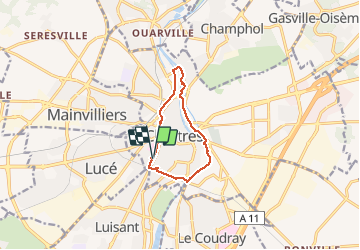
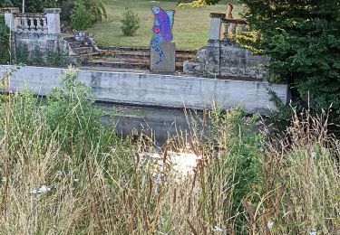
Trail Walking of 8.5 km to be discovered at Centre-Loire Valley, Eure-et-Loir, Chartres. This trail is proposed by zaegelmarc.
Description
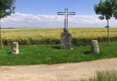
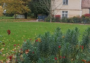
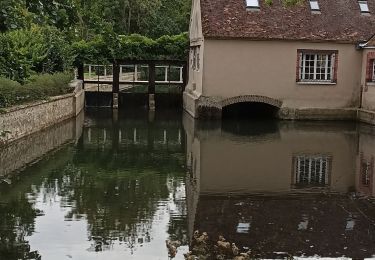
Trois ponts, les marais, bd clemenceau, parc de la fonderie, grands prés, avenue d'Aligre, butte des charbonniers
Positioning
Country:
France
Region :
Centre-Loire Valley
Department/Province :
Eure-et-Loir
Municipality :
Chartres
Location:
Unknown
Start:(Dec)
Start:(UTM)
387667 ; 5366177 (31U) N.
Comments
Trails nearby
![Trail Walking Chartres - Parcours historique Chartres en Lumières - Photo](https://media.geolcdn.com/t/375/260/5af69804-d751-4429-87e4-2de41d93a942.jpg&format=jpg&maxdim=2)
![Walking Walking](https://static1.geolcdn.com/sitytour/trail-icons/101.png)
Parcours historique Chartres en Lumières
Walking
Easy
Chartres,
Centre-Loire Valley,
Eure-et-Loir,
France
![](/images/other/stat-length.png)
6.7 km | 7.8 km-effort
1h 42min
![](https://static1.geolcdn.com/siteimages/upload/files/16400158638029165_repeat_loop_refresh_sync_direction_icon.png)
No
![Trail Walking Chartres - Parcours de la ville historique de Chartres - Photo](https://media.geolcdn.com/t/375/260/5e4a7e3c-abb5-42c8-8b44-13932b698f48.jpg&format=jpg&maxdim=2)
![Walking Walking](https://static1.geolcdn.com/sitytour/trail-icons/101.png)
Parcours de la ville historique de Chartres
Walking
Very easy
Chartres,
Centre-Loire Valley,
Eure-et-Loir,
France
![](/images/other/stat-length.png)
7.7 km | 8.9 km-effort
2h 13min
![](https://static1.geolcdn.com/siteimages/upload/files/16400158638029165_repeat_loop_refresh_sync_direction_icon.png)
No
![Trail Walking Chartres - balade autour cathédrale de Chartres - Photo](https://media.geolcdn.com/t/375/260/589e1a6c-9aee-41e4-b0c1-21e1dc04e42e.jpg&format=jpg&maxdim=2)
![Walking Walking](https://static1.geolcdn.com/sitytour/trail-icons/101.png)
balade autour cathédrale de Chartres
Walking
Easy
Chartres,
Centre-Loire Valley,
Eure-et-Loir,
France
![](/images/other/stat-length.png)
5.3 km | 6.1 km-effort
2h 31min
![](https://static1.geolcdn.com/siteimages/upload/files/16400158638029165_repeat_loop_refresh_sync_direction_icon.png)
Yes
![Trail Walking Gasville-Oisème - proj 2020_20190716Oiseme - Photo](https://media.geolcdn.com/t/375/260/ext.jpg?maxdim=2&url=https%3A%2F%2Fstatic1.geolcdn.com%2Fsiteimages%2Fupload%2Ffiles%2F1553511878bg_sport_marche.png)
![Walking Walking](https://static1.geolcdn.com/sitytour/trail-icons/101.png)
proj 2020_20190716Oiseme
Walking
Very easy
(1)
Gasville-Oisème,
Centre-Loire Valley,
Eure-et-Loir,
France
![](/images/other/stat-length.png)
10.8 km | 12.7 km-effort
2h 35min
![](https://static1.geolcdn.com/siteimages/upload/files/16400158638029165_repeat_loop_refresh_sync_direction_icon.png)
Yes
![Trail Mountain bike Mainvilliers - Les planeurs de la base des planeurs d''Armenonville - Chartres - Photo](https://media.geolcdn.com/t/375/260/ext.jpg?maxdim=2&url=https%3A%2F%2Fservices.sitytrail.com%2FGeolivesWS%2FDownloadMedia.ashx%3FTrailID%3D172818%26Media%3D14251_6.jpg)
![Mountain bike Mountain bike](https://static1.geolcdn.com/sitytour/trail-icons/202.png)
Les planeurs de la base des planeurs d''Armenonville - Chartres
Mountain bike
Medium
(1)
Mainvilliers,
Centre-Loire Valley,
Eure-et-Loir,
France
![](/images/other/stat-length.png)
53 km | 60 km-effort
4h 0min
![](https://static1.geolcdn.com/siteimages/upload/files/16400158638029165_repeat_loop_refresh_sync_direction_icon.png)
Yes
![Trail Nordic walking Chartres - 2024 MB Jardin d'horticulture, Lèves - Photo](https://media.geolcdn.com/t/375/260/0e4f5937-b923-45b6-86aa-21a4f2d5122d.jpg&format=jpg&maxdim=2)
![Nordic walking Nordic walking](https://static1.geolcdn.com/sitytour/trail-icons/102.png)
2024 MB Jardin d'horticulture, Lèves
Nordic walking
Easy
Chartres,
Centre-Loire Valley,
Eure-et-Loir,
France
![](/images/other/stat-length.png)
9.4 km | 10.5 km-effort
1h 55min
![](https://static1.geolcdn.com/siteimages/upload/files/16400158638029165_repeat_loop_refresh_sync_direction_icon.png)
Yes
![Trail Walking Chartres - 2023 Chartres tour de ville - Photo](https://media.geolcdn.com/t/375/260/dc0d9c93-9da7-45cc-94c6-fd51d08d97c6.jpg&format=jpg&maxdim=2)
![Walking Walking](https://static1.geolcdn.com/sitytour/trail-icons/101.png)
2023 Chartres tour de ville
Walking
Easy
Chartres,
Centre-Loire Valley,
Eure-et-Loir,
France
![](/images/other/stat-length.png)
11.3 km | 12.4 km-effort
1h 58min
![](https://static1.geolcdn.com/siteimages/upload/files/16400158638029165_repeat_loop_refresh_sync_direction_icon.png)
Yes
![Trail Walking Luisant - 2023 poney club Luisant - Photo](https://media.geolcdn.com/t/375/260/f79cf83c-4943-43a3-b8fd-6c24cb55f677.jpg&format=jpg&maxdim=2)
![Walking Walking](https://static1.geolcdn.com/sitytour/trail-icons/101.png)
2023 poney club Luisant
Walking
Difficult
Luisant,
Centre-Loire Valley,
Eure-et-Loir,
France
![](/images/other/stat-length.png)
10.8 km | 12.3 km-effort
2h 48min
![](https://static1.geolcdn.com/siteimages/upload/files/16400158638029165_repeat_loop_refresh_sync_direction_icon.png)
Yes
![Trail Nordic walking Chartres - Chartres Stade GP vers St prest - Photo](https://media.geolcdn.com/t/375/260/38bd2996-8114-4e41-ad68-81ce046a739f.jpg&format=jpg&maxdim=2)
![Nordic walking Nordic walking](https://static1.geolcdn.com/sitytour/trail-icons/102.png)
Chartres Stade GP vers St prest
Nordic walking
Easy
Chartres,
Centre-Loire Valley,
Eure-et-Loir,
France
![](/images/other/stat-length.png)
12.9 km | 14.4 km-effort
2h 27min
![](https://static1.geolcdn.com/siteimages/upload/files/16400158638029165_repeat_loop_refresh_sync_direction_icon.png)
Yes