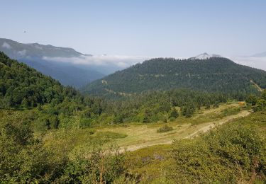
6.7 km | 12.3 km-effort
Circuit des mines de Baburet modifié
marmotte65
User GUIDE
Length
2.9 km
Max alt
700 m
Uphill gradient
152 m
Km-Effort
4.9 km
Min alt
551 m
Downhill gradient
152 m
Boucle
Yes
Creation date :
2021-02-10 10:04:41.986
Updated on :
2021-02-10 10:07:31.261
--
Difficulty : Medium
FREE GPS app for hiking
About
Trail On foot of 2.9 km to be discovered at Occitania, Hautespyrenees, Ferrières. This trail is proposed by marmotte65.
Description
Départ Eglise de Ferriere
Positioning
Country:
France
Region :
Occitania
Department/Province :
Hautespyrenees
Municipality :
Ferrières
Location:
Unknown
Start:(Dec)
Start:(UTM)
722953 ; 4765578 (30T) N.
Comments
Trails nearby
SityTrail - Arbeost le tour des quartiers d'Arbeost fait
On foot
Easy
(1)
Arbéost,
Occitania,
Hautespyrenees,
France
Unknown
Yes
pic de Bazes
Walking
Medium
Aucun,
Occitania,
Hautespyrenees,
France
7.2 km | 12.6 km-effort
5h 19min
No
Ferrière
Walking
Very easy
Arbéost,
Occitania,
Hautespyrenees,
France
3.4 km | 5.7 km-effort
2h 1min
Yes
col de couraduque vers col de liar
Walking
Difficult
Aucun,
Occitania,
Hautespyrenees,
France
12.3 km | 17.9 km-effort
5h 6min
Yes
Le Pic du Monbula - Arthez d'Asson
Walking
Difficult
Asson,
New Aquitaine,
Pyrénées-Atlantiques,
France
11.3 km | 26 km-effort
6h 30min
Yes
Le Pic de Bazès
Walking
Difficult
Aucun,
Occitania,
Hautespyrenees,
France
6.1 km | 12.1 km-effort
1h 25min
Yes
G3arbeost le tour fait 2022
Walking
Very difficult
Arbéost,
Occitania,
Hautespyrenees,
France
7.1 km | 12.5 km-effort
4h 48min
Yes
FERRIERES la mine de Baburet 295 0542
Walking
Easy
Ferrières,
Occitania,
Hautespyrenees,
France
2.8 km | 4.8 km-effort
1h 2min
Yes
pic de Bazès
Walking
Easy
Aucun,
Occitania,
Hautespyrenees,
France
6.9 km | 13.2 km-effort
4h 27min
Yes