Trail Touring skiing Le Dévoluy - L'Aiglière et serre de cheval - Photo
 nadd73
nadd73

User GUIDE

© OpenStreetMap contributors
Length
Length
10.9 km
Max alt
Max alt
2232 m
Uphill gradient
Uphill gradient
1139 m
Km-Effort
Km-Effort  
26 km
Min alt
Min alt
1404 m
Downhill gradient
Downhill gradient
1142 m
Boucle
Boucle
Yes
Creation date :
2021-02-05 08:22:32.972
Updated on :
2021-02-05 18:05:34.792

(0 Reviews)

Touring skiing
Touring skiing
6h10
Difficulty : Medium

Scan this QR Code to open this trail in the SityTrail application

FREE GPS app for hiking

Logo SityTrail SityTrail

IGN / Geographical institutes

Download SityTrail from the App Store Download SityTrail from Google Play

Logo SityTrail SityTrail World

The world is yours!

Download SityTrail from the App Store Download SityTrail from Google Play Download SityTrail on Huawei AppGallery

About

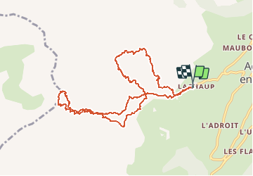
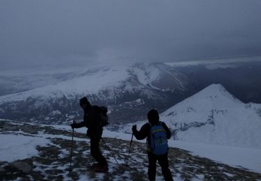
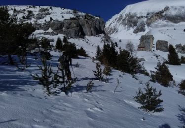
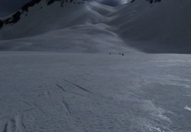
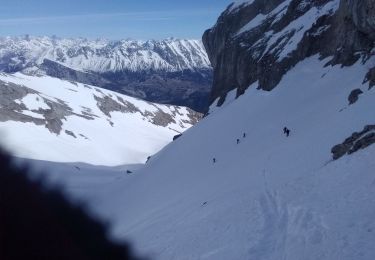
Trail Touring skiing of 10.9 km to be discovered at Provence-Alpes-Côte d'Azur, Hautes-Alpes, Le Dévoluy. This trail is proposed by nadd73.

Description

Départ de Lachaud,
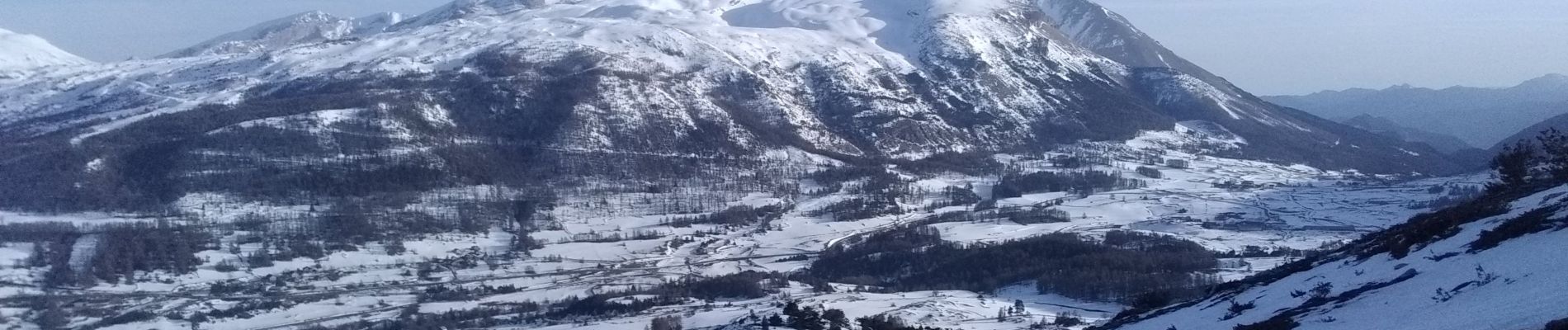
Très belle pente de L'Aiglière.
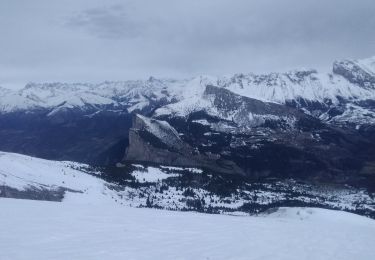
Par contre la descente sur le serre de cheval était très molle mais surtout pas assez de neige et beaucoup de cailloux.

Elevation profile

Photos

Positioning

Country:
France
Region :
Provence-Alpes-Côte d'Azur
Department/Province :
Hautes-Alpes
Municipality :
Le Dévoluy
Location:
Agnières-en-Dévoluy
Start:(UTM)
726810 ; 4952634 (31T) N.

Trails nearby

Trail Walking Le Dévoluy - R12   Le Col des Aiguilles - Photo
Walking
GUIDE+

Walking

Medium
(1)
Le Dévoluy, Provence-Alpes-Côte d'Azur, Hautes-Alpes, France
10.2 km | 19.2 km-effort
3h 56min
Yes
Trail Walking Le Dévoluy - R11   Cabane Rama - Photo
Walking
GUIDE+

Walking

Very easy
(4)
Le Dévoluy, Provence-Alpes-Côte d'Azur, Hautes-Alpes, France
5.5 km | 8.4 km-effort
1h 46min
Yes
Trail Walking Le Dévoluy - Cascade de Saute Aure - Photo
Walking
marmotte83

Walking

Easy
(3)
Le Dévoluy, Provence-Alpes-Côte d'Azur, Hautes-Alpes, France
7.7 km | 10.8 km-effort
3h 1min
Yes
Trail Touring skiing Le Dévoluy - col sou la tête d'oriol et crête de la clape - Photo
Touring skiing
GUIDE
nadd73

Touring skiing

Medium
Le Dévoluy, Provence-Alpes-Côte d'Azur, Hautes-Alpes, France
14.6 km | 31 km-effort
6h 9min
Yes
Trail Touring skiing Le Dévoluy - la combe de la Cluse et sommet 2595 - Photo
Touring skiing
GUIDE
nadd73

Touring skiing

Difficult
Le Dévoluy, Provence-Alpes-Côte d'Azur, Hautes-Alpes, France
13.9 km | 31 km-effort
7h 35min
Yes
Trail Touring skiing Le Dévoluy - La Rama 2379m. Le Chauvet - Photo
Touring skiing
GUIDE
nadd73

Touring skiing

Medium
Le Dévoluy, Provence-Alpes-Côte d'Azur, Hautes-Alpes, France
14.1 km | 33 km-effort
7h 0min
Yes
Trail Touring skiing Le Dévoluy - Le Nid - Photo
Touring skiing
GUIDE
nadd73

Touring skiing

Difficult
Le Dévoluy, Provence-Alpes-Côte d'Azur, Hautes-Alpes, France
15.8 km | 34 km-effort
8h 0min
Yes
Trail Touring skiing Le Dévoluy - au dessus du col des aiguilles - Photo
Touring skiing
GUIDE
nadd73

Touring skiing

Easy
Le Dévoluy, Provence-Alpes-Côte d'Azur, Hautes-Alpes, France
11.8 km | 24 km-effort
6h 15min
Yes
Trail Touring skiing Le Dévoluy - le pas de la cloche. - Photo
Touring skiing
GUIDE
nadd73

Touring skiing

Difficult
Le Dévoluy, Provence-Alpes-Côte d'Azur, Hautes-Alpes, France
7.1 km | 19.2 km-effort
6h 15min
No


Close
My subscriptions