![](/images/other/stat-length.png)
![Trail Walking Cramans - Cramans Mochard 2021-02-04 CAF - Photo](https://media.geolcdn.com/t/1900/400/42121a58-6316-4979-99db-48595569155b.jpg&format=pjpeg&maxdim=2)
Cramans Mochard 2021-02-04 CAF
TRIMAILLE
User
![Length](/images/other/stat-length.png)
![Max alt](https://static1.geolcdn.com/siteimages/upload/files/1508320355ic_sort_altitude_max_24dp.png)
![Uphill gradient](https://static1.geolcdn.com/siteimages/upload/files/1508320355ic_sort_den_pos_24dp.png)
![Km-Effort](/images/other/stat-length.png)
![Min alt](https://static1.geolcdn.com/siteimages/upload/files/1508320355ic_sort_altitude_min_24dp.png)
![Downhill gradient](https://static1.geolcdn.com/siteimages/upload/files/1508320355ic_sort_den_neg_24dp.png)
![Boucle](https://static1.geolcdn.com/siteimages/upload/files/16400158638029165_repeat_loop_refresh_sync_direction_icon.png)
![Walking](https://static1.geolcdn.com/sitytour/trail-icons/101.png)
4h27
Difficulty : Medium
![Scan this QR Code to open this trail in the SityTrail application](https://capi.geolives.com/qq0zvz2zws4bq2lad0pu/sitytour/trails/2660562/qr.png?size=200)
FREE GPS app for hiking
About
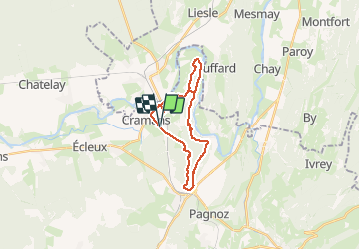
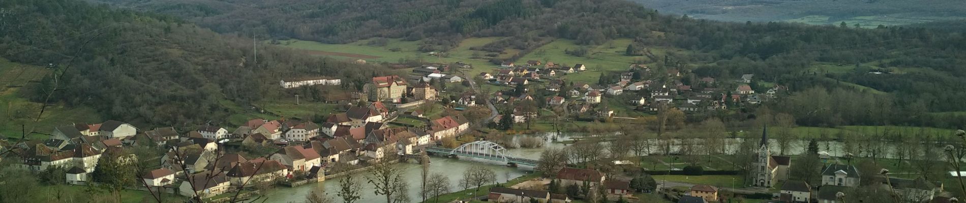
Trail Walking of 21 km to be discovered at Bourgogne-Franche-Comté, Jura, Cramans. This trail is proposed by TRIMAILLE.
Description
Départ de la station de pompage de Cramans au croisement de la D121 et D48.
A noter une partie hors sentier en début de la rando.
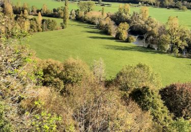
La bonne moitié de la randonnée est en forêt.
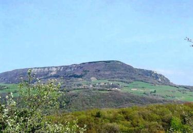
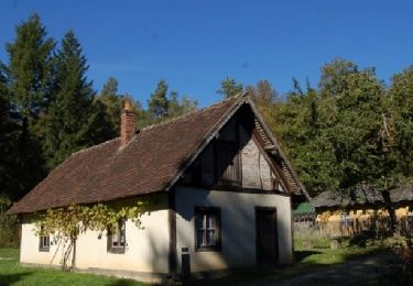
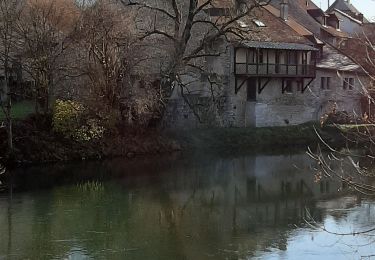
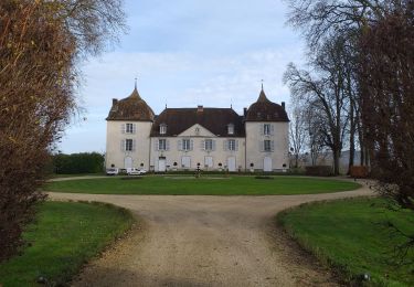
A voir Belvédères, chapelle de Lorette, conservatoire de la vigne.
Attention voir le point d’intérêt parcours.
Positioning
Comments
Trails nearby
![Trail Walking Pagnoz - Colline et ruines du château de Vaulgrenant - Photo](https://media.geolcdn.com/t/375/260/ext.jpg?maxdim=2&url=https%3A%2F%2Fservices.sitytrail.com%2FGeolivesWS%2FDownloadMedia.ashx%3FTrailID%3D108771%26Media%3D1913_1.jpg)
![Walking Walking](https://static1.geolcdn.com/sitytour/trail-icons/101.png)
Walking
![](/images/other/stat-length.png)
![](https://static1.geolcdn.com/siteimages/upload/files/16400158638029165_repeat_loop_refresh_sync_direction_icon.png)
![Trail On foot Chissey-sur-Loue - VTToutrail - Photo](https://media.geolcdn.com/t/375/260/00ee013d-9a44-4a24-8b71-4e7efa590a4c.jpeg&format=jpg&maxdim=2)
![On foot On foot](https://static1.geolcdn.com/sitytour/trail-icons/100.png)
On foot
![](/images/other/stat-length.png)
![](https://static1.geolcdn.com/siteimages/upload/files/16400158638029165_repeat_loop_refresh_sync_direction_icon.png)
![Trail On foot Port-Lesney - Val d'Amour - Photo](https://media.geolcdn.com/t/375/260/5cfc7e14-9f65-4fa1-a053-b82c7404ed99.jpeg&format=jpg&maxdim=2)
![On foot On foot](https://static1.geolcdn.com/sitytour/trail-icons/100.png)
On foot
![](/images/other/stat-length.png)
![](https://static1.geolcdn.com/siteimages/upload/files/16400158638029165_repeat_loop_refresh_sync_direction_icon.png)
![Trail On foot Villers-Farlay - Four tuilier - Photo](https://media.geolcdn.com/t/375/260/82a10c26-9ed7-4536-8432-445535097e12.jpeg&format=jpg&maxdim=2)
![On foot On foot](https://static1.geolcdn.com/sitytour/trail-icons/100.png)
On foot
![](/images/other/stat-length.png)
![](https://static1.geolcdn.com/siteimages/upload/files/16400158638029165_repeat_loop_refresh_sync_direction_icon.png)
![Trail On foot Port-Lesney - Chemin des Gabelous - Photo](https://media.geolcdn.com/t/375/260/09807b3d-6dc5-4f94-a372-f894abc0bac2.jpeg&format=jpg&maxdim=2)
![On foot On foot](https://static1.geolcdn.com/sitytour/trail-icons/100.png)
On foot
![](/images/other/stat-length.png)
![](https://static1.geolcdn.com/siteimages/upload/files/16400158638029165_repeat_loop_refresh_sync_direction_icon.png)
![Trail Mountain bike Arc-et-Senans - Les Baraques du 14 depuis la Saline Royale d'Arc-et-Senans - Photo](https://media.geolcdn.com/t/375/260/ext.jpg?maxdim=2&url=https%3A%2F%2Fservices.sitytrail.com%2FGeolivesWS%2FDownloadMedia.ashx%3FTrailID%3D317255%26Media%3D16439_4.jpg)
![Mountain bike Mountain bike](https://static1.geolcdn.com/sitytour/trail-icons/202.png)
Mountain bike
![](/images/other/stat-length.png)
![](https://static1.geolcdn.com/siteimages/upload/files/16400158638029165_repeat_loop_refresh_sync_direction_icon.png)
![Trail Walking Champagne-sur-Loue - champagne sur Loue - Photo](https://media.geolcdn.com/t/375/260/dd8d5849-8e09-4521-8614-bfddc1d7c7ae.jpg&format=jpg&maxdim=2)
![Walking Walking](https://static1.geolcdn.com/sitytour/trail-icons/101.png)
Walking
![](/images/other/stat-length.png)
![](https://static1.geolcdn.com/siteimages/upload/files/16400158638029165_repeat_loop_refresh_sync_direction_icon.png)
![Trail Walking Port-Lesney - Vaulgrenan depuis Port Lesney. - Photo](https://media.geolcdn.com/t/375/260/888b9e37-2427-47c6-a53b-dfa1373cf9fa.jpg&format=jpg&maxdim=2)
![Walking Walking](https://static1.geolcdn.com/sitytour/trail-icons/101.png)
Walking
![](/images/other/stat-length.png)
![](https://static1.geolcdn.com/siteimages/upload/files/16400158638029165_repeat_loop_refresh_sync_direction_icon.png)
![Trail Walking Arc-et-Senans - Arc et Senans - Photo](https://media.geolcdn.com/t/375/260/2334323b-d438-4b84-9e9e-ba5bf6e226d2.jpg&format=jpg&maxdim=2)
![Walking Walking](https://static1.geolcdn.com/sitytour/trail-icons/101.png)
Walking
![](/images/other/stat-length.png)
![](https://static1.geolcdn.com/siteimages/upload/files/16400158638029165_repeat_loop_refresh_sync_direction_icon.png)