


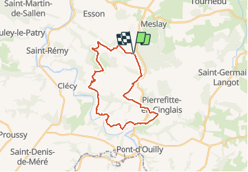

25 km | 34 km-effort


User


FREE GPS app for hiking
 SityTrail
IGN / Geographical institutes
SityTrail World
The world is yours!
Trail Mountain bike of 25 km to be discovered at Normandy, Calvados, Donnay. This trail is proposed by albers.
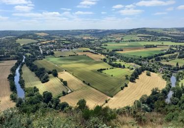
belle rando beau panorama au départ. De bien belle descentes certaine un peu technique, et surtout et évidemment des montées..... de vaches!!! c'est la Suisse Normande.

Mountain bike


On foot

On foot
On foot

On foot

On foot
Nordic walking