Trail Walking Peille - Cîme des Cabanelles - Photo
 bozo1970
bozo1970

User

© OpenStreetMap contributors
Length
Length
14.5 km
Max alt
Max alt
1062 m
Uphill gradient
Uphill gradient
785 m
Km-Effort
Km-Effort  
25 km
Min alt
Min alt
454 m
Downhill gradient
Downhill gradient
790 m
Boucle
Boucle
Yes
Creation date :
2021-01-28 08:12:48.0
Updated on :
2021-01-29 05:28:30.987

(0 Reviews)

Walking
Walking
4h01
Difficulty : Easy

Scan this QR Code to open this trail in the SityTrail application

FREE GPS app for hiking

Logo SityTrail SityTrail

IGN / Geographical institutes

Download SityTrail from the App Store Download SityTrail from Google Play

Logo SityTrail SityTrail World

The world is yours!

Download SityTrail from the App Store Download SityTrail from Google Play Download SityTrail on Huawei AppGallery

About

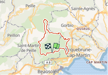
Trail Walking of 14.5 km to be discovered at Provence-Alpes-Côte d'Azur, Maritime Alps, Peille. This trail is proposed by bozo1970.

Description

Départ Rocagel, tour du Mont Gros, col de la Coupière, montée sur la Baisse des Cabanelles, retour par le flan ouest du Mont Agel et le Golf.
14km, 4h et 785m D
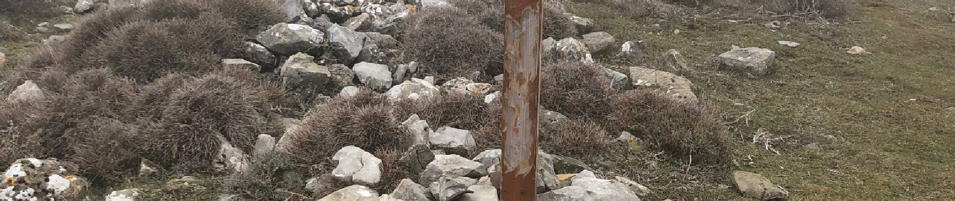
Dans le brouillard et boueux sur le retour.

Elevation profile

Photos

Positioning

Country:
France
Region :
Provence-Alpes-Côte d'Azur
Department/Province :
Maritime Alps
Municipality :
Peille
Location:
Unknown
Start:(UTM)
373384 ; 4846831 (32T) N.

Trails nearby

Trail Walking Peillon - Via Alpina - R161: Peillon > Monaco - Place du Palais - Photo
Walking
tracegps

Walking

Medium
(2)
Peillon, Provence-Alpes-Côte d'Azur, Maritime Alps, France
10.3 km | 16.7 km-effort
2h 49min
No
Trail Walking Cap-d'Ail - Nice Cap d'Ail en train et retour par les cretes - Photo
Walking
GUIDE
jouans

Walking

Very difficult
Cap-d'Ail, Provence-Alpes-Côte d'Azur, Maritime Alps, France
23 km | 36 km-effort
8h 6min
No
Trail On foot Peille - Cime de Baudon - Photo
On foot
GUIDE+

On foot

Easy
Peille, Provence-Alpes-Côte d'Azur, Maritime Alps, France
7 km | 14.7 km-effort
3h 20min
Yes
Trail Walking Roquebrune-Cap-Martin - cape martin - Photo
Walking
danpar

Walking

Medium
(2)
Roquebrune-Cap-Martin, Provence-Alpes-Côte d'Azur, Maritime Alps, France
4.4 km | 5.9 km-effort
1h 57min
Yes
Trail Walking Gorbio - Gorbio-Circuit des Cabanelles 31-10-2016 - Photo
Walking
GUIDE
fredetpascale

Walking

Medium
(1)
Gorbio, Provence-Alpes-Côte d'Azur, Maritime Alps, France
10.8 km | 21 km-effort
3h 51min
Yes
Trail Other activity La Turbie - fort de la Revere  - Photo
Other activity
juleyann

Other activity

Very easy
(1)
La Turbie, Provence-Alpes-Côte d'Azur, Maritime Alps, France
8.4 km | 12 km-effort
1h 37min
Yes
Trail Walking Monaco - Monaco - Photo
Walking
GUIDE
Orcal37

Walking

Very easy
Monaco, Unknown, Unknown, Monaco
3.6 km | 4.9 km-effort
55min
Yes
Trail Walking Roquebrune-Cap-Martin - Menton - Cap Martin - Photo
Walking
GUIDE
Orcal37

Walking

Easy
Roquebrune-Cap-Martin, Provence-Alpes-Côte d'Azur, Maritime Alps, France
7.1 km | 9.1 km-effort
2h 15min
Yes
Trail Walking Peille - Cime de Baudon - Photo
Walking
maxcagaze

Walking

Medium
(1)
Peille, Provence-Alpes-Côte d'Azur, Maritime Alps, France
7.8 km | 15.7 km-effort
4h 15min
Yes


Close
My subscriptions