![](/images/other/stat-length.png)
![Trail Walking Kortessem - Vliermaal - Photo](https://media.geolcdn.com/t/1900/400/23f694a3-c027-4914-bd82-d77dc32fbd8b.jpg&format=pjpeg&maxdim=2)
Vliermaal
mumu.larandonneuse
User GUIDE
![Length](/images/other/stat-length.png)
Length
13 km
![Max alt](https://static1.geolcdn.com/siteimages/upload/files/1508320355ic_sort_altitude_max_24dp.png)
Max alt
101 m
![Uphill gradient](https://static1.geolcdn.com/siteimages/upload/files/1508320355ic_sort_den_pos_24dp.png)
Uphill gradient
138 m
![Km-Effort](/images/other/stat-length.png)
Km-Effort
14.9 km
![Min alt](https://static1.geolcdn.com/siteimages/upload/files/1508320355ic_sort_altitude_min_24dp.png)
Min alt
43 m
![Downhill gradient](https://static1.geolcdn.com/siteimages/upload/files/1508320355ic_sort_den_neg_24dp.png)
Downhill gradient
139 m
![Boucle](https://static1.geolcdn.com/siteimages/upload/files/16400158638029165_repeat_loop_refresh_sync_direction_icon.png)
Boucle
Yes
Creation date :
2021-01-25 09:27:12.282
Updated on :
2021-01-25 16:20:27.861
![Walking](https://static1.geolcdn.com/sitytour/trail-icons/101.png)
2h42
Difficulty : Very easy
![Scan this QR Code to open this trail in the SityTrail application](https://capi.geolives.com/qq0zvz2zws4bq2lad0pu/sitytour/trails/2650734/qr.png?size=200)
FREE GPS app for hiking
About
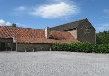
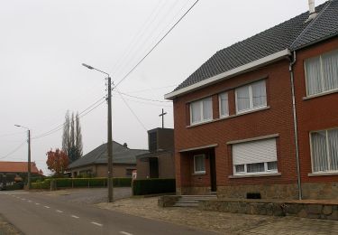
Trail Walking of 13 km to be discovered at Flanders, Limburg, Kortessem. This trail is proposed by mumu.larandonneuse.
Description
7 km 6 km, 2 boucles avec 650m identiques au début du parcours.
📌 Parking à côté de Buurthuis 't Blierhof, Kersendaelstraat 1 à Vliermaal.
Positioning
Country:
Belgium
Region :
Flanders
Department/Province :
Limburg
Municipality :
Kortessem
Location:
Vliermaal
Start:(Dec)
Start:(UTM)
671058 ; 5634755 (31U) N.
Comments
Trails nearby
![Trail Walking Borgloon - Promenade vers l'Aeneas Wilder - Photo](https://media.geolcdn.com/t/375/260/8625d454-03fc-46d2-bafa-261470717766.jpg&format=jpg&maxdim=2)
![Walking Walking](https://static1.geolcdn.com/sitytour/trail-icons/101.png)
Promenade vers l'Aeneas Wilder
Walking
Easy
(1)
Borgloon,
Flanders,
Limburg,
Belgium
![](/images/other/stat-length.png)
4.1 km | 4.8 km-effort
1h 5min
![](https://static1.geolcdn.com/siteimages/upload/files/16400158638029165_repeat_loop_refresh_sync_direction_icon.png)
Yes
![Trail On foot Kortessem - pittoreske-kerkdorpen-startplaats-zammelen-oranje - Photo](https://media.geolcdn.com/t/375/260/fc718cb3-95ec-485f-a77f-edadc1be0696.jpeg&format=jpg&maxdim=2)
![On foot On foot](https://static1.geolcdn.com/sitytour/trail-icons/100.png)
pittoreske-kerkdorpen-startplaats-zammelen-oranje
On foot
Easy
(1)
Kortessem,
Flanders,
Limburg,
Belgium
![](/images/other/stat-length.png)
6.4 km | 7.3 km-effort
1h 39min
![](https://static1.geolcdn.com/siteimages/upload/files/16400158638029165_repeat_loop_refresh_sync_direction_icon.png)
Yes
![Trail On foot Borgloon - Mariënlof Rode pijl - Photo](https://media.geolcdn.com/t/375/260/f9353f39-8b13-4a24-b09a-7fe4cf454715.jpeg&format=jpg&maxdim=2)
![On foot On foot](https://static1.geolcdn.com/sitytour/trail-icons/100.png)
Mariënlof Rode pijl
On foot
Easy
Borgloon,
Flanders,
Limburg,
Belgium
![](/images/other/stat-length.png)
3.9 km | 4.6 km-effort
1h 3min
![](https://static1.geolcdn.com/siteimages/upload/files/16400158638029165_repeat_loop_refresh_sync_direction_icon.png)
Yes
![Trail On foot Tongeren - Molsterbos - Photo](https://media.geolcdn.com/t/375/260/3c500f4e-d8ab-4470-8eed-45fbfc940cd4.jpeg&format=jpg&maxdim=2)
![On foot On foot](https://static1.geolcdn.com/sitytour/trail-icons/100.png)
![Trail On foot Tongeren - 's Herenelderen - Photo](https://media.geolcdn.com/t/375/260/5ab8c445-6053-4792-93e2-8364cf86f17e.jpeg&format=jpg&maxdim=2)
![On foot On foot](https://static1.geolcdn.com/sitytour/trail-icons/100.png)
's Herenelderen
On foot
Easy
Tongeren,
Flanders,
Limburg,
Belgium
![](/images/other/stat-length.png)
6.5 km | 7.3 km-effort
1h 39min
![](https://static1.geolcdn.com/siteimages/upload/files/16400158638029165_repeat_loop_refresh_sync_direction_icon.png)
Yes
![Trail On foot Kortessem - 3-Bekenroute Eggeringen - Photo](https://media.geolcdn.com/t/375/260/348e48f1-e1dd-48a8-8fb5-7a592d6db187.jpeg&format=jpg&maxdim=2)
![On foot On foot](https://static1.geolcdn.com/sitytour/trail-icons/100.png)
3-Bekenroute Eggeringen
On foot
Easy
Kortessem,
Flanders,
Limburg,
Belgium
![](/images/other/stat-length.png)
7.5 km | 8.5 km-effort
1h 55min
![](https://static1.geolcdn.com/siteimages/upload/files/16400158638029165_repeat_loop_refresh_sync_direction_icon.png)
Yes
![Trail On foot Hoeselt - Tweekruizenwandeling gele zeshoek - Photo](https://media.geolcdn.com/t/375/260/2653ece4-549d-4211-a1fa-9bd3ba924b80.jpeg&format=jpg&maxdim=2)
![On foot On foot](https://static1.geolcdn.com/sitytour/trail-icons/100.png)
Tweekruizenwandeling gele zeshoek
On foot
Easy
Hoeselt,
Flanders,
Limburg,
Belgium
![](/images/other/stat-length.png)
8.5 km | 9.6 km-effort
2h 11min
![](https://static1.geolcdn.com/siteimages/upload/files/16400158638029165_repeat_loop_refresh_sync_direction_icon.png)
Yes
![Trail On foot Tongeren - Kolment Zwart - Photo](https://media.geolcdn.com/t/375/260/c7edafc2-5156-487c-b4e6-8b3b09a5b390.jpeg&format=jpg&maxdim=2)
![On foot On foot](https://static1.geolcdn.com/sitytour/trail-icons/100.png)
![Trail On foot Hoeselt - Hoeselt Rode driehoek - Photo](https://media.geolcdn.com/t/375/260/1ec2fadb-97a8-450f-96f1-9823312e748b.jpeg&format=jpg&maxdim=2)
![On foot On foot](https://static1.geolcdn.com/sitytour/trail-icons/100.png)
Hoeselt Rode driehoek
On foot
Easy
Hoeselt,
Flanders,
Limburg,
Belgium
![](/images/other/stat-length.png)
7.3 km | 8.1 km-effort
1h 50min
![](https://static1.geolcdn.com/siteimages/upload/files/16400158638029165_repeat_loop_refresh_sync_direction_icon.png)
Yes