


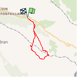

13.1 km | 23 km-effort


User


FREE GPS app for hiking
 SityTrail
IGN / Geographical institutes
SityTrail World
The world is yours!
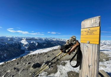
Trail Other activity of 12.1 km to be discovered at Provence-Alpes-Côte d'Azur, Hautes-Alpes, Molines-en-Queyras. This trail is proposed by FREERIDE13006.
dé
part parking col agnel. pic traversier descente puis col observatoire puis couloir puis retour..1300m dénivelé

Walking

Walking

Walking

Snowshoes
Snowshoes

Walking

Other activity
Walking
Walking