Trail Horseback riding Corcy - 20210117 chasse à courre - Photo

20210117 chasse à courre

© OpenStreetMap contributors
Length
Length
1.6 km
Max alt
Max alt
159 m
Uphill gradient
Uphill gradient
22 m
Km-Effort
Km-Effort  
1.9 km
Min alt
Min alt
141 m
Downhill gradient
Downhill gradient
20 m
Boucle
Boucle
No
Creation date :
2021-01-19 08:55:58.182
Updated on :
2021-01-19 13:41:04.714

(0 Reviews)

Horseback riding
Horseback riding
15m
Difficulty : Very easy

Scan this QR Code to open this trail in the SityTrail application

FREE GPS app for hiking

Logo SityTrail SityTrail

IGN / Geographical institutes

Download SityTrail from the App Store Download SityTrail from Google Play

Logo SityTrail SityTrail World

The world is yours!

Download SityTrail from the App Store Download SityTrail from Google Play Download SityTrail on Huawei AppGallery

About

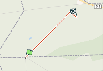
Trail Horseback riding of 1.6 km to be discovered at Hauts-de-France, Aisne, Corcy. This trail is proposed by patcaillou.

Elevation profile

Positioning

Country:
France
Region :
Hauts-de-France
Department/Province :
Aisne
Municipality :
Corcy
Location:
Unknown
Start:(UTM)
512947 ; 5456913 (31U) N.

Trails nearby

Trail Walking Longpont - en forêt de Retz_19_Longpont_carrefour de Vauvaudran_AR - Photo
Walking

Walking

Medium
(1)
Longpont, Hauts-de-France, Aisne, France
17.5 km | 21 km-effort
4h 10min
Yes
Trail Walking Corcy - FLEURY .AISNE  - Photo
Walking
TURLUPIN2010

Walking

Medium
Corcy, Hauts-de-France, Aisne, France
5.7 km | 7.9 km-effort
1h 25min
Yes
Trail Walking Fleury - en Forêt de Retz_92_05_2022_Rond d'Orléans_Chapeau des Cordeliers_la Laie des étangs de Longpont - Photo
Walking

Walking

Medium
Fleury, Hauts-de-France, Aisne, France
9.2 km | 10.9 km-effort
2h 46min
Yes
Trail Walking Corcy - en forêt de Retz_91_04_2022_la Laie de la Belle Epine - Photo
Walking

Walking

Difficult
Corcy, Hauts-de-France, Aisne, France
10.6 km | 13.3 km-effort
3h 32min
Yes
Trail On foot Puiseux-en-Retz - Route du Faîte - Photo
On foot
GUIDE+

On foot

Easy
Puiseux-en-Retz, Hauts-de-France, Aisne, France
5.8 km | 7.1 km-effort
1h 37min
No
Trail Walking Villers-Cotterêts - en forêt de Retz_87_la Laie des Masures par la Route Chrétiennette - Photo
Walking

Walking

Very difficult
Villers-Cotterêts, Hauts-de-France, Aisne, France
12 km | 15 km-effort
3h 57min
Yes
Trail On foot Longpont - en forêt de Retz_22_Longpont_Rond d'Orléans_AR - Photo
On foot

On foot

Medium
Longpont, Hauts-de-France, Aisne, France
14.6 km | 17.5 km-effort
Unknown
Yes
Trail Walking Montgobert - en forêt de Retz_83_les Champs Mentard_le Fond d'Argent - Photo
Walking

Walking

Medium
Montgobert, Hauts-de-France, Aisne, France
13.6 km | 16.2 km-effort
3h 46min
Yes
Trail Walking Dampleux - en forêt de Retz_82_sur les Routes de la Bruyère aux Loups et de la Chrétiennette - Photo
Walking

Walking

Difficult
Dampleux, Hauts-de-France, Aisne, France
17.5 km | 21 km-effort
5h 38min
Yes


Close
My subscriptions