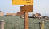

RANDO Montmort Le Mont

PhilippeDu71
User

Length
8.1 km

Max alt
361 m

Uphill gradient
148 m

Km-Effort
10.1 km

Min alt
260 m

Downhill gradient
149 m
Boucle
Yes
Creation date :
2021-01-16 08:50:37.787
Updated on :
2021-02-02 17:20:42.128
2h17
Difficulty : Medium

FREE GPS app for hiking
About
Trail Walking of 8.1 km to be discovered at Bourgogne-Franche-Comté, Saône-et-Loire, Montmort. This trail is proposed by PhilippeDu71.
Description
Départ en face de la mairie, grand parking et resto
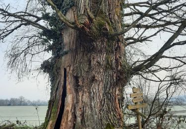
Parcours dans l'ensemble assez facile, plat et tranquille, juste une petite partie sur 200m où ça monte un peu à 4.8km du départ, vieux chêne de 5.70m de circonférence à voir
Positioning
Country:
France
Region :
Bourgogne-Franche-Comté
Department/Province :
Saône-et-Loire
Municipality :
Montmort
Location:
Unknown
Start:(Dec)
Start:(UTM)
583321 ; 5176472 (31T) N.
Comments
Trails nearby

Toulon sur Arroux les berges


Walking
Medium
(1)
Toulon-sur-Arroux,
Bourgogne-Franche-Comté,
Saône-et-Loire,
France

9 km | 10.7 km-effort
2h 25min
Yes

LA BOULAYE


Walking
Medium
(1)
La Boulaye,
Bourgogne-Franche-Comté,
Saône-et-Loire,
France

9.4 km | 12.6 km-effort
2h 41min
Yes
RANDO Montmort Bois Du Nom


Walking
Medium
(1)
Montmort,
Bourgogne-Franche-Comté,
Saône-et-Loire,
France

6.8 km | 8.8 km-effort
1h 48min
Yes
RANDO_Montmort_Bois_Du_Nom


Walking
Medium
Montmort,
Bourgogne-Franche-Comté,
Saône-et-Loire,
France

10.8 km | 13.5 km-effort
3h 3min
Yes

Bernard pluchot


Walking
Medium
Toulon-sur-Arroux,
Bourgogne-Franche-Comté,
Saône-et-Loire,
France

7.5 km | 9.1 km-effort
2h 4min
Yes

Toulon sur Arroux


Walking
Difficult
Toulon-sur-Arroux,
Bourgogne-Franche-Comté,
Saône-et-Loire,
France

11.6 km | 13.8 km-effort
3h 8min
Yes

Les Grands Vallots 30 déc. 2019


Walking
Medium
Toulon-sur-Arroux,
Bourgogne-Franche-Comté,
Saône-et-Loire,
France

8.9 km | 11.2 km-effort
2h 24min
Yes

MONTMORT BOIS DU NOM


Walking
Medium
Montmort,
Bourgogne-Franche-Comté,
Saône-et-Loire,
France

8.9 km | 11.4 km-effort
2h 35min
Yes

J7 Toulon sur Aroux - Bourbon Lancy


Mountain bike
Very difficult
Toulon-sur-Arroux,
Bourgogne-Franche-Comté,
Saône-et-Loire,
France

48 km | 61 km-effort
4h 13min
No


 SityTrail


