


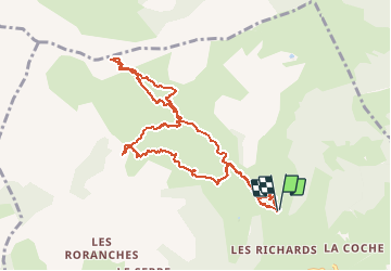

7.4 km | 12.1 km-effort


User GUIDE


FREE GPS app for hiking
 SityTrail
IGN / Geographical institutes
SityTrail World
The world is yours!
Trail Touring skiing of 10.4 km to be discovered at Provence-Alpes-Côte d'Azur, Hautes-Alpes, Saint-Jean-Saint-Nicolas. This trail is proposed by nadd73.
Départ les Richards. Bcp de monde et de traces...
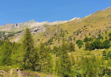
Vue magnifique sur le vieux Chaillol, grande Autane...


Walking

Walking

Walking

On foot

Walking

Walking

Touring skiing

Touring skiing
Walking