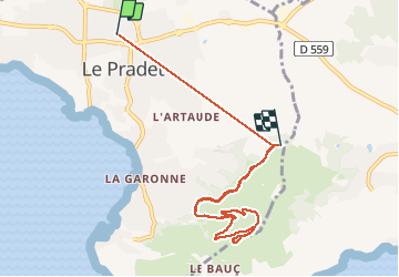
13.3 km | 19.6 km-effort
Colle noire
fannetteenfolyes
User
Length
9.3 km
Max alt
217 m
Uphill gradient
268 m
Km-Effort
12.6 km
Min alt
29 m
Downhill gradient
194 m
Boucle
No
Creation date :
2020-12-29 13:37:04.0
Updated on :
2020-12-29 16:25:48.846
2h05
Difficulty : Easy
FREE GPS app for hiking
About
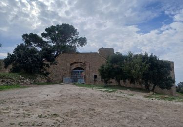
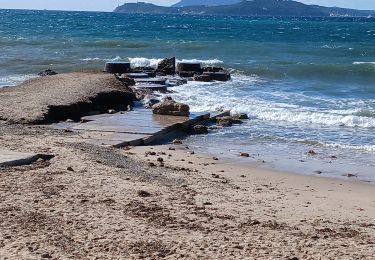
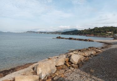
Trail Walking of 9.3 km to be discovered at Provence-Alpes-Côte d'Azur, Var, Le Pradet. This trail is proposed by fannetteenfolyes.
Description
Balade facile, avec une enfant de 8 ans, vue splendide
Positioning
Country:
France
Region :
Provence-Alpes-Côte d'Azur
Department/Province :
Var
Municipality :
Le Pradet
Location:
Unknown
Start:(Dec)
Start:(UTM)
257644 ; 4777079 (32T) N.
Comments
Trails nearby
SityTrail - le Pradet les trois forts
Walking
Very difficult
(1)
Le Pradet,
Provence-Alpes-Côte d'Azur,
Var,
France
4h 27min
Yes
le pradet plage de la garonne la mine
On foot
Easy
(1)
Le Pradet,
Provence-Alpes-Côte d'Azur,
Var,
France
6.1 km | 8.2 km-effort
Unknown
Yes
piste cyclable la garde almanar hyeres
Cycle
Very easy
(1)
La Garde,
Provence-Alpes-Côte d'Azur,
Var,
France
13.8 km | 15.1 km-effort
41min
No
Les 3 forts-la Garonne-21-04-23
Walking
Medium
Le Pradet,
Provence-Alpes-Côte d'Azur,
Var,
France
14.5 km | 21 km-effort
3h 56min
Yes
pointe du baou rouge
Walking
Medium
Le Pradet,
Provence-Alpes-Côte d'Azur,
Var,
France
6.8 km | 8.9 km-effort
2h 20min
Yes
Le Revest les Eaux-29-03-2023
Walking
Difficult
La Valette-du-Var,
Provence-Alpes-Côte d'Azur,
Var,
France
24 km | 36 km-effort
6h 49min
Yes
Le Plan-la Garde-24-03-23
Walking
Easy
La Garde,
Provence-Alpes-Côte d'Azur,
Var,
France
6 km | 6.4 km-effort
1h 57min
Yes
Le Coudon-08-03-23
Walking
Medium
La Valette-du-Var,
Provence-Alpes-Côte d'Azur,
Var,
France
19.8 km | 31 km-effort
5h 46min
Yes
Fort Faron-14-10-22
Walking
Medium
La Valette-du-Var,
Provence-Alpes-Côte d'Azur,
Var,
France
11.9 km | 19.7 km-effort
3h 39min
Yes