Trail Walking Grasse - Grasse ouest par le canal - Photo
 steanje
steanje

User

© OpenStreetMap contributors
Length
Length
8.1 km
Max alt
Max alt
301 m
Uphill gradient
Uphill gradient
170 m
Km-Effort
Km-Effort  
10.4 km
Min alt
Min alt
194 m
Downhill gradient
Downhill gradient
163 m
Boucle
Boucle
Yes
Creation date :
2020-12-27 08:02:26.885
Updated on :
2020-12-27 10:30:38.253

(0 Reviews)

Walking
Walking
1h23
Difficulty : Medium

Scan this QR Code to open this trail in the SityTrail application

FREE GPS app for hiking

Logo SityTrail SityTrail

IGN / Geographical institutes

Download SityTrail from the App Store Download SityTrail from Google Play

Logo SityTrail SityTrail World

The world is yours!

Download SityTrail from the App Store Download SityTrail from Google Play Download SityTrail on Huawei AppGallery

About

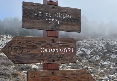
Trail Walking of 8.1 km to be discovered at Provence-Alpes-Côte d'Azur, Maritime Alps, Grasse. This trail is proposed by steanje.

Description

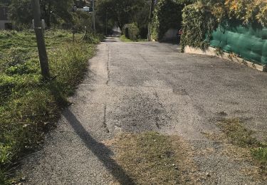
Emprunter la route par moment surtout à la fin.
Ne pas hésiter à pousser les petits portails et de les refermer et les chiens 🐕 sont bien dans leurs propriétés fermé, vous ne risquez rien 👍

Elevation profile

Positioning

Country:
France
Region :
Provence-Alpes-Côte d'Azur
Department/Province :
Maritime Alps
Municipality :
Grasse
Location:
Unknown
Start:(UTM)
333206 ; 4835000 (32T) N.

Trails nearby

Trail Walking Grasse - petit rando au dessus de Grasse - Photo
Walking
patsure

Walking

Medium
(1)
Grasse, Provence-Alpes-Côte d'Azur, Maritime Alps, France
6 km | 10.6 km-effort
1h 55min
Yes
Trail On foot Le Bar-sur-Loup - Circuit de la Malle - Photo
On foot
PRO

On foot

Difficult
Le Bar-sur-Loup, Provence-Alpes-Côte d'Azur, Maritime Alps, France
22 km | 34 km-effort
7h 43min
Yes
Trail On foot Grasse - Tour de la Marbrière - Photo
On foot
PRO

On foot

Easy
Grasse, Provence-Alpes-Côte d'Azur, Maritime Alps, France
5.5 km | 10 km-effort
2h 16min
Yes
Trail Mountain bike Grasse - vttour_2051 - Photo
Mountain bike
Reich

Mountain bike

Medium
(1)
Grasse, Provence-Alpes-Côte d'Azur, Maritime Alps, France
18.5 km | 27 km-effort
1h 42min
Yes
Trail sport Mougins - Le long du canal de la Siagne (une partie) - Photo
sport
jwo47

sport

Very easy
Mougins, Provence-Alpes-Côte d'Azur, Maritime Alps, France
6.6 km | 7.9 km-effort
Unknown
Yes
Trail Walking Grasse - La croix de Cbris - Photo
Walking
56jj

Walking

Easy
Grasse, Provence-Alpes-Côte d'Azur, Maritime Alps, France
14.1 km | 19 km-effort
5h 40min
Yes
Trail Walking Saint-Vallier-de-Thiey - Col du Pilon : Colle maçon et haut Montet  - Photo
Walking
ETMU5496

Walking

Very difficult
Saint-Vallier-de-Thiey, Provence-Alpes-Côte d'Azur, Maritime Alps, France
23 km | 38 km-effort
8h 37min
Yes
Trail On foot Saint-Vallier-de-Thiey - Col du Pilon La Marbrière Route des 3 Ponts Croix de Cabris 3543 ET - Photo
On foot
verotrail

On foot

Medium
Saint-Vallier-de-Thiey, Provence-Alpes-Côte d'Azur, Maritime Alps, France
15.5 km | 24 km-effort
5h 20min
Yes
Trail Walking Grasse - Mont Doublier  - Photo
Walking
ETMU5496

Walking

Medium
Grasse, Provence-Alpes-Côte d'Azur, Maritime Alps, France
18.9 km | 29 km-effort
5h 13min
Yes


Close
My subscriptions