Trail On foot Gehée - Randonnée - boucle jaune - Géhée - Photo

Randonnée - boucle jaune - Géhée

© OpenStreetMap contributors
Length
Length
10.5 km
Max alt
Max alt
165 m
Uphill gradient
Uphill gradient
124 m
Km-Effort
Km-Effort  
12.1 km
Min alt
Min alt
112 m
Downhill gradient
Downhill gradient
126 m
Boucle
Boucle
Yes
Creation date :
2020-12-26 16:28:54.687
Updated on :
2020-12-26 16:35:43.229

(0 Reviews)

On foot
On foot
2h45
Difficulty : Easy

Scan this QR Code to open this trail in the SityTrail application

FREE GPS app for hiking

Logo SityTrail SityTrail

IGN / Geographical institutes

Download SityTrail from the App Store Download SityTrail from Google Play

Logo SityTrail SityTrail World

The world is yours!

Download SityTrail from the App Store Download SityTrail from Google Play Download SityTrail on Huawei AppGallery

About

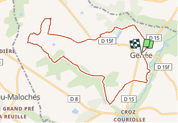
Trail On foot of 10.5 km to be discovered at Centre-Loire Valley, Indre, Gehée. This trail is proposed by Fredrando64.

Description

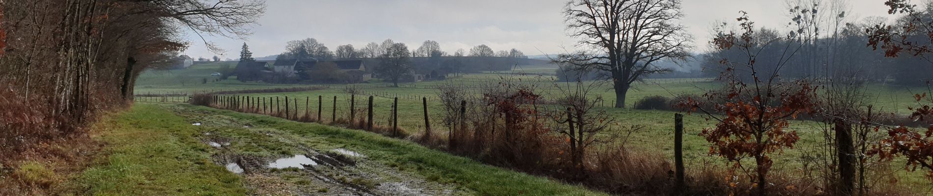
Jolie boucle à travers champs et forêts
Accessible à la belle saison en VTT facile.

Elevation profile

Photos

Positioning

Country:
France
Region :
Centre-Loire Valley
Department/Province :
Indre
Municipality :
Gehée
Location:
Unknown
Start:(UTM)
386211 ; 5211513 (31T) N.

Trails nearby

Trail On foot Gehée - Randonnée - boucle bleue - Géhée - Photo
On foot
Fredrando64

On foot

Easy
Gehée, Centre-Loire Valley, Indre, France
5.2 km | 6.2 km-effort
1h 30min
Yes
Trail sport Moulins-sur-Céphons - Sob 14 moulins/cephons St pierre de lamps  - Photo
sport
Glurps

sport

Very easy
Moulins-sur-Céphons, Centre-Loire Valley, Indre, France
6 km | 6.6 km-effort
Unknown
No
Trail Horseback riding Langé - boucle marchaisiere / la boutelaie / le marchais/plaineffe - Photo
Horseback riding
Gwen Bonneau

Horseback riding

Easy
Langé, Centre-Loire Valley, Indre, France
7.2 km | 8 km-effort
1h 2min
No


Close
My subscriptions